Click to visit the main New York Public Library Homepage
The New York Public Library
Digital Collections
About Digital Collections
Browse
Search only public domain materials
Items
Collections
Divisions
Home
Search
Browse
About
Search only public domain materials
Items
Collections
Divisions
Digital Collections
Using Images
Using Data
Search
Filtered keyword search
Show filters
Hide filters
Show Only Public Domain
topic
Nautical charts
11
Real property
6
Discovery and exploration
4
Coasts
3
Harbors
3
More
Less
name
Bache, A. D. (Alexander Dallas), 1806-1867
11
United States Coast Survey
11
Benham, Henry Washington, 1813-1884
4
Gerdes, F. H
4
Ohman Map Co
4
More
Less
collection
Maps of North America
20
Maps of New York City and State
11
Lawrence H. Slaughter Collection of English maps, charts, globes, books and atlases
6
Atlases of New York City
3
Atlases of the United States
2
More
Less
place
New York (State)
11
New York
4
New York (N.Y.)
4
Pennsylvania
4
America
3
More
Less
genre
Maps
44
Nautical charts
6
Illustrations
3
Topographic maps
3
Atlases
2
More
Less
publisher
U.S. Coast Survey
4
U.S. Coast Survey Office
4
E. Robinson Co
3
A. R. Ohman Map Co., H.B. Petersen, Daughtsmen & Engravers,
2
A.R. Ohman Map Co
2
More
Less
division
Map Division
42
General Research Division
2
Berg Collection
1
Schomburg Jean Blackwell Hutson Research and Reference Division
1
type
x
cartographic
still image
1
text
1
Date Range
to
46 results found for:
x
H. B. R
Filtering on:
x
Type
: cartographic
Sort by:
Relevance
Title
Date created
Date digitized
Sequence
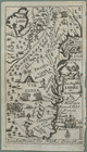
The English empire in America
parent:
4247
b
920-c5d5-012f-f573-58d385a7bc34
Map of the borough of Brookly…
parent:
5c726c30-846a-013
b
-5
b
09-0242ac110006
Map of the borough of Manhatt…
parent:
31a51f90-32e3-013
b
-530e-0242ac110003
m
….
B
]
parent:
45cb4830-c5fa-012f-2a5
b
-58d385a7bc34
m
….
B
, Houston St
parent:
3db7cb20-c5fa-012f-0
b
74-58d385a7bc34
Map of the city of Savannah, …
parent:
0c79e7e0-2
b
8c-0136-ef56-63da78af51cd
… River (Avenue
B
), E
parent:
2e12
b
9d0-c5fa-012f-29a5-58d385a7bc34
North America : according to …
note:
by Pat. Gordon, M.A.F.
R
.S.
Passe A Loutre, Mississippi D…
parent:
af813990-22e3-0135-11f1-3
b
7eb8fe3d7e
…,
b
. Deux statues
parent:
3
b
43ae70-c6ba-012f-f083-58d385a7bc34
Plan des superbes edifices su…
note:
…,
r
. Lignes
Map of Jersey City, Hoboken &…
parent:
6026d090-c52
b
-012f-3261-3c075448cc4
b
Patapsco River and the approa…
parent:
3231
b
290-5e70-0135-a200-2bb85970eb5a
Preliminary Chart of Atchafal…
parent:
49fc01f0-c52
b
-012f-0aff-3c075448cc4
b
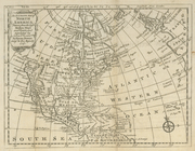
An accurate map of North Amer…
parent:
6a5739c0-c5d4-012f-7f0
b
-58d385a7bc34
Lynn Harbor, Massachusetts 18…
parent:
bac116a0-
b
143-0132-83cb-58d385a7bbd0
Montana, Helena special map
parent:
17603
b
30-2930-0136-4517-77871d97e33e
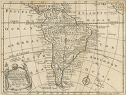
An accurate map of South Amer…
parent:
6ad2def0-c5d4-012f-a7
b
9-58d385a7bc34
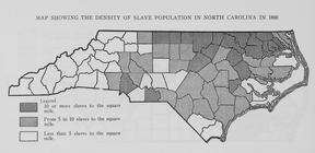
Map showing the density of sl…
parent:
5ac33870-c607-012f-
b
469-58d385a7bc34
Map of wagon routes in Utah T…
parent:
d802d9f0-
b
144-0132-592c-58d385a7bbd0
Western New York in 1809
first:
510d47da-f14
b
-a3d9-e040-e00a18064a99
Middle part of Long Island So…
first:
99386140-91a1-0135-109d-6
b
28c3143f35
A map of New England, New Yor…
note:
Also available on microfilm in: Sc Micro
R
Entrance to Columbia River, O…
parent:
8517
b
870-
b
144-0132-5074-58d385a7bbd0
North America
parent:
475d0f20-c5d5-012f-f6
b
0-58d385a7bc34
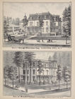
A. C. Osborn. ; Res. of A. C.…
parent:
d0255
b
50-c5f7-012f-6eba-58d385a7bc34
Tidal currents of Long Island…
note:
…"From observations by Lieuts. C.
H
. Davis & J.
R
Philadelphia and vicinity : P…
parent:
43d78210-c969-0135-afce-27ef828
b
31c7
Map of the head waters of the…
parent:
ff3ad580-
b
954-0133-04a6-00505686d14e
Map of the country between th…
parent:
f58affb0-c52a-012f-56dd-3c075448cc4
b
m
Walden Pond. A reduced plan. …
parent:
671d26d0-f962-0139-90
b
7-0242ac110002
Galveston entrance, Texas
parent:
f5a23a70-e81
b
-0135-
b
7e6-396757a6328d
Long Island Sound (western sh…
first:
86d0
b
3d0-91a1-0135-8784-396798343025
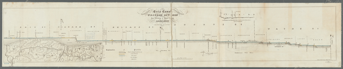
Statistical profile of Erie C…
parent:
3f8241f0-8
b
02-0133-3197-00505686a51c
Military topographical map of…
parent:
93faf260-52
b
0-0135-d6ad-1f8a89972be0
m
Map of Albany County, New Yor…
parent:
bb840860-c6
b
4-0133-3cd2-00505686a51c
Map of military reservation o…
parent:
e3c91230-
b
143-0132-d0bf-58d385a7bbd0
Topographical map in ten-foot…
parent:
69bfffd0-c52
b
-012f-6
b
53-3c075448cc4
b
…. G.
R
. Putman Saratoga
parent:
da8958
b
0-c5f9-012f-9fb9-58d385a7bc34
m
Petersen's map of Brooklyn
parent:
406d3c40-895c-013
b
-aa64-0242ac110003
North America west coast, Har…
parent:
267c9660-3221-0133-0f42-58d385a7
b
928
New and improved map of the c…
parent:
7
b
0a2650-c52
b
-012f-c914-3c075448cc4
b
Preliminary chart of Beaufort…
parent:
ef6c89e0-3ff7-0135-dd26-0a1e3
b
7ef334
America, N.W. Coast, Strait o…
parent:
7d109db0-c52a-012f-
b
115-3c075448cc4
b
m
Map showing 50 miles around N…
parent:
2c18d560-83bb-013
b-b
0fe-0242ac110003
Bass River Harbor, Massachuse…
parent:
bac116a0-
b
143-0132-83cb-58d385a7bbd0
End of results
|
Top