Click to visit the main New York Public Library Homepage
The New York Public Library
Digital Collections
About Digital Collections
Browse
Search only public domain materials
Items
Collections
Divisions
Home
Search
Browse
About
Search only public domain materials
Items
Collections
Divisions
Digital Collections
Using Images
Using Data
Search
Filtered keyword search
Show filters
Hide filters
Show Only Public Domain
topic
Nautical charts
43
Real property
36
Fire insurance
21
Harbors
20
Landowners
19
More
Less
name
Davis, F. A
72
Kochersperger, H. L
72
O.W. Gray & Son
72
Robinson, E. (Elisha)
68
A.H. Mueller (Publisher)
66
More
Less
collection
Atlases of the United States
163
Maps of North America
131
Lawrence H. Slaughter Collection of English maps, charts, globes, books and atlases
93
Maps of New York City and State
26
Atlases of New York City
24
More
Less
place
Dutchess County (N.Y.)
73
Newark (N.J.)
66
New York (State)
52
North America
50
United States
38
More
Less
genre
Maps
467
Atlases
163
Nautical charts
32
Bathymetric maps
20
Cadastral maps
18
More
Less
publisher
Reading Publishing House
72
A.H. Mueller
66
Higginson, J. H
21
D.L. Miller
18
U.S. Coast Survey
14
More
Less
division
Map Division
458
Rare Book Division
6
General Research Division
5
Schomburg Manuscripts, Archives and Rare Books Division
3
Berg Collection
1
More
Less
type
x
cartographic
still image
8
text
5
Date Range
to
475 results found for:
x
H. L
Filtering on:
x
Type
: cartographic
Sort by:
Relevance
Title
Date created
Date digitized
Sequence
Thayer's map of Colorado
note:
H.L
. Thayer, draftsman ; Rufus Blanchard
Thayer's map of Colorado
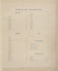
Table of Contents.
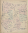
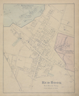
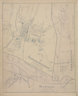
Red Hook [Township]
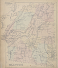
Rhinebeck [Township]
Rhinebeck [Village]
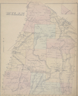
Milan [Township]
Clinton [Township]
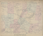
Stanford [Township]
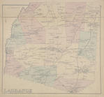
Lagrange [Township]
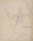
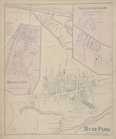
Dover Plains [Village]
Map of Unionvale Township.
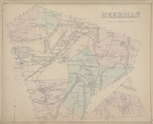
Beekman [Township]
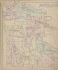
Pawling [Township]
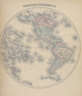
Western Hemisphere
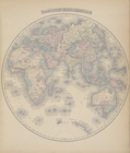
Eastern Hemisphere
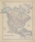
North America
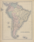
South America
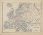
General Description - Europe.
Europe
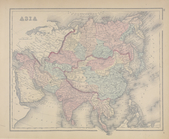
Asia
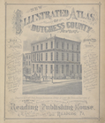
New Illustrated Atlas of Dutc…
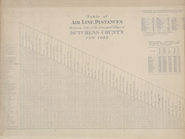
Table of Air Line Distances
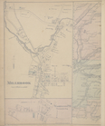
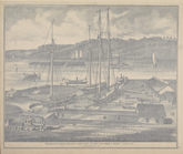
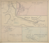
Poughkeepsie Marine Railways …
m
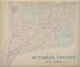
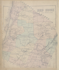
Map of Dutchess County New Yo…
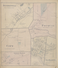
Annandale [Village]; Red Hook…
m
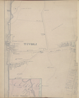
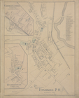
Tivoli [Village]; Hibernia [V…
m
Stanfordville [Village]; Hyde…
Rhinecliff [Village]; Staatsb…
m
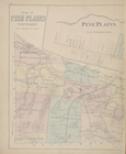
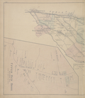
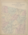
Map of Pine Plains Township. …
m
Irondale [Village]; Millerton…
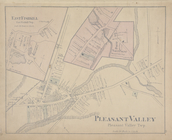
Map of Pleasant Valley Dutche…
Salt Point [Village]; East Fi…
m
Millbrook [Village]; Washingt…
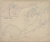
Mechanic [Village]; Amenia [V…
m
Upper Red Hook [Village]; Lee…
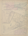
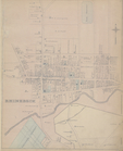
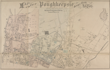
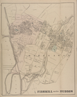
Map of the city of Poughkeeps…
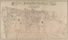
Map of the city of Poughkeeps…
Carthage Landing [Village]; H…
PawlingStation [Village]; Was…
m
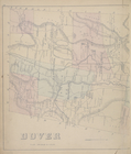
Dover [Township]; Mabbettsvil…
Beekmanville [Vilage]; City […
m
Johnsville [Village]; East Fi…
Wing Station [Village]; South…
Fishkill on the Hudson [Villa…
m
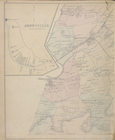
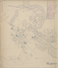
Wappingers Falls [Village]; N…
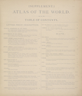
Supplement. Atlas of the Worl…
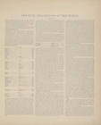
Physical Description of the W…
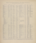
The Governments of the World.
General Description - North A…
1
2
Previous
Next
1
2
Previous
Next