Click to visit the main New York Public Library Homepage
The New York Public Library
Digital Collections
About Digital Collections
Browse
Search only public domain materials
Items
Collections
Divisions
Home
Search
Browse
About
Search only public domain materials
Items
Collections
Divisions
Digital Collections
Using Images
Using Data
Search
Filtered keyword search
Show filters
Hide filters
Show Only Public Domain
topic
Indian reservations
4
Military reservations
3
Railroads
3
Colonies
2
Land grants
2
More
Less
name
Berthrong, I. P
4
United States. General Land Office
4
Harris, John, fl. 1680-1740
3
King, Harry, (Harold G. R.)
3
Julius Bien & Co
2
More
Less
collection
Maps of North America
4
Lawrence H. Slaughter Collection of English maps, charts, globes, books and atlases
2
Century Company records
1
I. N. Phelps Stokes Collection of American Historical Prints
1
John H. Levine Collection
1
place
America
2
Great Britain
2
North America
2
Atlantic Ocean
1
Atlantic Ocean -- Maps -- Early works to 1800
1
More
Less
genre
Maps
9
Correspondence
1
Prints
1
publisher
Department of the Interior, General Land Office
3
General Land Office
1
Printed for Daniel Browne ... , John Senex
1
Printed for Daniel Browne ... , John Senex ..
1
This chart is to be sold by Rich. Mount and Tho. Page at the Postern on Tower-Hill,
1
division
Map Division
7
Manuscripts and Archives Division
1
Wallach Division: Print Collection
1
type
x
cartographic
text
1
Date Range
to
9 results found for:
x
Harris, I
Filtering on:
x
Type
: cartographic
Sort by:
Relevance
Title
Date created
Date digitized
Sequence
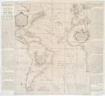
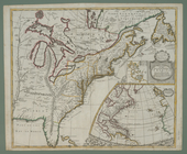
A new and correct chart shewi…
use:
Release Source File for Free (
i
.e., high-res
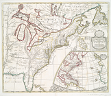
A new map of the English empi…
use:
Release Source File for Free (
i
.e., high-res
A mapp of ye improved part of…
collection:
I
. N. Phelps Stokes Collection of American
A new map of the English empi…
use:
Release Source File for Free (
i
.e., high-res
m
Reid,
Harry
Fielding
collection:
Series
I
. General Correspondence
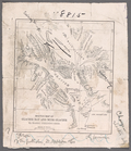
Map of the state of Ohio
use:
Release Source File for Free (
i
.e., high-res
Map of the state of Montana
use:
Release Source File for Free (
i
.e., high-res
Territory of New Mexico
use:
Release Source File for Free (
i
.e., high-res
Map of the state of Kansas
use:
Release Source File for Free (
i
.e., high-res