Click to visit the main New York Public Library Homepage
The New York Public Library
Digital Collections
About Digital Collections
Browse
Search only public domain materials
Items
Collections
Divisions
Home
Search
Browse
About
Search only public domain materials
Items
Collections
Divisions
Digital Collections
Using Images
Using Data
Search
Filtered keyword search
Show filters
Hide filters
Show Only Public Domain
topic
Real property
192
Description and travel
93
Geography
53
Antiquities
52
History
48
More
Less
name
F.W. Beers & Co
148
Everts, Ensign & Everts
99
Davis, F. A
72
Kochersperger, H. L
72
O.W. Gray & Son
72
More
Less
collection
Atlases of the United States
359
Maps of North America
159
Maps of New York City and State
87
Lawrence H. Slaughter Collection of English maps, charts, globes, books and atlases
71
In motion : the African-American migration experience: Maps by Michael Siegel
47
More
Less
place
New York (State)
259
Erie County
149
Erie County (N.Y.)
149
United States
101
Broome County (N.Y.)
100
More
Less
genre
Maps
877
Atlases
361
Illustrations
304
Prints
144
Charts
48
More
Less
publisher
F. W. Beers & Co
148
Everts, Ensign & Everts
99
Reading Publishing House
72
Rutgers Cartography
46
Printed for Timothy Childe at the White Hart at the West-end of St. Paul's Church-yard
43
More
Less
division
Map Division
697
General Research Division
114
Schomburg Jean Blackwell Hutson Research and Reference Division
80
Rare Book Division
59
Schomburg Manuscripts, Archives and Rare Books Division
29
More
Less
type
x
cartographic
still image
84
text
41
Date Range
to
998 results found for:
x
Illustrators
Filtering on:
x
Type
: cartographic
Sort by:
Relevance
Title
Date created
Date digitized
Sequence
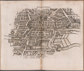
Koningsberga
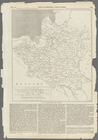
Map of Poland, showing the pa…
collection:
The
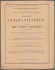
Illustrated
London news, Vol. 42, no
New
Illustrated
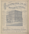
Atlas of Dutchess County
Battle of the Thames
note:
Illustrated
half-title.
m
…
illustrated
Siege of Fort Meigs
note:
Illustrated
half-title.
Plan of the Battle of Fallen …
note:
Illustrated
half-title.
Detroit River and vicinity
note:
Illustrated
half-title.
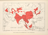
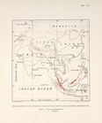
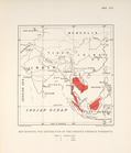
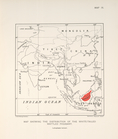
Map showing the distribution …
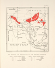
Map showing the distrubution …
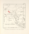
Map showing the distribution …
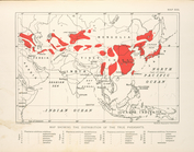
Map showing the distribution …
Map showing the distrubution …
Map showing the distribution …
Map showing the distribution …
Plan of the Tippecanoe camp a…
note:
Illustrated
half-title.
m
Bartholdi's
illustrated
map of New York
Illustrated
Times map of the United
note:
…"Supplement (gratis) to the
Illustrated
Times, October 11
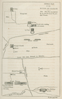
Plan of Uxmal
collection:
…. Stephens ...
Illustrated
Section of the cave
collection:
…. Stephens ...
Illustrated
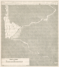
Plan of the City wall
collection:
…. Stephens ...
Illustrated
m
Atlas of the
illustrated
building laws
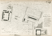
General plan of the ruins of …
collection:
…. Stephens ...
Illustrated
Ancient Indian map of Mani
collection:
…. Stephens ...
Illustrated
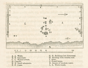
General plan of the buildings…
collection:
…. Stephens ...
Illustrated
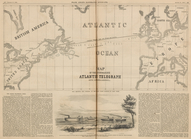
Map of the Submarine Atlantic…
collection:
Frank Leslie's
illustrated
newspaper, Dec
Table of Contents.
collection:
New
illustrated
atlas of Dutchess County
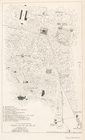
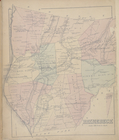
Rhinebeck [Township]
collection:
New
illustrated
atlas of Dutchess County
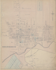
Rhinebeck [Village]
collection:
New
illustrated
atlas of Dutchess County
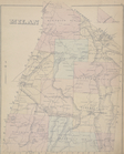
Milan [Township]
collection:
New
illustrated
atlas of Dutchess County
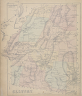
Clinton [Township]
collection:
New
illustrated
atlas of Dutchess County
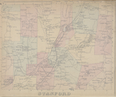
Stanford [Township]
collection:
New
illustrated
atlas of Dutchess County
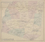
Lagrange [Township]
collection:
New
illustrated
atlas of Dutchess County
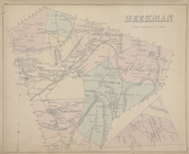
Beekman [Township]
collection:
New
illustrated
atlas of Dutchess County
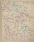
Pawling [Township]
collection:
New
illustrated
atlas of Dutchess County
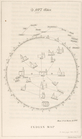
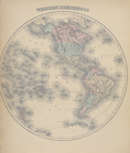
Western Hemisphere
collection:
New
illustrated
atlas of Dutchess County
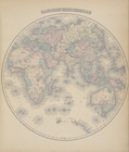
Eastern Hemisphere
collection:
New
illustrated
atlas of Dutchess County
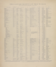
The Governments of the World.
collection:
New
illustrated
atlas of Dutchess County
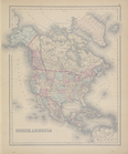
North America
collection:
New
illustrated
atlas of Dutchess County
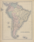
South America
collection:
New
illustrated
atlas of Dutchess County
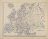
Europe
collection:
New
illustrated
atlas of Dutchess County
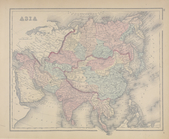
Asia
collection:
New
illustrated
atlas of Dutchess County
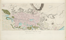
Pianta della città del Cairo.
North America
note:
… ; the
illustrations
by J. Marchant
m
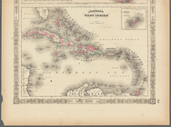
Johnson's West Indies, Plate …
collection:
Johnson's new
illustrated
(steel plate
m
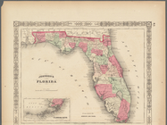
Johnson's Florida, Plate 43
collection:
Johnson's new
illustrated
(steel plate
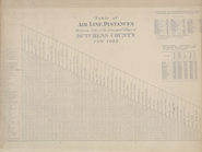
Table of Air Line Distances
collection:
New
illustrated
atlas of Dutchess County
m
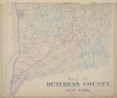
Map of Dutchess County New Yo…
collection:
New
illustrated
atlas of Dutchess County
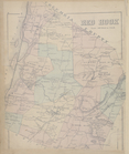
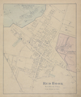
Red Hook [Township]
collection:
New
illustrated
atlas of Dutchess County
Annandale [Village]; Red Hook…
collection:
New
illustrated
atlas of Dutchess County
1
2
3
4
Previous
Next
1
2
3
4
Previous
Next