Click to visit the main New York Public Library Homepage
The New York Public Library
Digital Collections
About Digital Collections
Browse
Search only public domain materials
Items
Collections
Divisions
Home
Search
Browse
About
Search only public domain materials
Items
Collections
Divisions
Digital Collections
Using Images
Using Data
Search
Filtered keyword search
Show filters
Hide filters
Show Only Public Domain
topic
Nautical charts
165
Real property
132
Administrative and political divisions
110
Railroads
79
Harbors
50
More
Less
name
United States Coast Survey
141
Bache, A. D. (Alexander Dallas), 1806-1867
126
Beers, S. N
51
Mathiot, G
42
Bien, Julius, 1826-1909
38
More
Less
collection
Maps of North America
489
Atlases of the United States
114
Maps of New York City and State
104
Lawrence H. Slaughter Collection of English maps, charts, globes, books and atlases
43
I. N. Phelps Stokes Collection of American Historical Prints
19
More
Less
place
New York (State)
178
United States
90
New York (N.Y.)
67
New Jersey
54
Virginia
51
More
Less
genre
Maps
815
Nautical charts
121
Atlases
112
Bathymetric maps
63
Prints
41
More
Less
publisher
U.S. Coast Survey
60
U.S. Coast Survey Office
41
J.H. Toudy & Co
31
publisher not identified
24
General Land Office
15
More
Less
division
Map Division
776
Wallach Division: Print Collection
24
General Research Division
16
Rare Book Division
4
Dorot Jewish Division
2
More
Less
type
x
cartographic
still image
26
text
5
Date Range
to
827 results found for:
x
J. D
Filtering on:
x
Type
: cartographic
Sort by:
Relevance
Title
Date created
Date digitized
Sequence
Itinéraire, de Karak a Chauba…
parent:
d
089c2
d
0-c6e4-012f-4b7b-58
d
385a7bc34
Réduction des cartes du cours…
parent:
b57684
d
0-c6e4-012f-
d
775-58
d
385a7bc34
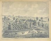
Summer Res. & Stock Farm of
J
.
D
. Willis
parent:
94ee7910-c5f9-012f-ff24-58
d
385a7bc34
Maryland - District of Columb…
note:
… by
J.D
. Hoffman,
D.J
Revised map of the rail roads…
parent:
ea614290-8bc3-0133-3b71-00505686
d
14e
Revised map of the rail roads…
parent:
a202b2e0-c5a6-012f-9190-58
d
385a7bc34
Geological map of Keweenaw Po…
parent:
81a0e120-bcec-0135-
d
3ca-0ffe8c55e36b
Washington and vicinity, Mary…
first:
a6dd0510-081f-0135-f2cb-536af172953
d
The boundary lines between th…
Geological map of the distric…
parent:
c2e47e80-b143-0132-9cdd-58
d
385a7bbd0
Geological map of Isle Royale…
parent:
191
d
3640-b820-0135-f1
d
7-01b9a6f05df9
m
Topographical map of central …
parent:
85f1
d
740-0542-0136-691b-0cfce68b61ca
…. T.
J
. Cram, T.E
parent:
c2e47e80-b143-0132-9cdd-58
d
385a7bbd0
Geological map of the Lake Su…
parent:
c2e47e80-b143-0132-9cdd-58
d
385a7bbd0
Geological map of the distric…
parent:
c2e47e80-b143-0132-9cdd-58
d
385a7bbd0
m
Charleston Harbour and the ad…
parent:
b5897740-b144-0132-f312-58
d
385a7bbd0
Chicago harbor
parent:
6dae2340-b143-0132-02db-58
d
385a7bbd0
A map of part of Alabama & Fl…
parent:
9
d
3576e0-ed59-0134-a3ed-5bc3589fc5db
Barometric profile of the rou…
parent:
8888cf20-bc16-0135-b08
d
-2fcd654e623
d
A map of the extremity of Cap…
parent:
bac116a0-b143-0132-83cb-58
d
385a7bbd0
Harbor of Manitowoc, Wis. : t…
parent:
5c323b90-e50f-0135-89
d
4-7fd7a9a18e32
… Colonel
J
.
D
. Graham, U.S
first:
510
d
47da-edfe-a3
d
9-e040-e00a18064a99
Harbor of Manitowoc, Wis. : t…
parent:
f404
d
380-
d
446-012f-412b-58
d
385a7b928
Map of the boundary lines bet…
parent:
a9f066a0-54c7-0133-8
d
30-00505686a51c
Map of the city of Savannah, …
parent:
3b2ec720-b143-0132-959c-58
d
385a7bbd0
…. le capitaine
d
parent:
e3c14680-c5fe-012f-7
d
72-58
d
385a7bc34
Tabula Nautica.
parent:
015980f0-c619-012f-be0c-58
d
385a7bc34
… Orleans by
D
'Anville for
J
parent:
23391240-c603-012f-43
d
8-58
d
385a7bc34
Preliminary chart of the sea …
parent:
0b61aca0-
d
632-0132-f6cd-58
d
385a7b928
Bird's eye view of Rochester …
first:
510
d
47
d
9-7
d
96-a3
d
9-e040-e00a18064a99
A draught[sic] of New York fr…
parent:
2
d
4f30c0-c5f0-012f-aef2-58
d
385a7bc34
A Map of Africa drawn & engraved from
D
parent:
22a21c30-c603-012f-6927-58
d
385a7bc34
Plan and site for a royal pal…
parent:
a8bd5b90-c6f4-012f-cb42-58
d
385a7bc34
… Cantons
d
' Argauvie et
parent:
77ab4
d
70-c6e7-012f-
d
1
d
0-58
d
385a7bc34
… Gouvernement
d
' Arlberg et
parent:
794a2170-c6e7-012f-c442-58
d
385a7bc34
…
D
'Anville's two
parent:
22feaaf0-c603-012f-40b8-58
d
385a7bc34
Map showing the relative posi…
parent:
924cadb0-f092-0130-acdf-58
d
385a7b928
Preliminary chart of St. Andr…
parent:
32958040-b143-0132-2eae-58
d
385a7bbd0
Map of Waldo County, Maine: f…
parent:
acea7850-b143-0132-c36f-58
d
385a7bbd0
….
D
., Langaster, N.Y.
parent:
c4639380-c5f7-012f-025e-58
d
385a7bc34
Map of the state of New York …
parent:
a202b2e0-c5a6-012f-9190-58
d
385a7bc34
m
Johnson's Physical Map
parent:
b28be120-c602-012f-769c-58
d
385a7bc34
m
Plate from The tapestry hangi…
parent:
670b6ba0-c607-012f-01ea-58
d
385a7bc34
Carta general de la Republica…
parent:
a44e5740-c6f7-012f-a282-58
d
385a7bc34
Plano general de la ciudad de…
parent:
93cae230-c6f7-012f-68ad-58
d
385a7bc34
Map of the state of New York …
parent:
a202b2e0-c5a6-012f-9190-58
d
385a7bc34
A general map of North Americ…
parent:
60b5cd60-c5
d
5-012f-35be-58
d
385a7bc34
Metomkin Inlet, Virginia : fr…
parent:
87229fd0-c52b-012f-390
d
-3c075448cc4b
The tourist's pocket map of P…
parent:
7273c120-c52b-012f-ba9
d
-3c075448cc4b
The tourist's pocket map of P…
first:
510
d
47da-efdf-a3
d
9-e040-e00a18064a99
1
2
3
4
Previous
Next
1
2
3
4
Previous
Next