Click to visit the main New York Public Library Homepage
The New York Public Library
Digital Collections
About Digital Collections
Browse
Search only public domain materials
Items
Collections
Divisions
Home
Search
Browse
About
Search only public domain materials
Items
Collections
Divisions
Digital Collections
Using Images
Using Data
Search
Filtered keyword search
Show filters
Hide filters
Show Only Public Domain
topic
Real property
265
Nautical charts
122
Administrative and political divisions
95
Railroads
77
Landowners
60
More
Less
name
Beers, F. W. (Frederick W.)
256
J.B. Beers & Co
136
United States Coast Survey
78
Bromley, George Washington
72
Bromley, Walter Scott
72
More
Less
collection
Maps of North America
399
Atlases of the United States
374
Maps of New York City and State
165
Lawrence H. Slaughter Collection of English maps, charts, globes, books and atlases
41
Atlases of New York City
40
More
Less
place
New York (State)
348
New Jersey
107
New York (N.Y.)
78
Bergen County (N.J.)
74
United States
72
More
Less
genre
Maps
1030
Atlases
375
Nautical charts
79
Cadastral maps
49
Bathymetric maps
37
More
Less
publisher
G.W. Bromley and Co.,
69
Walker & Jewett
54
Watson & co
53
J.B. Beers & Co
36
publisher not identified
31
More
Less
division
Map Division
1033
Manuscripts and Archives Division
6
Pforzheimer Collection
4
Wallach Division: Print Collection
3
Berg Collection
1
More
Less
type
x
cartographic
still image
14
text
8
Date Range
to
1,052 results found for:
x
J. W.
Filtering on:
x
Type
: cartographic
Sort by:
Relevance
Title
Date created
Date digitized
Sequence
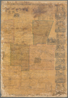
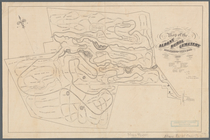
Map of the Albany Rural Cemet…
note:
…"
J
.
W
. Greene
Geological map of Keweenaw Po…
note:
By
J.W
. Foster &
J
.D. Whitney, U.S
m
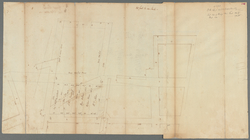
Great Dock - original protrac…
note:
… Milner,
J
.
W
. Vreedenberg
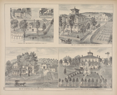
Residence of
J
.
W
… Orange County Press;
J
.
W
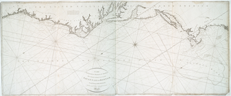
A new chart of the Atlantic o…
note:
In lower left margin: [?] by
J
. Norie
McClung's map of Minnesota : …
note:
… in the year 1870 by
J.W
To the independent mariners o…
note:
In lower left margin: Drawn by
J
. Norie
Map of the Pittsburg & Baltim…
note:
… by
J.W
. Harden.
Map of the iron mines of Lake…
note:
J.W
. Foster.
Geological map of the distric…
note:
J.W
. Foster &
J
A new chart of America with t…
note:
In lower left margin: Drawn by
J
. Norie
Geological map of Isle Royale…
note:
…, by
J.W
. Foster &
J
Military map of South Carolina
note:
… ; approved James
W
. Abert
…, Hudson County, N.
J
.
note:
… and published by
J.W
. Harrison
1892, Harrison's map of Jerse…
note:
… & published by
J.W
. Harrison
City and harbor of Portland, …
note:
…,
J.W
. Donn, C. Hosmer
Geological map of the distric…
note:
J.W
. Foster &
J
.D. Whitney, U.S. geologists.
Map of the Department of the …
note:
…
W
. Symons, Corps
Department of Arizona, Sheet …
note:
… ; drawn by
J.W
. Ward.
Department of Arizona, Sheet …
note:
… ; drawn by
J.W
. Ward.
A new county map of the state…
note:
Reduced from the large state map by
J.W
Plan No. 3 : Milwaukee Harbor…
note:
J.W
. Gunnison, U.S. Agent & Engineer.
Map of the territory of New M…
note:
…, U.S.T.E. by Lieuts.
J.W
Sketch of the Yellowstone Lak…
Reconnaissance of the Pamunky…
note:
…"
J.W
. Maedel"--lower left margin.
Plan exhibiting the system of…
note:
Prepared by
J.W
. Adams.
Route of the Peninsula Railro…
note:
Prepared by
J.W
. Foster.
Geological map of the Lake Su…
note:
By
J.W
. Foster &
J
.D. Whitney, U. S
m
Map of Mahoning County, Ohio …
m
Map of Genesee County, New Yo…
note:
from actual surveys by
J.W
. Otley & S.M. Rea.
Map of Genesee County, New Yo…
note:
from actual surveys by
J.W
. Otley & S.M. Rea.
Map of a reconnoissance betwe…
note:
….
J.W
. Gunnison, Corps
Map of the Great Salt Lake an…
note:
… of Col.
J.J
. Abert, Chief
Chart of Green Bay
note:
….
J.W
. Gunnison, Corps
Map showing the route pursued…
note:
… by Lieut.
J.W
. Abert
Map no. 2, from the mouth of …
note:
by Capt.
J.W
A chart of the coast of Ameri…
note:
… 1837, by
J.W
. Norie
Plan and section of the north…
note:
J.W
. Gunnison, U.S. agent & Eng'r
… of
J
. Fitch ESQ
Res. of
J
. Mulock
m
… for
J
. Augustus Page
note:
Scale 1:600. (
W
74°00ʹ02ʺ--
W
73°59ʹ38ʺ/N
Map of North America
note:
by
J
. Calvin Smith.
m
Sable Island
collection:
… F.
W
. Des Barres
Map of the city of Washington…
note:
… of Thos.
J
. Fisher and Co
…. of and Store of E.
J
. Markham
m
Chicago
note:
… by F.L. Flower and
J
. Van
…. ; Residence and Store of
J
. L
Map of New York City
note:
Scale not given. (
W
74°01ʹ23ʺ--
W
73°54ʹ47ʺ/N
… / by
J
. F. Harrison.
note:
… feet to one inch. (
W
74°01ʹ07ʺ--
W
73°57ʹ30ʺ/N
1
2
3
4
5
Previous
Next
1
2
3
4
5
Previous
Next