Click to visit the main New York Public Library Homepage
The New York Public Library
Digital Collections
About Digital Collections
Browse
Search only public domain materials
Items
Collections
Divisions
Home
Search
Browse
About
Search only public domain materials
Items
Collections
Divisions
Digital Collections
Using Images
Using Data
Search
Filtered keyword search
Show filters
Hide filters
Show Only Public Domain
topic
Railroads
22
Nautical charts
19
Indians of North America
18
Discovery and exploration
14
Administrative and political divisions
13
More
Less
name
United States Coast Survey
19
Bache, A. D. (Alexander Dallas), 1806-1867
15
Catherwood, Frederick
7
Moll, Herman, -1732
7
Stephens, John Lloyd, 1805-1852
7
More
Less
collection
Maps of North America
138
Lawrence H. Slaughter Collection of English maps, charts, globes, books and atlases
18
Incidents of travel in Yucatan: By John L. Stephens ... Illustrated by 120 engravings...
7
Atlases of the United States
6
Terzo volvme delle navigationi et viaggi: nel qvale si contengono le nauigationi al mondo nuouo, alli antichi incognito, fatte da don Christoforo Colombo Genouese, che fu il primo à scoprirlo à i Re Catholici, detto hora le Indie occidentali, con gli acquisti fatti da lui, et accresciuti poi da Fernando Cortese, da Francesco Pizzarro, & altri valorosi capitani, in diuerse parti delle dette Indie, in nome della Ces. Maes
6
More
Less
place
United States
52
Mexico
50
North America
33
Mexico, Gulf of
25
New Mexico
25
More
Less
genre
Maps
194
Nautical charts
16
Prints
11
Illustrations
8
Bathymetric maps
5
More
Less
publisher
U.S. Coast Survey
13
publisher not identified
10
Harper & Brothers
7
s.n
7
Nella stamperia de Givnti
6
More
Less
division
Map Division
174
Rare Book Division
14
General Research Division
3
Manuscripts and Archives Division
1
Schomburg Jean Blackwell Hutson Research and Reference Division
1
More
Less
type
x
cartographic
text
17
still image
6
Date Range
to
195 results found for:
x
New Mexico
Filtering on:
x
Type
: cartographic
Sort by:
Relevance
Title
Date created
Date digitized
Sequence
… of the territories of
New
Mexico
use:
… partner (e.g.,
New
York
Territory of
New
Mexico
…
use:
… partner (e.g.,
New
York
District of
New
Mexico
use:
… partner (e.g.,
New
York
Territory of
New
Mexico
…
use:
… partner (e.g.,
New
York
Morley's map of
New
Mexico
:…
use:
… partner (e.g.,
New
York
Sketch of public surveys in
New
Mexico
use:
… partner (e.g.,
New
York
Sketch of public surveys in
New
Mexico
use:
… partner (e.g.,
New
York
Territory of
New
Mexico
…
use:
… partner (e.g.,
New
York
…,
New
Mexico
use:
… partner (e.g.,
New
York
… and military department of
New
Mexico
use:
… partner (e.g.,
New
York
… map of Arizona and
New
Mexico
use:
… partner (e.g.,
New
York
Map of the territory of
New
Mexico
use:
… partner (e.g.,
New
York
… and
New
Mexico
…
use:
… partner (e.g.,
New
York
… and northern
New
Mexico
…
use:
… partner (e.g.,
New
York
m
Automobile local tours: Locke…
use:
… partner (e.g.,
New
York
…, in
New
Mexico
, in 1851
use:
… partner (e.g.,
New
York
Houston Post map of the great…
use:
… partner (e.g.,
New
York
Map of explorations and surveys in
New
Mexico
use:
… partner (e.g.,
New
York
Map of the territory of
New
Mexico
use:
… partner (e.g.,
New
York
… of Arkansas and
New
Mexico
use:
… partner (e.g.,
New
York
Le Nouveau Mexique et la Flor…
use:
… partner (e.g.,
New
York
… and
New
Mexico
.
use:
… partner (e.g.,
New
York
… by the exploring expedition to
New
Mexico
and the southern
use:
… partner (e.g.,
New
York
…, in
New
Mexico
, Colorado
use:
… partner (e.g.,
New
York
Map of part of the state of C…
use:
… partner (e.g.,
New
York
Preliminary map of the wester…
use:
… partner (e.g.,
New
York
…, Colorado,
New
Mexico
use:
… partner (e.g.,
New
York
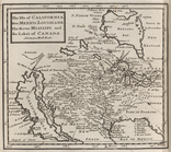
The isle of California,
New
Mexico
use:
… partner (e.g.,
New
York
Accurata delineatio celeberri…
use:
… partner (e.g.,
New
York
County map California; Map of…
use:
… partner (e.g.,
New
York
…, Washington, Utah &
New
Mexico
use:
… partner (e.g.,
New
York
… of the
New
York and Texas
use:
… partner (e.g.,
New
York
United States
use:
… partner (e.g.,
New
York
New
Mexico
; Florida.
use:
… partner (e.g.,
New
York
General geologic map of the a…
use:
… partner (e.g.,
New
York
m
Map of the states of Kansas a…
use:
… partner (e.g.,
New
York
County map of the state of Te…
use:
… partner (e.g.,
New
York
United States
use:
… partner (e.g.,
New
York
m
Map of the Denver & Rio Grand…
use:
… partner (e.g.,
New
York
m
The isle of California,
New
Mexico
use:
… partner (e.g.,
New
York
Mapa de la Sierra Gorda, y Co…
use:
… partner (e.g.,
New
York
A
new
map of the United States, upon which
use:
… partner (e.g.,
New
York
Native races of the Pacific States,
New
use:
… partner (e.g.,
New
York
Route through
Mexico
, Guatemala, & S
use:
… partner (e.g.,
New
York
Carta general de la Republica…
use:
… partner (e.g.,
New
York
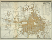
Plano general de la ciudad de
México
, 1875.
use:
… partner (e.g.,
New
York
… Ocean and part of
Mexico
use:
… partner (e.g.,
New
York
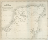
Map of Yucatan
use:
… partner (e.g.,
New
York
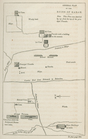
Plan of Uxmal
use:
… partner (e.g.,
New
York
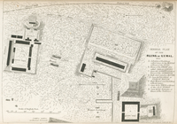
General plan of the ruins of …
use:
… partner (e.g.,
New
York