Click to visit the main New York Public Library Homepage
The New York Public Library
Digital Collections
About Digital Collections
Browse
Search only public domain materials
Items
Collections
Divisions
Home
Search
Browse
About
Search only public domain materials
Items
Collections
Divisions
Digital Collections
Using Images
Using Data
Search
Filtered keyword search
Show filters
Hide filters
Show Only Public Domain
topic
Harbors
1
Nautical charts
1
name
Anville, Jean Baptiste Bourguignon d', 1697-1782
2
Bolton, Solomon, -approximately 1768
2
Gravelot, Hubert François, 1699-1773
2
Jefferys, Thomas, -1771
2
John and Paul Knapton (Firm)
2
More
Less
collection
Maps of North America
4
Atlases of New York City
1
Lawrence H. Slaughter Collection of English maps, charts, globes, books and atlases
1
Maps of North and South America
1
place
Boston Harbor (Mass.)
2
Connecticut
2
Long Island (N.Y.)
2
Massachusetts
2
New England
2
More
Less
genre
Maps
7
Bathymetric maps
1
Nautical charts
1
Topographic maps
1
publisher
Thomas Jefferys
2
Printed for John and Paul Knapton
1
Printed for John and Paul Knapton,
1
Publish'd as the act directs, 1st April 1772, by Robt. Sayer, map & printseller at the Golden Buck near Serjeants Inn, Fleet Street
1
U.S. Coast Survey Office
1
division
Map Division
7
type
x
cartographic
Date Range
to
7 results found for:
x
Prince's Bay (New York, N.Y.)
Filtering on:
x
Type
: cartographic
Sort by:
Relevance
Title
Date created
Date digitized
Sequence
… and Vernon Avenue in
Prince
's
Bay
.]
use:
… partner (e.g.,
New
York
Preliminary chart of Winyah
Bay
& Georgetown
use:
… partner (e.g.,
New
York
m
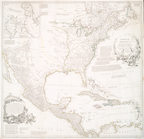
A map of the most inhabited part of
New
use:
… partner (e.g.,
New
York
… of Orleans, First
Prince
use:
… partner (e.g.,
New
York
m
A map of the most inhabited part of
New
use:
… partner (e.g.,
New
York
North America
use:
… partner (e.g.,
New
York
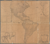
A map of the whole continent …
use:
… partner (e.g.,
New
York