Click to visit the main New York Public Library Homepage
The New York Public Library
Digital Collections
About Digital Collections
Browse
Search only public domain materials
Items
Collections
Divisions
Home
Search
Browse
About
Search only public domain materials
Items
Collections
Divisions
Digital Collections
Using Images
Using Data
Search
Filtered keyword search
Show filters
Hide filters
Show Only Public Domain
topic
Administrative and political divisions
3
Real property
3
Landowners
2
Railroads
2
Buoys
1
More
Less
name
Walling, Henry Francis, 1825-1888
5
Baker, William E
1
Borden, William G
1
E. Robinson Co
1
Friend & Aub
1
More
Less
collection
Maps of North America
4
Atlases of New York City
1
Maps of New York City and State
1
place
Connecticut
2
New York (N.Y.)
2
Rhode Island
2
Bergen County (N.J.)
1
Clinton County
1
More
Less
genre
Maps
6
Cadastral maps
2
Illustrations
1
publisher
E. Robinson Co
1
G.W. & C.B. Colton & Co
1
H.F. Walling
1
Walling, Rice & Moon
1
William E. Baker
1
More
Less
division
Map Division
6
type
x
cartographic
still image
1
Date Range
to
6 results found for:
x
Walling, William H
Filtering on:
x
Type
: cartographic
Sort by:
Relevance
Title
Date created
Date digitized
Sequence
Map of New England with adjac…
m
Map of New London County, Con…
note:
… the direction of
H
.F.
Walling
Map of Clinton County, Ohio
note:
… the direction of
H
.F.
Walling
Map of the town of Tiverton, …
note:
… furnished by
H
.F.
Walling
m
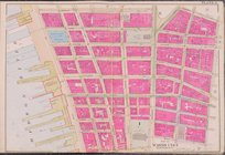
Map of the City of New York a…
note:
… of
H
.F.
Walling
.
….,
William
St.,
Wall
St