Click to visit the main New York Public Library Homepage
The New York Public Library
Digital Collections
About Digital Collections
Browse
Search only public domain materials
Items
Collections
Divisions
Home
Search
Browse
About
Search only public domain materials
Items
Collections
Divisions
Digital Collections
Using Images
Using Data
Search
Filtered keyword search
Show filters
Hide filters
Show Only Public Domain
topic
Nautical charts
18
History
9
Real property
6
Coasts
5
Pilot guides
5
More
Less
name
United States Coast Survey
11
Bache, A. D. (Alexander Dallas), 1806-1867
10
Alden, James, 1810-1877
6
Davidson, George, 1825-1911
6
Mathiot, G
6
More
Less
collection
Maps of North America
28
Maps of New York City and State
12
Lawrence H. Slaughter Collection of English maps, charts, globes, books and atlases
6
I. N. Phelps Stokes Collection of American Historical Prints
2
Maps of property in the city of New York belonging to John J. Astor Esq
1
More
Less
place
New York (State)
10
Atlantic Coast (North America)
5
Atlantic Coast (South America)
5
George, Lake (N.Y. : Lake)
5
Hudson River (N.Y. and N.J.)
5
More
Less
genre
Maps
51
Nautical charts
12
Prints
4
Bathymetric maps
2
Cadastral maps
2
More
Less
publisher
U.S. Coast Survey
9
publisher not identified
7
Pub. by E.M. Blunt for W. Hooker
5
Printed for Robt. Sayer & Jno. Bennett
2
U.S. Coast Survey Office
2
More
Less
division
Map Division
46
Wallach Division: Print Collection
2
Manuscripts and Archives Division
1
No Division
1
Rare Book Division
1
type
x
cartographic
still image
3
text
3
Date Range
to
51 results found for:
x
Williams, George A
Filtering on:
x
Type
: cartographic
Sort by:
Relevance
Title
Date created
Date digitized
Sequence
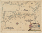
Boston Harbor, Massachusetts:…
parent:
9b408420-8f40-0134-1e9f-00505686
a
51c
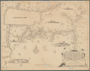
Boston Harbor, Massachusetts
parent:
01155650-97e5-0134-2547-00505686
a
51c
m
Survey for a ship canal to co…
parent:
4ee62e00-c5aa-012f-
a
458-58d385
a
7bc34
Eastern part of St.
George
's Sound, Florida …
parent:
32958040-b143-0132-2eae-58d385
a
7bbd0
Preliminary chart of western part of St.
George
parent:
7b556910-13fb-0135-b04d-7b8
a
8660587f
…
George
, on the 8th
parent:
887
a
0da0-bed0-0133-c112-00505686
a
51c
…
George
, on the 8th
parent:
822bf8b0-bed2-0133-1021-00505686
a
51c
… of Lt. Col. G.
A
. Custer
parent:
f58affb0-c52
a
-012f-56dd-3c075448cc4b
A survey of Lake Champlain: i…
parent:
31c2db50-
a
295-0133-3fb2-00505686d14e
A survey of Lake Champlain: i…
parent:
f967d270-
a
295-0133-d15c-00505686d14e
… and
George
Folsom Esq
parent:
fb72bd20-c5aa-012f-5141-58d385
a
7bc34
A mappe of Colonel Römers voy…
parent:
b05837f0-34aa-0134-d0dc-00505686
a
51c
A mappe of Colonel Römers voy…
parent:
ce0de150-34ad-0134-e9ec-00505686
a
51c
The harbor of Wood's Hole, Ma…
parent:
30d2c2e0-6bce-0134-65e7-00505686
a
51c
The ichnography of Charles-to…
parent:
323995b0-c5ed-012f-d6f9-58d385
a
7bc34
…
George
on the 8th
parent:
39bb8900-c5ed-012f-2af7-58d385
a
7bc34
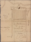
Plan
parent:
76bf87d0-c532-012f-64d5-58d385
a
7bc34
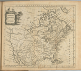
North America
parent:
76
a
3f410-c5d4-012f-c987-58d385
a
7bc34
Harbors of Captain's Island E…
parent:
e1af2c00-327
a
-0134-747c-00505686
a
51c
The town of Boston: in New En…
parent:
bac116
a
0-b143-0132-83cb-58d385
a
7bbd0
A sketch of the operations of…
parent:
bf53
a
080-d486-0135-83ec-25bca6786666
Map of a portion of the Salem…
parent:
bbb12fa0-6bfa-0135-66ca-214de227dd9
a
A sketch of the siege of Fort…
parent:
0ae18f60-c5ab-012f-991b-58d385
a
7bc34
A compleat map of North-Carol…
parent:
6
a
1
a
7e00-1e48-0136-0aec-4dee13904d15
A topographical map of Hudson…
parent:
da021
a
40-8afa-0133-1fb0-00505686d14e
m
A map of South Carolina and a…
parent:
4f713cc0-3
a
53-0135-28da-0d95294e4bcc
A plan of Bahia del Espiritu …
parent:
e880f140-1722-0135-27e2-4f2ecae5
a
515
Reconnaissance of the western…
parent:
6
a
1381c0-3636-0134-02c4-00505686
a
51c
m
Maps of property in the city …
abstract:
… by City Surveyor
George
W
Map of the state of Georgia :…
parent:
4798eed0-f52d-0134-5
a
87-04dba674c71d
Reconnaissance of the western…
parent:
87ff7000-7398-0134-fe6b-00505686
a
51c
A topographical map of the st…
parent:
e9ddf0
a
0-
a
5d7-0134-9d32-00505686
a
51c
A map of a portion of the Ind…
parent:
e9e83d20-429e-0133-d7ea-00505686
a
51c
m
A map of South Carolina and a…
parent:
32ca8880-3
a
5e-0135-dac3-0f9
a
3d5d919f
State of Indiana
parent:
76e029d0-b143-0132-d8e6-58d385
a
7bbd0
Chart of Long Island Sound, 1…
parent:
c9fc54f0-c5d4-012f-ba00-58d385
a
7bc34
Chart of the entrance to Ches…
parent:
cc57c570-c5d4-012f-acf7-58d385
a
7bc34
Entrance to New York Bay from…
parent:
ca95ce80-c5d4-012f-
a
2df-58d385
a
7bc34
Nautical chart of Little Egg …
parent:
cb28
a
870-c5d4-012f-88e0-58d385
a
7bc34
The Bay and river of Delaware
parent:
cbcef260-c5d4-012f-1c60-58d385
a
7bc34
Reconnaissance of the western…
parent:
c3caa0b0-50fd-0134-6
a
48-00505686
a
51c
Map of the United States of A…
parent:
9cd8c410-c52
a
-012f-41
a
9-3c075448cc4b
m
Map of the United States of A…
parent:
9d69e760-c52
a
-012f-e82
a
-3c075448cc4b
m
Topographical map of the Wyom…
parent:
886f6df0-c091-0134-7ea0-00505686
a
51c
Chart of Narraganset Bay : su…
parent:
1f03cb30-df35-0134-e7c8-611
a
4
a
8adb80
Reconnaissance of the western…
parent:
63606b80-7396-0134-6412-00505686
a
51c
m
Map of that portion of her ma…
parent:
481cbcd0-79
a
2-0133-1397-00505686d14e
Entrance to San Francisco Bay…
parent:
b8e12c20-c52
a
-012f-11bb-3c075448cc4b
This Map of the City of New Y…
parent:
b52c3410-0f64-0132-
a
724-58d385
a
7b928
Reconnaissance of the harbors…
parent:
b8e12c20-c52
a
-012f-11bb-3c075448cc4b