Click to visit the main New York Public Library Homepage
The New York Public Library
Digital Collections
About Digital Collections
Browse
Search only public domain materials
Items
Collections
Divisions
Home
Search
Browse
About
Search only public domain materials
Items
Collections
Divisions
Digital Collections
Using Images
Using Data
Search
Filtered keyword search
Show filters
Hide filters
Show Only Public Domain
topic
Real property
422
Fire insurance
125
Administrative and political divisions
120
Nautical charts
103
Railroads
96
More
Less
name
Perris, William
308
Perris & Browne
141
Faden, William, 1749-1836
110
United States Coast Survey
61
Bache, A. D. (Alexander Dallas), 1806-1867
52
More
Less
collection
Maps of North America
450
Atlases of New York City
413
Lawrence H. Slaughter Collection of English maps, charts, globes, books and atlases
215
Maps of New York City and State
208
Bancker plans
60
More
Less
place
New York (State)
547
New York
399
Manhattan (New York, N.Y.)
329
New York (N.Y.)
112
United States
111
More
Less
genre
Maps
1521
Nautical charts
69
Surveys
67
Cadastral maps
61
land surveys
59
More
Less
publisher
William Perris
142
Perris & Browne
124
Published by Wm. Faden, geographer to His Majesty, and His R.H. the Prince of Wales
53
Printed by A. Godbid and J. Playford, for R. Scott, bookseller
52
publisher not identified
42
More
Less
division
Map Division
1232
Manuscripts and Archives Division
88
General Research Division
28
Wallach Division: Print Collection
25
Rare Book Division
14
More
Less
type
x
cartographic
text
46
still image
35
Date Range
to
1,535 results found for:
x
Williams, William
Filtering on:
x
Type
: cartographic
Sort by:
Relevance
Title
Date created
Date digitized
Sequence
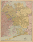
The tourist's map of the stat…
note:
…, in the year 1831, by
William
Williams
, Northern District
The tourist's map of the stat…
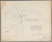
Survey for a ship canal aroun…
note:
… the direction of W.G.
Williams
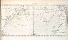
A new chart of America with t…
note:
… and
Williams
, at the Navigation
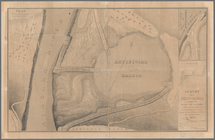
Cataraugus harbor and the pub…
note:
…"W. G.
Williams
, capt., U.S. Topl. Engs."…
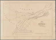
Map of the vicinity of Buffal…
Chart of Green Bay
note:
….
Williams
, assisted by Lieut
Williams
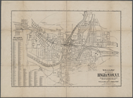
' map of the City of Binghamton, N.Y.
note:
…"Copyrighted July, 1899 by J.E.
Williams
Map of borough of Queens
note:
Accompanied by: Street index to
Williams
Williams
' map of Borough of Brooklyn …
Cincinnati : with Covington, …
note:
Drawn for
Williams
' Cincinnati Directory, 1865.
…
Williams
, Horace
Williams
Map of borough of Richmond
note:
Williams
Map & Guide Co.
Williams
' map of boroughs of Manhattan
note:
by
Williams
Map & Guide Co.
Map of reconnaissance exhibit…
note:
….
Williams
of the Infantry
Telegraph and rail road map o…
note:
by Alex.
Williams
.
Map of Presqu'ile Bay or Erie…
note:
Surveyed by Capt. W.C.
Williams
, Topl
m
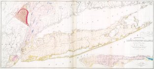
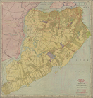
Geological map of Long & Stat…
m
Survey for a ship canal to co…
note:
….
Williams
, U.S. Top. Engs
A diagram of Oregon
United States
… Jonathan
Williams
' article
Map of the diocese of Massach…
Map of Boston 1875: from A. W…
A new map of the United State…
note:
compiled, drawn & engraved by W.
Williams
m
Back of City Hall
note:
… of City Hall at
Williams
m
Four lots near North Church
note:
Jonathan Hampton. On Anne and
Williams
m
Bowery Lane
note:
Williamson. Bounded by
Williams
, Anderson
Map of Boston in the state of…
Map of New England City, Dade…
note:
by R.M.
Williams
, c.e.
Aqueduct Commissioners topogr…
m
Mitchell's new national map e…
note:
engraved by W.
Williams
, map engraver
m
Cedar Street near
Williams
Street
Plat of the city of Tallapoos…
note:
Surveyed by F. Reiman and R.M.
Williams
.
A mapp of Virginia
Preliminary reconnaissance of…
note:
…. drng. by L.D.
Williams
…: [Bounded by
Williams
Bridge
note:
… of lands near
Williams
General map of explorations a…
note:
…
Williams
Smith, Civ. Engr.
Map of Dunkirk Harbor, showin…
note:
….
Williams
, capt. U.S. topo
New-York
m
A sectional map of Iowa
note:
… reconnoissance by Henn,
Williams
Metropolitan district of Chic…
note:
… ; Benezette
Williams
, Samuel G
Preliminary chart of Plymouth…
note:
…"Redd drng. by L.D.
Williams
". "Eng'd. by E
Bass River Harbor, Massachuse…
note:
…"Redd. drng. by L. Dazer & L.S.
Williams
Preliminary chart of San Luis…
note:
….
Williams
; topography
Post route map of the state o…
Map and profile of the Tejon …
note:
…
Williams
Smith, Civ. Engr
Preliminary chart of the sea …
note:
….
Williams
; engd. by E
Map of the surveyed part of I…
note:
… by Jesse
Williams
, late
Map and profile of the Cañada…
note:
…., and Mr. Isaac
Williams
1
2
3
4
5
6
7
Previous
Next
1
2
3
4
5
6
7
Previous
Next