Click to visit the main New York Public Library Homepage
The New York Public Library
Digital Collections
About Digital Collections
Browse
Search only public domain materials
Items
Collections
Divisions
Home
Search
Browse
About
Search only public domain materials
Items
Collections
Divisions
Digital Collections
Using Images
Using Data
Search
Filtered keyword search
Show filters
Hide filters
Show Only Public Domain
topic
Real property
49
Fire insurance
7
History
7
Railroads
7
Landowners
6
More
Less
name
Davis, F. A
72
Kochersperger, H. L
72
O.W. Gray & Son
72
G.W. Bromley & Co
31
Perris, William
6
More
Less
collection
Atlases of the United States
75
Atlases of New York City
51
Bancker plans
17
Maps of North America
17
Maps of New York City and State
9
More
Less
place
Dutchess County (N.Y.)
72
New York (State)
55
New York
40
Manhattan (New York, N.Y.)
38
New York (N.Y.)
13
More
Less
genre
Maps
174
Atlases
75
Surveys
17
land surveys
15
Cadastral maps
3
More
Less
publisher
Reading Publishing House
72
G.W. Bromley & Co
28
E. Robinson Co
5
William Perris
4
G. W. Bromley & E. Robinson
3
More
Less
division
Map Division
157
Manuscripts and Archives Division
17
Berg Collection
1
General Research Division
1
type
x
cartographic
text
3
still image
1
Date Range
to
176 results found for:
x
reading
Filtering on:
x
Type
: cartographic
Sort by:
Relevance
Title
Date created
Date digitized
Sequence
… of the Philadelphia and
Reading
Rail
Map showing the anthracite co…
abstract:
… by the Philadelphia and
Reading
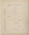
Table of Contents.
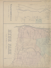
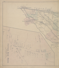
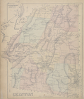
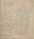
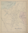
Red Hook [Township]
Rhinebeck [Township]
Rhinebeck [Village]
Milan [Township]
Clinton [Township]
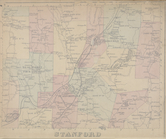
Stanford [Township]
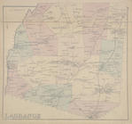
Lagrange [Township]
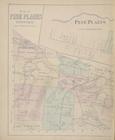
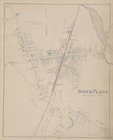
Dover Plains [Village]
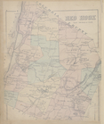
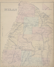
Map of Unionvale Township.
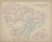
Beekman [Township]
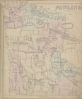
Pawling [Township]
Western Hemisphere
Eastern Hemisphere
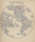
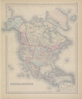
North America
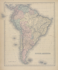
South America
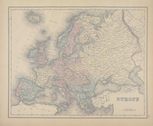
General Description - Europe.
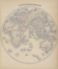
Europe
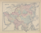
Asia
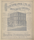
New Illustrated Atlas of Dutc…
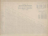
Table of Air Line Distances
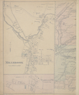
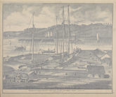
Poughkeepsie Marine Railways …
m
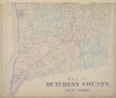
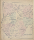
Map of Dutchess County New Yo…
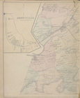
Annandale [Village]; Red Hook…
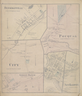
m
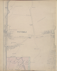
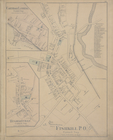
Tivoli [Village]; Hibernia [V…
m
Stanfordville [Village]; Hyde…
Rhinecliff [Village]; Staatsb…
m
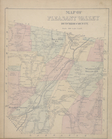
Map of Pine Plains Township. …
m
Irondale [Village]; Millerton…
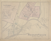
Map of Pleasant Valley Dutche…
Salt Point [Village]; East Fi…
m
Millbrook [Village]; Washingt…
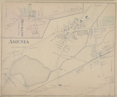
Mechanic [Village]; Amenia [V…
m
Upper Red Hook [Village]; Lee…
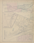
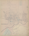
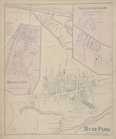
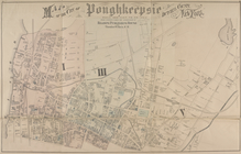
Map of the city of Poughkeeps…
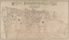
Map of the city of Poughkeeps…
Carthage Landing [Village]; H…
PawlingStation [Village]; Was…
m
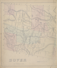
Dover [Township]; Mabbettsvil…
Beekmanville [Vilage]; City […
m
Johnsville [Village]; East Fi…
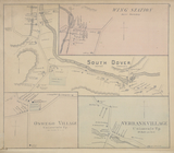
Wing Station [Village]; South…
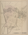
Fishkill on the Hudson [Villa…
m
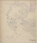
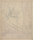
Wappingers Falls [Village]; N…
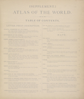
Supplement. Atlas of the Worl…
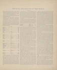
Physical Description of the W…
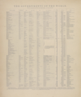
The Governments of the World.
General Description - North A…