Click to visit the main New York Public Library Homepage
The New York Public Library
Digital Collections
About Digital Collections
Browse
Search only public domain materials
Items
Collections
Divisions
Home
Search
Browse
About
Search only public domain materials
Items
Collections
Divisions
Digital Collections
Using Images
Using Data
Search
Filtered keyword search
Show filters
Hide filters
Show Only Public Domain
topic
Real property
108
Fire insurance
81
Cities & towns
79
City planning
6
Railroads
4
More
Less
name
Sanborn Map Company
80
G.W. Bromley & Co
18
Bromley, George Washington
9
Bromley, Walter Scott
9
New York (N.Y.). Common Council
6
More
Less
collection
Atlases of New York City
114
Maps of New York City and State
12
Maps of North America
6
Lawrence H. Slaughter Collection of English maps, charts, globes, books and atlases
3
Atlases of the United States
2
More
Less
place
New York (State)
113
New York
29
Manhattan (New York, N.Y.)
20
New York (N.Y.)
11
Central Park (New York, N.Y.)
8
More
Less
genre
Maps
141
Topographic maps
3
Atlases
2
Surveys
2
Documents
1
More
Less
publisher
Sanborn Map Company
80
G.W. Bromley & Co
18
Perris & Browne
6
E. Belcher Hyde
4
The Division
2
More
Less
division
Map Division
131
Manuscripts and Archives Division
2
Billy Rose Theatre Division
1
Rare Book Division
1
Schomburg Manuscripts, Archives and Rare Books Division
1
type
x
cartographic
text
2
still image
1
Date Range
to
142 results found for:
x
source_note_id:67
Filtering on:
x
Type
: cartographic
Sort by:
Relevance
Title
Date created
Date digitized
Sequence
Cerca la
Source
.
use:
Release
Source
File for Free (i.e., high-res
Plate
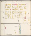
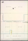
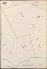
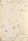
67
m
Ide
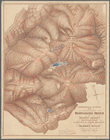
's map of Montana …
use:
Release
Source
File for Free (i.e., high-res
Map of the
sources
of Snake River …
use:
Release
Source
File for Free (i.e., high-res
Gazetteer of New York [
67
]
use:
Release
Source
File for Free (i.e., high-res
From Annapolis (
67
) to Fredericksburg, Va.
use:
Release
Source
File for Free (i.e., high-res
…
Source
of the Nile.
Plate
67
, Part of Sections 3 & 5
Plate
67
, Part of Sections 3 & 5
Plate
67
, Part of Sections 3 & 5
m
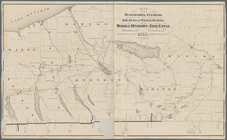
Land computations and
notes
… and
sources
of water supply
use:
Release
Source
File for Free (i.e., high-res
… to the
source
of the Mississippi
use:
Release
Source
File for Free (i.e., high-res
Road from Philadela. to New York, seg.
6
-7.
use:
Release
Source
File for Free (i.e., high-res
Plate
67
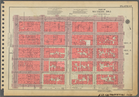
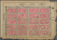
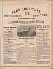
: Park Institute, Rye, Westchester
use:
Release
Source
File for Free (i.e., high-res
Richmond, Plate No.
67
[Map bounded
use:
Release
Source
File for Free (i.e., high-res
… & other authentic
sources
.
use:
Release
Source
File for Free (i.e., high-res
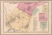
Plate
67
: Cold Spring - Nelsonville
use:
Release
Source
File for Free (i.e., high-res
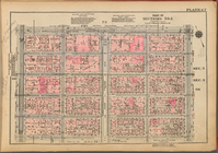
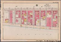
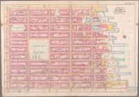
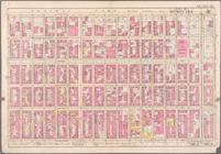
Manhattan, V. 7, Plate No.
67
[Map
use:
Release
Source
File for Free (i.e., high-res
Bronx, V. A, Plate No.
67
[Map bounded
use:
Release
Source
File for Free (i.e., high-res
…
sources
of the Hudson
use:
Release
Source
File for Free (i.e., high-res
Bounded by Avenue A, E. 76th …
use:
Release
Source
File for Free (i.e., high-res
Staten Island, V. 1, Plate No.
67
[Map
use:
Release
Source
File for Free (i.e., high-res
Manhattan, V. 5, Plate No.
67
[Map
use:
Release
Source
File for Free (i.e., high-res
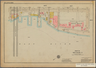
… River, Piers
67
-[73]), E
use:
Release
Source
File for Free (i.e., high-res
Map bounded by West 67th Stre…
use:
Release
Source
File for Free (i.e., high-res
Map bounded by West 72nd Stre…
use:
Release
Source
File for Free (i.e., high-res
Map bounded by East 67th Stre…
use:
Release
Source
File for Free (i.e., high-res
Map bounded by East 67th Stre…
use:
Release
Source
File for Free (i.e., high-res
Map bounded by East 72nd Stre…
use:
Release
Source
File for Free (i.e., high-res
Map bounded by East 72nd Stre…
use:
Release
Source
File for Free (i.e., high-res
Bronx, V. 18, Plate No.
67
[Map bounded
use:
Release
Source
File for Free (i.e., high-res
Staten Island, V. 1, Plate No.
67
[Map
use:
Release
Source
File for Free (i.e., high-res
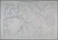
Map and profile showing
sources
of
use:
Release
Source
File for Free (i.e., high-res
Bounded by Avenue A, E. 76th …
collection:
… Street and E.
67
th Street
Bounded by Avenue A, E. 67th …
use:
Release
Source
File for Free (i.e., high-res
Brooklyn Vol. A Plate No.
67
[Map
use:
Release
Source
File for Free (i.e., high-res
Queens V. 4, Plate No.
67
[Map bounded
use:
Release
Source
File for Free (i.e., high-res
Queens V. 3, Plate No.
67
[Map bounded
use:
Release
Source
File for Free (i.e., high-res
Queens V. 6, Plate No.
67
[Map bounded
parent:
7d
67
b420-c601-012f-56e2-58d385a7bc34
Queens V. 10, Plate No.
67
[Map bounded
use:
Release
Source
File for Free (i.e., high-res
Bronx, V. A, Plate No.
67
[Map bounded
use:
Release
Source
File for Free (i.e., high-res
Bounded by Avenue A, E. 67th …
collection:
Bounded by Avenue A, E.
67
th Street
m
Script with blocking
notes
, including
first:
1ad1e6c0-0708-0137-6ce1-2be
67
ce68c96
m
Note
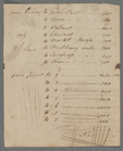
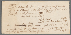
on two parcels of land belonging to Peter
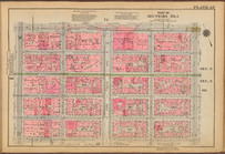
Bounded by Fifth Avenue (Cent…
use:
Release
Source
File for Free (i.e., high-res
Sheet No.
67
. [Includes Huegnot Avenue
use:
Release
Source
File for Free (i.e., high-res
Brooklyn V. 7, Plate No.
67
[Map
use:
Release
Source
File for Free (i.e., high-res
Brooklyn V. 8, Plate No.
67
[Map
use:
Release
Source
File for Free (i.e., high-res
Brooklyn V. 11, Plate No. 31 …
use:
Release
Source
File for Free (i.e., high-res