Click to visit the main New York Public Library Homepage
The New York Public Library
Digital Collections
About Digital Collections
Browse
Search only public domain materials
Items
Collections
Divisions
Home
Search
Browse
About
Search only public domain materials
Items
Collections
Divisions
Digital Collections
Using Images
Using Data
Search
Filtered keyword search
Show filters
Hide filters
Show Only Public Domain
topic
Real property
332
Apartment houses
304
Dwellings
304
Jews
213
Ethnic relations
206
More
Less
name
G.W. Bromley & Co
133
Brockedon, William (1787-1854)
128
Croly, George (1780-1860)
128
Haghe, Louis (1806-1885 )
128
Roberts, David (1796-1864)
128
More
Less
collection
Atlases of New York City
330
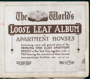
The World's loose leaf album of apartment houses: containing views and ground plans of the principal high class apartment houses in New York City, together with a map showing the situation of these houses, transportation facilities, etc
304
Yizkor Book Collection
211
Atlases of the United States
140
The Holy Land, Syria, Idumea, Arabia, Egypt and Nubia: From drawings made on the spot
128
More
Less
place
New York (State)
704
New York
557
Middle East
129
New York (N.Y.)
126
Great Britain
115
More
Less
genre
Maps
672
Photographs
531
Floor plans
306
Books
249
Portraits
215
More
Less
publisher
N.Y. World
304
F.G. Moon,
128
G.W. Bromley & Co
127
Printed for John Cary
53
E. Belcher Hyde
40
More
Less
division
Map Division
755
Dorot Jewish Division
343
Milstein Division
309
Manuscripts and Archives Division
245
Rare Book Division
189
More
Less
type
x
text
still image
1053
cartographic
647
Date Range
to
Looking for one of these collections?
The World's loose leaf album of apartment houses: containing views and ground plans of the principal high class apartment houses in New York City, together with a map showing the situation of these houses, transportation facilities, etc.
304 items
The Holy Land, Syria, Idumea, Arabia, Egypt and Nubia: From drawings made on the spot
252 items
2,063 results found for:
x
map
Filtering on:
x
Type
: text
Sort by:
Relevance
Title
Date created
Date digitized
Sequence
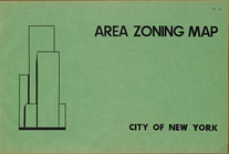
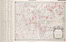
Area Zoning
Map
. City of New York
note:
Scale of
maps
ca. 1:9,600.
Map
of the Greenwich Village section
image:
psnypl_
map
_352
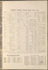
Additional Index
collection:
Insurance
maps
of the City of New York
Index
collection:
Insurance
maps
of the City of New York
Index
collection:
Insurance
maps
of the City of New York
Index
collection:
Insurance
maps
of New York [1884-]
Insurance
maps
Insurance
maps
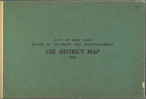
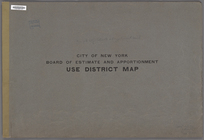
… and Apportionment. Use District
Map
m
Reynolds'
map
of modern London divided
Index to
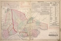
map
of the city of Brooklyn
… and Apportionment. Use District
Map
.
The Sea-Atlas.
Zeichenerklärung
m
… standard guide
map
note:
… catalog of the
Map
m
Servoss' Sectional road
map
of Long Island
note:
The
map
points N.N.W.
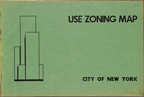
Use Zoning
Map
. City of New York. 1953
Insurance
maps
Insurance
maps
… Insurance
maps
Staten Island
…
Map
. 1927.
collection:
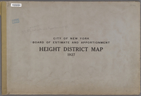
… and Apportionment.Height District
Map
. 1927.
Index
collection:
Insurance
maps
of New York [1884-]
Index
collection:
Insurance
maps
of New York [1884-]
Index
collection:
Insurance
maps
of New York [1884-]
Index
collection:
Insurance
maps
of New York [1884-]
Index
collection:
Insurance
maps
of New York [1884-]
Index
collection:
Insurance
maps
of New York [1884-]
Index
collection:
Insurance
maps
of Staten Island, Borough
Index (cont.)
collection:
Insurance
maps
of Staten Island, Borough
Index
collection:
Insurance
maps
of Staten Island, Borough
…
Map
.
note:
…"The Amended area district
map
consists
Insurance
maps
Insurance
maps
…
Map
. 1937
… and Apportionment. Area District
Map
topic:
Maps
… and Apportionment. Area District
Map
m
Map
10 - Queens
m
Map
19 - Queens
m
Map
15 - Queens
m
Map
22 - Brooklyn
Map
of the territory of Idaho
note:
Mapping
the Nation (NEH grant, 2015-2018)…
m
Map
25 - Queens
m
Map
4 - Bronx
m
Map
5 - Manhattan
m
Map
14 - Queens
m
Map
21 - Richmond
m
Map
23 - Brooklyn
m
Map
31 - Queens
m
Map
33 - Richmond
m
Map
28 - Brooklyn
1
2
3
4
5
6
7
8
9
Previous
Next
1
2
3
4
5
6
7
8
9
Previous
Next