Click to visit the main New York Public Library Homepage
The New York Public Library
Digital Collections
About Digital Collections
Browse
Search only public domain materials
Items
Collections
Divisions
Home
Search
Browse
About
Search only public domain materials
Items
Collections
Divisions
Digital Collections
Using Images
Using Data
Search
Keyword search
Show filters
Hide filters
Show Only Public Domain
topic
Real property
75
Description and travel
59
Nautical charts
59
Cities & towns
49
Fire insurance
49
More
Less
name
Ogilby, John (1600-1676)
58
Sanborn Map Company
49
United States Coast Survey
21
Bache, A. D. (Alexander Dallas), 1806-1867
18
Ullitz, Hugo
17
More
Less
collection
Atlases of New York City
85
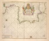
Africa: being an accurate description of the regions of Ægypt, Barbary, Lybia, and Billedulgerid, the land of Negroes, Guinee, Æthiopia, and the Abyssines, with all the adjacent islands ... collected and translated from most authentick authors ... by John Ogilby ..
58
Maps of North America
43
Lawrence H. Slaughter Collection of English maps, charts, globes, books and atlases
41
Robert N. Dennis collection of stereoscopic views
30
More
Less
place
Atlantic Ocean
116
New York (State)
77
Africa
58
Islands of the Atlantic
58
Islands of the Indian Ocean
58
More
Less
genre
Maps
260
Prints
75
Illustrations
67
Photographs
40
Nautical charts
36
More
Less
publisher
Sanborn Map Company
49
E. Belcher Hyde
15
C. Wolverton
12
U.S. Coast Survey
12
A.H. Mueller Co.,
9
More
Less
division
Map Division
255
General Research Division
65
Wallach Division: Photography Collection
37
Wallach Division: Picture Collection
23
Schomburg Manuscripts, Archives and Rare Books Division
8
More
Less
type
cartographic
277
still image
130
text
6
sound recording
2
notated music
1
More
Less
Date Range
to
411 results found for:
Atlantic Ocean
Sort by:
Relevance
Title
Date created
Date digitized
Sequence
Results 251 - 300
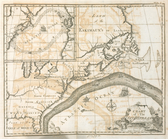
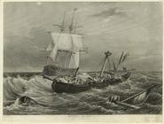
A chart of the Gulf Stream
note:
…
Atlantic
Seaboard.
…
Atlantic
patrol
note:
… on the North
Atlantic
patrol
Map showing the Southern Mary…
…., (
Atlantic
Ocean
) Surf Ave. and
Atlantic
Ave.
Preliminary sketch of Chincot…
Amerikanisch-Spanischer krieg…
note:
Insets: Der Nordatlant.
Ocean
-- Puerto
… by
Ocean
Parkway,
Atlantic
Ocean
; Including
…
Atlantic
Ocean
,
Ocean
Preliminary sketch showing th…
Carte nouvelle de la mer du S…
note:
Covers the Pacific and
Atlantic
oceans
Accuratissima totius terrarum…
note:
…
Atlantic
Ocean
to the North
Carte du Mexique et de la Flo…
note:
…
Atlantic
Seaboard.
Narraganset Bay: [Rhode Islan…
… with the
Atlantic
Ocean
.
Kitoboi" vykhodim iz Atlantic…
collection:
… Sea from
Atlantic
Ocean
War of 1812
topic:
Naval warfare --
Atlantic
Ocean
-- 1810-1819
Pas-caart van Hispangien, ver…
Pascaerte van Vlaemsche, Sout…
….,
Atlantic
Ocean
; Including W
… by Stillwell Ave.,
Atlantic
Ocean
; Including W. 33rd
…,
Atlantic
Ocean
, Moriches
…,
Atlantic
Ocean
]
… by First Neck Rd.,
Atlantic
Ocean
, Haeady Creek
…,
Atlantic
Ocean
, First Neck
m
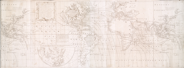
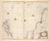
Mercator projection exhibitin…
m
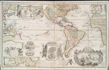
A chart of North and South Am…
note:
… of the
Atlantic
Ocean
Sketch of Ocracoke Inlet, Nor…
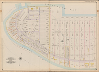
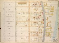
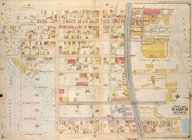
Queens, Vol. 1, Double Page P…
collection:
… York;
Atlantic
Ocean
]
…., Beach 40th St.,
Atlantic
Ocean
]; Sub Plan; [Map
….,
Atlantic
Ocean
, Beach 40th
… by E. 5th St.,
Atlantic
Ocean
, Stillwell Ave
m
Afro American travel map
abstract:
… of the Mississippi to the
Atlantic
Ocean
and from the Great
Bounded by (
Atlantic
Ocean
, Manhattan
Reconnoissance of the entranc…
…. 29th St.,
Atlantic
Ocean
]
… by Stillwell Ave.,
Atlantic
Ocean
, W. 29th St
Tidal currents of Long Island…
A view of the rivers Kenebec …
abstract:
… from the
Atlantic
Ocean
A map of part of Rhode Island…
…. 12th St. and (
Atlantic
Ocean
) Surf Ave.
collection:
…. and (
Atlantic
Ocean
) Surf Ave.
Carte de la Louisiane et du c…
note:
… the
Atlantic
Ocean
and Hudson
A chart of North and South Am…
note:
… of the
Atlantic
Ocean
Chart of Narraganset Bay : su…
Map of the boundary line betw…
Tidal currents of Nantucket S…
A map of East and West Florid…
note:
…, "
Atlantic
Ocean
Reconnaissance of New River a…
Preliminary sketch showing th…
A new and accurate map of the…
note:
… Harbour -- The
Atlantic
Ocean
-- Fort Frederick
Map of the boundary line betw…
1
2
Previous
Next
1
2
Previous
Next