Click to visit the main New York Public Library Homepage
The New York Public Library
Digital Collections
About Digital Collections
Browse
Search only public domain materials
Items
Collections
Divisions
Home
Search
Browse
About
Search only public domain materials
Items
Collections
Divisions
Digital Collections
Using Images
Using Data
Search
Keyword search
Show filters
Hide filters
Show Only Public Domain
topic
Real property
101
Geography
79
Landowners
63
Administrative and political divisions
62
Railroads
58
More
Less
name
Burr, David H., 1803-1875
176
Moll, Herman, -1732
86
Rawdon, Clark & Co
79
Rawdon, Wright & Co
79
De Witt, Simeon, 1756-1834
58
More
Less
collection
Maps of North America
392
Lawrence H. Slaughter Collection of English maps, charts, globes, books and atlases
344
Maps of New York City and State
259
Atlases of the United States
187
John H. Levine Collection
26
More
Less
place
New York (State)
308
United States
254
New York (N.Y.)
245
Middle Atlantic States
149
Maps
130
More
Less
genre
Maps
1225
Atlases
159
Prints
7
Title pages
4
Early works to 1800
3
More
Less
publisher
For sale by the principal booksellers
67
Printed for Timothy Childe at the White Hart at the West-end of St. Paul's Church-yard
47
s.n
45
s.n.,
34
... Sold ... by Tho. Bowles, print and map-seller in St. Paul's-Churchyard
32
More
Less
division
Map Division
1220
Wallach Division: Print Collection
7
Rare Book Division
1
type
cartographic
1215
text
20
still image
9
Date Range
to
1,230 results found for:
Middle Atlantic States
Sort by:
Relevance
Title
Date created
Date digitized
Sequence
Results 251 - 300
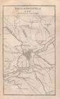
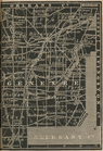
Philadelphia.
note:
…
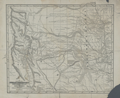
States
.
United
States
.
note:
… to Early Maps of the
Middle
Atlantic
Seaboard.
Maryland
note:
… to Early Maps of the
Middle
Atlantic
Seaboard.
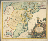
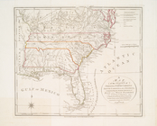
Virginia, Marylandia et Carol…
note:
… to Early Maps of the
Middle
Atlantic
Seaboard.
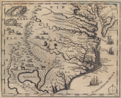
Map of Virginia, North Caroli…
note:
… to Early Maps of the
Middle
Atlantic
Seaboard.
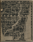
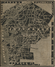
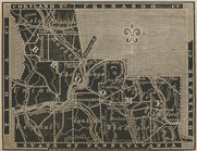
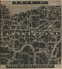
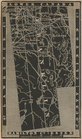
Chenango County.
note:
… to Early Maps of the
Middle
Atlantic
Seaboard.
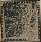
Clinton County.
note:
… to Early Maps of the
Middle
Atlantic
Seaboard.
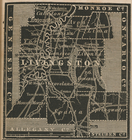
Livingston County.
note:
… to Early Maps of the
Middle
Atlantic
Seaboard.
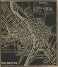
Rochester City.
note:
… to Early Maps of the
Middle
Atlantic
Seaboard.
New map of the
states
of Georgia South
note:
…
States
of America.
… of the United
States
note:
Covers Vermont and adjacent
states
.
Map of the United
States
showing canals
note:
… to Early Maps of the
Middle
Atlantic
Seaboard.
…
States
.
note:
… to Early Maps of the
Middle
Atlantic
Seaboard.
Map of the United
States
of America.
note:
… to Early Maps of the
Middle
Atlantic
Seaboard.
A map of the United
States
of North America
note:
… to Early Maps of the
Middle
Atlantic
Seaboard.
Map of the Indian Territory, …
note:
… to Early Maps of the
Middle
Atlantic
Seaboard.
A map of the
states
note:
… to Early Maps of the
Middle
Atlantic
Seaboard.
Northern section of the United
States
, including
note:
… to Early Maps of the
Middle
Atlantic
Seaboard.
Map of the
states
of Virginia and Maryland
note:
… to Early Maps of the
Middle
Atlantic
Seaboard.
Philadelphia
note:
… to Early Maps of the
Middle
Atlantic
Seaboard.
Virginia
note:
… to Early Maps of the
Middle
Atlantic
Seaboard.
Plan du siege N'York et de Gl…
note:
… to Early Maps of the
Middle
Atlantic
Seaboard.
Carte des Etats-unis : provin…
note:
… to Early Maps of the
Middle
Atlantic
Seaboard.
… map of the
middle
note:
… to Early Maps of the
Middle
Atlantic
Seaboard.
Virginiae partis australis, e…
note:
Covers
Atlantic
Coast from Virginia
United
States
.
note:
… to Early Maps of the
Middle
Atlantic
Seaboard.
…
States
note:
… to Early Maps of the
Middle
Atlantic
Seaboard.
A new map of the United
States
of America
note:
… to Early Maps of the
Middle
Atlantic
Seaboard.
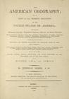
The American geography ... , …
note:
… to Early Maps of the
Middle
Atlantic
Seaboard.
Plan of the investment & atta…
note:
… to Early Maps of the
Middle
Atlantic
Seaboard.
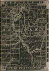
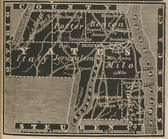
Pennsylvania and New Jersey.
note:
… to Early Maps of the
Middle
Atlantic
Seaboard.
Philadelphia and adjacent cou…
note:
… to Early Maps of the
Middle
Atlantic
Seaboard.
Jefferson County.
note:
… to Early Maps of the
Middle
Atlantic
Seaboard.
Allegany County.
note:
… to Early Maps of the
Middle
Atlantic
Seaboard.
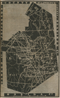
Broome County.
note:
… to Early Maps of the
Middle
Atlantic
Seaboard.
Cattaraugus County.
note:
… to Early Maps of the
Middle
Atlantic
Seaboard.
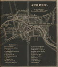
Auburn.
note:
… to Early Maps of the
Middle
Atlantic
Seaboard.
Chautauque County.
note:
… to Early Maps of the
Middle
Atlantic
Seaboard.
Cortland County.
note:
… to Early Maps of the
Middle
Atlantic
Seaboard.
Essex County.
note:
… to Early Maps of the
Middle
Atlantic
Seaboard.
Franklin County.
note:
… to Early Maps of the
Middle
Atlantic
Seaboard.
Genesee County.
note:
… to Early Maps of the
Middle
Atlantic
Seaboard.
Lewis County.
note:
… to Early Maps of the
Middle
Atlantic
Seaboard.
Yates County.
note:
… to Early Maps of the
Middle
Atlantic
Seaboard.
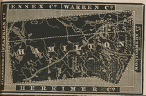
Hamilton County.
note:
… to Early Maps of the
Middle
Atlantic
Seaboard.
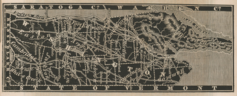
Warren County.
note:
… to Early Maps of the
Middle
Atlantic
Seaboard.
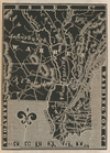
Sullivan County.
note:
… to Early Maps of the
Middle
Atlantic
Seaboard.
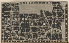
Chemung and Tioga Counties.
note:
… to Early Maps of the
Middle
Atlantic
Seaboard.
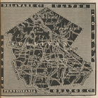
Washington County.
note:
… to Early Maps of the
Middle
Atlantic
Seaboard.
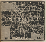
Tompkins County.
note:
… to Early Maps of the
Middle
Atlantic
Seaboard.
1
2
3
4
5
Previous
Next
1
2
3
4
5
Previous
Next