Click to visit the main New York Public Library Homepage
The New York Public Library
Digital Collections
About Digital Collections
Browse
Search only public domain materials
Items
Collections
Divisions
Home
Search
Browse
About
Search only public domain materials
Items
Collections
Divisions
Digital Collections
Using Images
Using Data
Search
Keyword search
Show filters
Hide filters
Show Only Public Domain
topic
Bas-reliefs
771
Politics and culture
632
Antiquities
570
Political satire, Mexican
452
Administrative and political divisions
425
More
Less
name
Vanegas Arroyo, Antonio, 1852-1917
632
Posada, José Guadalupe, 1852-1913
578
United States. Farm Security Administration
219
Flandin, Eugène, 1809-1876
175
Holt, Claire
159
More
Less
collection
Maps of North America
1835
Posada Collection
632
Maps of New York City and State
570
Lawrence H. Slaughter Collection of English maps, charts, globes, books and atlases
326
Farm Security Administration Photographs
217
More
Less
place
Mexico
679
New York (State)
625
Egypt
572
United States
480
Assyria
290
More
Less
genre
Maps
3021
Prints
1875
Illustrations
1556
Photographs
820
Ephemera
633
More
Less
publisher
publisher not identified
200
J. Murray
118
Impr. impériale
114
Imprimerie nationale
110
Society of Biblical Archaeology
94
More
Less
division
Map Division
2975
General Research Division
847
Wallach Division: Print Collection
763
Wallach Division: Photography Collection
404
Wallach Division: Picture Collection
231
More
Less
type
cartographic
3017
still image
2965
text
882
sound recording
11
moving image
3
More
Less
Date Range
to
Looking for one of these collections?
Maps of North America
3,345 items
Posada Collection
665 items
6,018 results found for:
Reliefs
Sort by:
Relevance
Title
Date created
Date digitized
Sequence
Results 3251 - 3300
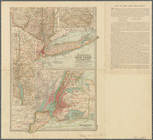
Driving chart of Hartford and…
note:
Relief
shown by spot heights.
A map of the county between C…
note:
Relief
shown by hachures.
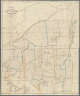
Topographical map of that por…
note:
… physical features.
Relief
Map of Livingston Manor anno …
note:
Relief
shown pictorially.
Lake George and part of Lake …
note:
Relief
shown by hachures.
Map of the manors erected wit…
note:
Relief
shown by hachures.
Plan of Oswego, 1727: (from P…
abstract:
Relief
shown by hachures. Oriented
Map of the Oranges, New Jerse…
note:
Relief
shown by hachures and spot heights.
m
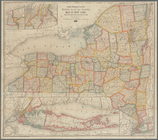
Colton's map of the United St…
note:
Relief
shown by hachures.
A new and accurate map of Nor…
abstract:
… physical features.
Relief
Map of the United States show…
note:
Relief
shown by hachures.
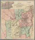
Map of the Catskill Mountains…
note:
Relief
shown by hachures.
Map of Steuben County: to acc…
note:
Relief
shown by hachures.
Map of Salem and surrounding …
note:
Relief
shown by hachures.
Rand, McNally & Co.'s Massach…
abstract:
….
Relief
shown by hachures
m
New map of that portion of No…
note:
Relief
shown by hachures and spot heights.
Plan of Charlestown peninsula…
note:
Relief
shown by hachures.
The Century atlas, New York, …
note:
Relief
shown hachures.
Rand McNally & Co.'s North Da…
abstract:
….
Relief
shown by hachures.
State of Arkansas
note:
Relief
shown by hachures.
m
Official map of Georgia
abstract:
…, and congressional districts.
Relief
Rand, McNally & Co.'s new geo…
abstract:
… diggings.
Relief
shown
m
Map of Ontario County, New Yo…
note:
Relief
shown by hachures.
The principal parts of Norwal…
note:
Relief
shown by hachures, and land forms.
Road map of the island of Rho…
note:
Relief
shown by hachures.
Map of Rockingham County, Vir…
abstract:
… offices.
Relief
shown
Yukon River, Alaska
note:
Relief
shown by hachures and spot heights.
Bien & Sterner's new rail roa…
note:
Relief
shown by hachures.
Brattleboro and vicinity : co…
abstract:
… homeowners' names.
Relief
Map of the White Mountains of…
note:
Relief
shown by hachures and spot heights.
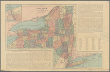
[Map of] New York [State]: [S…
note:
Relief
shown by shading and hachures.
Map of the New York Wildernes…
note:
Relief
shown by hachures and spot heights.
A new and accurate map of the…
note:
Relief
shown pictorially.
Map of the country upon the B…
abstract:
… reservations.
Relief
shown
Map of property at Van Buren …
note:
Relief
shown by land forms and depths
m
A map of the most inhabited p…
note:
Relief
shown pictorially.
Rand McNally & Co.'s new rail…
note:
Relief
shown by hachures.
Map of the Sacketts Harbor an…
note:
Relief
shown by hachures.
Georgia and Alabama
abstract:
….
Relief
shown by hachures
Map of Jersey City and enviro…
note:
Relief
shown by hachures.
Geological map of north easte…
note:
Relief
shown by contours.
Disturnell's new map of the U…
note:
Relief
shown by hachures.
Chengwatana, Pine County, M.T…
abstract:
Relief
shown by hachures. Includes text
Northern Alabama and Georgia
abstract:
….
Relief
shown by hachures.
m
Colton's map of the states an…
note:
Relief
shown by hachures and spot heights.
Road map of 'he sea coast of …
note:
Relief
shown by harchures. Depths shown
m
Stony Point and Verplanck's P…
note:
Relief
shown pictorially and by hachures.
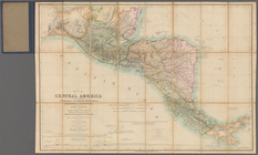
Map of Central America includ…
note:
Relief
shown by hachures and spot heights
Map of part of the state of C…
abstract:
….
Relief
shown by hachures
California, Utah, Lr. Califor…
note:
Relief
shown by hachures.
1
2
…
11
12
13
14
15
16
17
18
…
24
25
Previous
Next
1
2
…
11
12
13
14
15
16
17
18
…
24
25
Previous
Next