Click to visit the main New York Public Library Homepage
The New York Public Library
Digital Collections
About Digital Collections
Browse
Search only public domain materials
Items
Collections
Divisions
Home
Search
Browse
About
Search only public domain materials
Items
Collections
Divisions
Digital Collections
Using Images
Using Data
Search
Keyword search
Show filters
Hide filters
Show Only Public Domain
topic
Real property
486
Administrative and political divisions
245
Railroads
238
Landowners
128
History
87
More
Less
name
E. Belcher Hyde Map Company
265
E.B. Hyde & Co
265
Ullitz, Hugo
265
United States. Farm Security Administration
89
New York (N.Y.). Board of Estimate and Apportionment
81
More
Less
collection
Maps of North America
725
Maps of New York City and State
564
Atlases of New York City
454
Farm Security Administration Photographs
88
Atlases of the United States
87
More
Less
place
New York (State)
868
New York
563
New York (N.Y.)
390
Brooklyn (New York, N.Y.)
372
Maps
344
More
Less
genre
Maps
1961
Photographs
146
Cadastral maps
121
Prints
120
Atlases
85
More
Less
publisher
E. Belcher Hyde
269
publisher not identified
90
New York (N.Y.). Board of Estimate and Apportionment
38
M.B. Brown Printing & Binding Co.,
37
New York (N.Y.). Dept. of City Planning
37
More
Less
division
Map Division
1965
Wallach Division: Photography Collection
107
Wallach Division: Picture Collection
41
General Research Division
40
Billy Rose Theatre Division
35
More
Less
type
cartographic
1963
still image
384
text
89
moving image
7
sound recording
6
More
Less
Date Range
to
2,374 results found for:
Scales
Sort by:
Relevance
Title
Date created
Date digitized
Sequence
Results 2001 - 2050
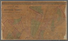
New York city map.
note:
Scale
[ca. 1:19,500] (W 74°04ʹ--W 73°55ʹ/N
New York city map.
note:
Scale
[ca. 1:19,500] (W 74°04ʹ--W 73°55ʹ/N
New York City map.
note:
Scale
[ca. 1:19,500] (W 74°04ʹ--W 73°55ʹ/N
m
Mississippi
note:
Scale
approximately 2:100,000 (W 92°--W 88°/N 35
Map of a portion of the Salem…
note:
Scale
approximately 1: 2,400 (W 80°07ʹ13
Lots & blocks shaded red belo…
note:
Scale
1:1,200. 100 feet to one inch (W
m
Colton's railroad & commercia…
note:
… on an enlarged
scale
-- General
State of Minnesota
note:
Scale
1:950,400. 15 miles to 1 inch (W 97°05
A topographical map of Hudson…
note:
…"On the original
scale
of four miles
Gardiner G. Hubbard's subdivi…
note:
Scale
approximately 1:1,310 ; 100 Feet to 1
m
Map of the City of New York a…
note:
Scale
1:30,600 (W 74°17ʹ19ʺ--W 73°41ʹ19ʺ/N
Map of Virginia
abstract:
… of Virginia,
scale
same
Map of the United States and …
note:
Scale
[ca. 1:6,250,000] (W 125⁰--W 64⁰/N
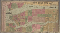
Map of the City & County of N…
note:
Scale
[ca. 1:16,200]. (W 74°03ʹ12ʺ--W 73°57
Map of the extinct Lake Passa…
note:
Scale
1:63,360. 1 mile to an inch (W
Design map of the village of …
note:
Scale
approximately 1:1200 (W 104°59ʹ--W
New-York City, County, and vi…
note:
Scale
[ca. 1:23,250]. (W 74°02ʹ59ʺ--W 73°55
Norfolk harbor, Virginia : fr…
note:
Scale
1:10,000 (W 76°19ʹ00ʺ--W 76°16ʹ30ʺ/N
Sketch of the public surveys …
note:
Scale
1:1,140,480. 18 miles to 1 inch (W
Map of the southern part of M…
note:
Scale
approximately 1:500,000 (W 87°25ʹ--W 82°10
m
The Matthews-Northrup up-to-d…
note:
Scale
1:1,647,360. 26 miles to the inch
Progress map of the state of …
note:
Scale
1:380,160. 6 miles to 1 inch (W 75°40
Map of property New York Dock…
note:
Scale
approximately 1:4,900.
Chicago harbor
note:
Scale
: 1:1,200. 100 feet to 1 inch (W 87°37
m
Higginson's map of New York a…
abstract:
….
Scale
approximately
Cram's sectional map of Dakot…
note:
Scale
approximately 1:1,300,000 (W 105°--W 96°/N
m
Impression of Dance Hall for …
note:
The pencilled annotation "
scale
one foot
New and enlarged map of Balti…
note:
Scale
approximately 1:14,076; 1173 feet
Map of the rail roads of the …
note:
Scale
approximately 1:1,000,000 (W 80°20ʹ--W 71°20
The only correct map of the c…
note:
Scale
approximately 1:21,700 (W 81°45ʹ16ʺ--W
New and enlarged map of Balti…
note:
Scale
approximately 1:14,076; 1173 feet
Colton's new illustrated & em…
note:
Scale
approximately 1:3,200,000 (W 128°--W 58°/N
Rand, McNally & Co.'s indexed…
abstract:
…
scale
as main map]. NYPL
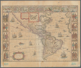
To the Right Honourable Willi…
abstract:
… by soundings.
Scale
of leagues
Phelps's national map of the …
note:
Scale
[ca. 1:4,700,000]. (W 98°--W 67°/N
Part of northern Georgia: no.…
note:
Scale
1:253,440. 1 inch to 4 miles (W
Map showing the boulevards an…
note:
Scale
approximately 1:33,000 (W 87°56ʹ24ʺ--W
Territory of Wyoming
note:
Scale
1:950,400. 15 miles to 1 inch (W 111
m
Map showing land grant of Nor…
note:
Scale
1:380,160. 6 miles to 1 inch (W
The Cornplanters Reserve, Ven…
note:
Scale
approximately 1:3,200 (W 79°43ʹ31ʺ--W
McClung's map of Minnesota : …
note:
Scale
approximately 1:1,200,000 (W 97°14ʹ--W 89°29
m
Map of Scott County, Minnesot…
note:
Scale
1:31,680. 2 inches to the mile (W
San Francisco Peninsula
abstract:
… and '68 ... The
scale
Outline map of the lands know…
note:
Scale
1:253,440. 4 miles to 1 inch (W
Map of the surveyed part of M…
note:
Scale
approximately 1:510,000 (W 87°20ʹ--W 82°10
Map of the city of Cleveland …
note:
Scale
approximately 1:21,000 (W 81°46ʹ37ʺ--W
m
Americae nova tabula
note:
Scale
approximately 1:45,000,000 (W 171°54ʹ00ʺ--W
Map of the country thirty thr…
note:
Scale
1:205,920. 31/4 miles to the inch
m
Sketch of the battle of Frede…
note:
Scale
approximately 1:44,000 (W 77°31ʹ57ʺ--W
A preliminary geological map …
note:
Scale
1:63,360. One mile to the inch (W
1
2
3
4
5
6
7
8
9
10
Previous
Next
1
2
3
4
5
6
7
8
9
10
Previous
Next