Click to visit the main New York Public Library Homepage
The New York Public Library
Digital Collections
About Digital Collections
Browse
Search only public domain materials
Items
Collections
Divisions
Home
Search
Browse
About
Search only public domain materials
Items
Collections
Divisions
Digital Collections
Using Images
Using Data
Search
Keyword search
Show filters
Hide filters
Show Only Public Domain
topic
Real property
11050
Fire insurance
5305
Cities & towns
5016
City planning
1101
Social conditions
946
More
Less
name
Sanborn Map Company
5108
G.W. Bromley & Co
2551
New York (N.Y.). City Planning Commission
980
M.I.T. Press
942
Bromley, George Washington
857
More
Less
collection
Atlases of New York City
11722
Atlases of the United States
3868
Maps of North America
3345
Maps of New York City and State
2059
Lawrence H. Slaughter Collection of English maps, charts, globes, books and atlases
1252
More
Less
place
New York (State)
14041
New York
5623
New York (N.Y.)
3512
Manhattan (New York, N.Y.)
2386
Brooklyn (New York, N.Y.)
1222
More
Less
genre
Maps
25787
Atlases
3791
Prints
1428
Topographic maps
1062
Surveys
1034
More
Less
publisher
Sanborn Map Company
5145
G.W. Bromley & Co
2371
MIT Press
942
E. Belcher Hyde
807
K.u.K. Militargeographisches Institut
774
More
Less
division
Map Division
23798
Manuscripts and Archives Division
1281
Wallach Division: Print Collection
746
Rare Book Division
518
Dorot Jewish Division
477
More
Less
type
cartographic
24808
still image
3785
text
2063
notated music
10
sound recording
3
More
Less
Date Range
to
Looking for one of these collections?
Atlases of New York City
11,722 items
Atlases of the United States
3,868 items
Maps of North America
3,345 items
Maps of New York City and State
2,059 items
Lawrence H. Slaughter Collection of English maps, charts, globes, books and atlases
1,252 items
Bancker plans
1,080 items
28,779 results found for:
maps
Sort by:
Relevance
Title
Date created
Date digitized
Sequence
Results 1751 - 1800
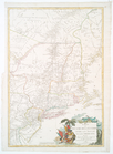
Côte de York-town à Boston : …
note:
Copy in
Map
Div. 97-6457: Lawrence H
A chart of New York Island & …
note:
Title adapted from LC
Maps
of North
m
Map
of the northern
note:
NYPL copies of
maps
in 2 sheets.
Maps
Information
map
of part of Georgia.
note:
… War
maps
(2nd ed.).
Map
of the northern provinces of the United
note:
… to Early
Maps
of the Middle
A New and accurate
map
of the present
note:
… and accurate
map
of the present
A
map
and chart of those parts of the Bay
note:
… to Early
Maps
of the Middle
A new
map
of the Hudson River : the post
note:
NYPL copy imperfect. Southern end of
map
, at New
A
map
of the canals & rail roads
note:
… to Early
Maps
of the Middle
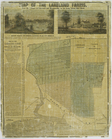
Map
of the Lakeland farms, near the villages
note:
… a
map
of the farms
m
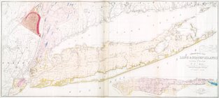
Geological
map
of Long & Staten islands
note:
Includes inset "
Map
of New-York Island."…
Regni Mexicani seu Novae Hisp…
note:
… to Early
Maps
of the Middle
Map
of the southern provinces of the United
note:
… to Early
Maps
of the Middle
An exact
map
of North and South Carolina
note:
… to Early
Maps
of the Middle
Map
of a tract of land called the Nyack
note:
… to Early
Maps
of the Middle
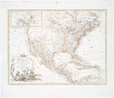
Map
of the United States in North America : …
note:
… to Early
Maps
of the Middle
Amerique septentrionale : sui…
note:
… to Early
Maps
of the Middle
A New and correct chart of th…
note:
… to Early
Maps
of the Middle
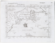
Tierra nveva.
note:
… to Early
Maps
of the Middle
Carte du théatre de la guerre…
note:
… to Early
Maps
of the Middle
Tierra nveva.
note:
… to Early
Maps
of the Middle
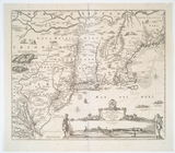
Novi Belgii Novaeque Angliae …
note:
…'s The Jansson-Visscher
maps
of New
L'Amérique septentrionale
note:
Copy in
Map
Div. 97-6407: Lawrence H
A
map
of America
note:
… to Early
Maps
of the Middle
Hemisphere occidental dresse …
note:
… to Early
Maps
of the Middle
Nouvelle Angleterre, Nlle. Yo…
note:
… to Early
Maps
of the Middle
Map
of part of the United States of North
note:
… to Early
Maps
of the Middle
Plan of the city of New-York
note:
Cartouche pasted on
map
.
Plan of the city of Washingto…
note:
… to Early
Maps
of the Middle
A
map
of Maryland with the Delaware counties
note:
Copy in
Map
Div. 00-443: Emmet Collection.
A
map
of the canals & rail roads
note:
… to Early
Maps
of the Middle
Plan of the city of New York …
note:
… to Early
Maps
of the Middle
Map
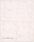
of the proposed widening of Rector & Morris
note:
… to Early
Maps
of the Middle
A plan of the operations of t…
note:
… to Early
Maps
of the Middle
Seat of war in the environs o…
note:
… to Early
Maps
of the Middle
m
Map
of the route of the proposed New York & Erie
note:
…
maps
.
Map
of the county of Westchester
note:
… to Early
Maps
of the Middle
An exact mapp of New England …
note:
… reference to the
map
in his
Map
of the United States showing the treaty
note:
… to Early
Maps
of the Middle
A
Map
of the frontier of British North
note:
At head of the
map
: (No. 2)…
…
map
designed
note:
LC Railroad
maps
, 10
A
map
of North America with the European
note:
… to Early
Maps
of the Middle
m
Amérique Septentrionale publi…
note:
… to Early
Maps
of the Middle
Nova Anglia Septentrionali Am…
note:
Differs from a variant
map
in engraving
A New and correct
map
of the British
note:
… to Early
Maps
of the Middle
Virginiae partis australis, e…
note:
…. Burden's
Mapping
of North
Part of the counties of Charl…
note:
Jolly, D.C.
Maps
of America in periodicals
America
note:
… to Early
Maps
of the Middle
A chart of Delawar Bay : with…
note:
… to Early
Maps
of the Middle
An accurate
map
of the British, French & Spanish
note:
Phillips.
Maps
of America, p. 579, p. 1056
1
2
…
5
6
7
8
9
10
11
12
…
115
116
Previous
Next
1
2
…
5
6
7
8
9
10
11
12
…
115
116
Previous
Next