Click to visit the main New York Public Library Homepage
The New York Public Library
Digital Collections
About Digital Collections
Browse
Search only public domain materials
Items
Collections
Divisions
Home
Search
Browse
About
Search only public domain materials
Items
Collections
Divisions
Digital Collections
Using Images
Using Data
Search
Keyword search
Show filters
Hide filters
Show Only Public Domain
topic
Nautical charts
14
History
7
Coasts
5
Atlases, British
2
Boundaries
2
More
Less
name
United States Coast Survey
4
Almy, John Jay, 1815-1895
3
Bache, A. D. (Alexander Dallas), 1806-1867
3
Balbach, Arthur
2
Bew, John, -1793
2
More
Less
collection
Maps of North America
22
Lawrence H. Slaughter Collection of English maps, charts, globes, books and atlases
7
John H. Levine Collection
2
Wallach Division Picture Collection
2
Archibald Robertson: his diaries and sketches in America, 1762-1780
1
More
Less
place
Chesapeake Bay (Md. and Va.)
22
Virginia
21
Maryland
13
Chesapeake Bay Region (Md. and Va.)
9
United States
8
More
Less
genre
Maps
32
Nautical charts
4
Bathymetric maps
3
Clippings
1
Conjectural works
1
More
Less
publisher
Chez P. Mortier
2
E. & G.W. Blunt
2
U.S. Coast Survey
2
Chez Basset, rue St. Jacques ...,
1
Ex Officina Guiljelmi Blaeuw,
1
More
Less
division
Map Division
32
Wallach Division: Picture Collection
2
Schomburg Photographs and Prints Division
1
Spencer Collection
1
type
cartographic
32
still image
4
text
1
Date Range
to
36 results found for:
Chesapeake Bay (Md. and Va.)
Sort by:
Relevance
Title
Date created
Date digitized
Sequence
Preliminary chart of the sea …
Reconnoissance of the entrance to
Chesapeake
Bay
… to
Chesapeake
Bay
…
abstract:
… to
Chesapeake
Bay
. [Scale
… in the
Chesapeake
Map showing the Southern Mary…
abstract:
… in
Chesapeake
Bay
. Includes text
View of the head of
Chesapeak
Bay
, shewing Turky
m
… chart of the
Bay
of
Chesapeake
: with all
note:
… of Herring
Bay
in Maryland."…
… waters of
Chesapeake
Bay
Chart of the entrance to
Chesapeake
Bay
… of those parts of the
Bay
of
Chesapeak
, York and James
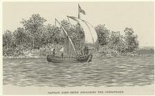
Captain John Smith exploring …
Pas kaart van de zee kusten v…
… of those parts of the
Bay
of
Chesapeak
, York and James
Preliminary sketch of Cherrys…
abstract:
Shows adjacent part of
Chesapeake
Bay
. Depths shown
The burning of Hampton by Mag…
Pas caerte van Nieu Nederland…
Principal seats of the war of…
… waters of
Chesapeake
Bay
Carta particolare della Virgi…
Carte particuliere de Virgini…
Carte particuliere de Virgini…
Carte generale des colonies a…
note:
… la
Baye
de
Chesapeake
Nova Virginiae tabvla
note:
… of the
Chesapeake
Bay
. "Copper
Chart of the entrance to
Chesapeake
Bay
The legacy of New Sweden: Swe…
note:
…
Chesapeake
Bay
region.
A new map of Virginia
note:
…
Va
. and
Md
.
m
Nova Virginiae tabula
abstract:
… pictorially. Covers
Chesapeake
Bay
region. Oriented
Noua Terrae-Mariae tabula
abstract:
… into the
Bay
of Chesapeack
D'Engelze volkplanting in Vir…
abstract:
…
Va
. and
Md
., Del
Strategic war points of the U…
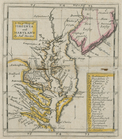
Virginia and Maryland
abstract:
…, in addition to
Chesapeake
Bay
Virginia.
note:
Covers
Chesapeake
Bay
Region.
Lord Balitmore's own plan : p…
note:
…:// www.mdarchives.state.
md
.us/msa/speccol/1399/reports/html
Map of part of Virginia, Mary…
m
Map of part of Virginia, Mary…
A new map of Virginia and Mar…
note:
Covers
Chesapeake
Bay
area of eastern
End of results
|
Top