Click to visit the main New York Public Library Homepage
The New York Public Library
Digital Collections
About Digital Collections
Browse
Search only public domain materials
Items
Collections
Divisions
Home
Search
Browse
About
Search only public domain materials
Items
Collections
Divisions
Digital Collections
Using Images
Using Data
Search
Keyword search
Show filters
Hide filters
Show Only Public Domain
topic
Geology
15
Anthracite coal mines and mining
5
Coal
5
Railroads
4
Geological surveys
3
More
Less
name
Hart, Lane S
20
Geological Survey of Pennsylvania
19
Lesley, J. P. (J. Peter), 1819-1903
19
Julius Bien & Co
10
Ashburner, Charles A. (Charles Albert), 1854-1889
9
More
Less
collection
Maps of North America
27
Robert N. Dennis collection of stereoscopic views
19
Thomas Addis Emmet collection, [legacy collection]
5
The Buttolph collection of menus
4
Detroit Publishing Company postcards
3
More
Less
place
Pennsylvania
48
Harrisburg (Pa.)
19
Schuylkill County
6
Carbon County
5
Schuylkill County (Pa.)
4
More
Less
genre
Maps
27
Photographs
20
Stereographs
19
Geological maps
8
Documents
6
More
Less
publisher
Geological Survey of Pennsylvania
11
Second Geological Survey of Pennsylvania
7
Detroit Publishing Company
3
Board of Commissioners for the Second Geological Survey
2
Department of Internal Affairs
2
More
Less
division
Map Division
27
Wallach Division: Photography Collection
22
Manuscripts and Archives Division
7
Rare Book Division
4
Wallach Division: Print Collection
2
More
Less
type
still image
31
cartographic
27
text
7
Date Range
to
65 results found for:
Harrisburg (Pa.)
Sort by:
Relevance
Title
Date created
Date digitized
Sequence
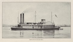
United States Steamer Sibyl
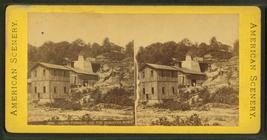
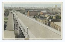
Mulberry Street Bridge,
Harrisburg
,
Pa
.
m
Steam railroad map of Pennsyl…
note:
… Commission,
Harrisburg
,
Pa
."…
m
…] "
HARRISBURG
,
PA
" (HOTEL;)…
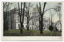
… Capitol,
Harrisburg
,
Pa
.
…,
Harrisburg
,
Pa
.
m
…] "
HARRISBURG
,
PA
" (HOTEL;)…
m
… AT THE COMMONWEALTH [at] "
HARRISBURG
,
PA
"…
Rail road map of Pennsylvania
m
Geological map of Pennsylvani…
m
… IN
HARRISBURG
,
PA
" (OTHER;)…
Rail road map of Pennsylvania
Geological map of Berks Count…
Topographical map in ten-foot…
Geological map of Fulton Coun…
Second Geological Survey of P…
Second Geological Survey of P…
Second Geological Survey of P…
Map of the mines of the Panth…
[S]econd Geolo[gical Survey o…
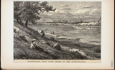
abstract:
… Schuylkill County,
Pa
. Shows
Harrisburg
, from west shore
Topographical map in thirty-f…
A series of columnar sections…
Geological map of Fayette Cou…
Geological map of the environ…
Geological map of Westmorelan…
Map of southern Butler County…
Geological map of Potter Coun…
Geological map of Allegheny C…
Map of Beaver County showing …
Map of North Allegheny, showi…
Geological map of Potter Coun…
Topographical map of the coal…
Map of Pennsylvania showing p…
Chester, U.S. minister, Liber…
Railroad, canal, iron and coa…
note:
…, Pottsville,
Pa
., March, 1869.
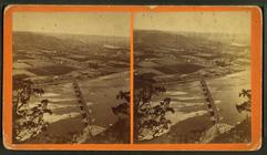
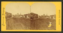
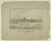
Southern view of
Harrisburg
, Penn.
m
Market Street,
Harrisburg
.
m
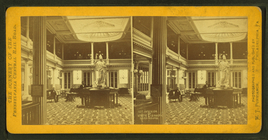
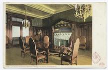
Interior of State Library,
Harrisburg
.
m
Towanda,
Pa
. Bradford Co.
note:
…
Harrisburg
,
Pa
.
m
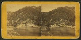
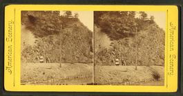
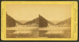
Jackstown Aqueduct, 1 mile ea…
m
Dam, west of Huntingdon.
m
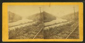
… on the P.R.R.,
Harrisburg
,
Pa
.
collection:
Near Newport on the P.R.R.,
Harrisburg
,
Pa
.
m
… the east side,
Harrisburg
,
Pa
.
m
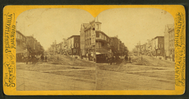
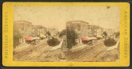
Market St., looking west,
Harrisburg
,
Pa
.
m
…, on the Guniatha River,
Harrisburg
,
Pa
.
m
Water St., dam on the Guniatha,
Harrisburg
,
Pa
.
m
State Street,
Harrisburg
.
m
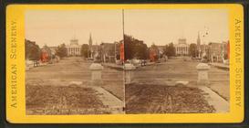
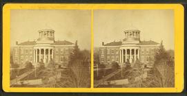
Capitol. [
Harrisburg
, Pennsylvania.]
m
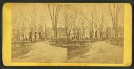
View of park and church.
collection:
Stereoscopic views of
Harrisburg
, Pennsylvania.