Click to visit the main New York Public Library Homepage
The New York Public Library
Digital Collections
About Digital Collections
Browse
Search only public domain materials
Items
Collections
Divisions
Home
Search
Browse
About
Search only public domain materials
Items
Collections
Divisions
Digital Collections
Using Images
Using Data
Search
Keyword search
Show filters
Hide filters
Show Only Public Domain
topic
Real property
316
Business enterprises
190
Maps
55
Railroads
45
Pictorial works
39
More
Less
name
Austro-Hungarian Monarchy. Militärgeographisches Institut
773
Stone & Stewart
151
Beers, S. N
146
Beers, D. G. (Daniel G.)
141
Geological Survey (U.S.)
101
More
Less
collection
Spezialkarte der Osterreichisch-Ungarischen Monarchie
773
Atlases of the United States
534
Maps of North America
316
Atlases of New York City
213
Maps of New York City and State
89
More
Less
place
New York (State)
425
Staten Island (New York, N.Y.)
91
Bronx (New York, N.Y.)
85
New Jersey
81
New York (N.Y.)
62
More
Less
genre
Maps
1897
Topographic maps
1062
Atlases
534
Prints
29
Cadastral maps
26
More
Less
publisher
K.u.K. Militargeographisches Institut
773
Stone & Stewart
99
Topographical Bureau
82
The Suvery
52
C. K. Stone
46
More
Less
division
Map Division
1931
Rare Book Division
18
General Research Division
5
Wallach Division: Picture Collection
5
Wallach Division: Print Collection
5
type
cartographic
1909
text
51
still image
26
Date Range
to
Looking for this collection?
Spezialkarte der Osterreichisch-Ungarischen Monarchie
774 items
1,964 results found for:
Topographic maps
Sort by:
Relevance
Title
Date created
Date digitized
Sequence
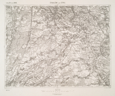
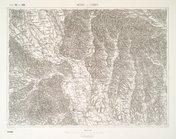
Zydaczow und Stryj.
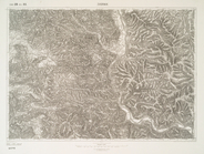
Zvornik.
Zuri [Zirije].
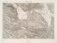
Zupanjac und Cista.
Zombor.
Zolkiew (Galizien).
Znaim.
Zlon.
Zloczow.
Zirovac und Vrnograc.
Zirl und Nassereith.
Zilah.
Zepce.
Zenta und Ada.
Zenica und Vares.
Zemplenoroszi und Dydiowa.
Zaravecchia und Stretto.
Zara.
Zapuntello.
Zalozce.
Zalom und Stolac.
Zaleszczyki (Galizien).
Zalatna.
Zagubica.
Zabukvica.
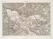
Yellowstone National Park
note:
… catalog of the
Map
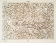
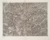
Ybbs.
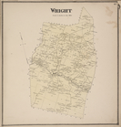
Wright [Township]
collection:
New
topographical
atlas of Schoharie Co
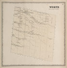
Worth. [Township]
collection:
New
topographical
atlas of Jefferson Co
Wola Michowa u. Izbugyarhdvan…
Wittingau und Moldauthein
Wisowitz und Bellus.
Wilton [Township]
collection:
New
topographical
atlas of Saratoga Co
Wilna [Township]
collection:
New
topographical
atlas of Jefferson Co
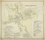
Williamsville [Village]; Will…
collection:
New
topographical
atlas of Erie Co., New
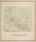
Williamstown [Township]
collection:
New
topographical
atlas of Oswego County
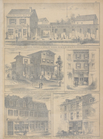
William L. Bamber's Marble & …
collection:
… :
topographical
, geological
Wildon und Leibnitz.
Wiener Neustadt.
Wien. (Nieder-Osterreich)
Wieliczka und Myslenice.
Whiting, survey of 1884, ed. …
note:
Many
maps
are rev. ed., many
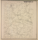
Weyer.
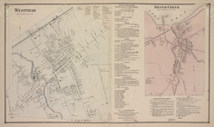
Westfield [Village]; Westfiel…
collection:
New
topographical
atlas of Chautauqua
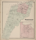
Westfield [Township]; Barcelo…
collection:
New
topographical
atlas of Chautauqua
Western vicinity of Frederick…
note:
Mapping
the Nation (NEH grant, 2015-2018)…
Westerlo [Township]
collection:
New
topographical
atlas of the counties
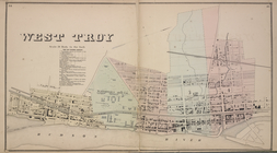
West Troy [Village]; West Tro…
collection:
New
topographical
atlas of the counties
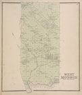
West Monroe [Township]
collection:
New
topographical
atlas of Oswego County
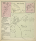
West Falls [Village]; Spring …
collection:
New
topographical
atlas of Erie Co., New
1
2
3
4
5
6
7
8
Previous
Next
1
2
3
4
5
6
7
8
Previous
Next