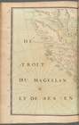
Buccaneer's Atlas or Portolano, entitled: "Description des principaux endroites de la Mer du Sud depuis les 52 degrez 30 minutes sud, ou est le d'Etroit du Magellan jusqu'au 41 degrez Nord qui est l'isle de Californie faite sur les lieux par le sr. Jouhan de la Guilabuadiere. Dresse et dessigné les plans qui l'accompagnent sur ses memoires, par le sr. Hanicle ingenieur ordinaire du Roy en l'année 1696."
Two hundred twenty pages of descriptive text, accompanied by thirty-five carefully executed colored maps and plans of the ports, harbors, anchorage, islands, etc. along the west coast of America, beginning with the Straits of Magellan, and extending as far as the Gulf of California The author of this volume was one of the celebrated band of buccaneers under the command of M. de Gennes. He was shipwrecked in the Straits of Magellan about 1688, and shortly afterward joined the buccaneering expedition of M. de Beauchesnegouin as second in command. This manuscript seems to have been compiled while on this expedition. In addition to the very exact survey of different harbors and ports, a detailed account is given of the inhabitants of the surrounding country, their manners and customs, etc. The volume also contains a long vocabulary of the buccaneer language.
Presented to the New York Public Library by Alexander Maitland. There is a description of this manuscript in G. Marcel's "Les Fuégiens à la fin du XVIIe siècle," Paris, 1892.