Click to visit the main New York Public Library Homepage
The New York Public Library
Digital Collections
About Digital Collections
Browse
Search only public domain materials
Items
Collections
Divisions
Home
Search
Browse
About
Search only public domain materials
Items
Collections
Divisions
Digital Collections
Using Images
Using Data
Collections
Atlases of the United States
Atlases of the United States
Navigation
About
Filters
Atlases of the United States
Previous
United States
42
Indiana
1
Kentucky
2
Maryland
1
New Jersey
910
New York
2887
Wisconsin
23
Michigan
2
More
Collection Data
Description
The Map Division's collection of historical atlases of the United States, showing states, counties, and cities. Includes fire insurance, cadastral, geological, and pictorial maps, dating largely from the 19th and early 20th centuries.
Library locations
Lionel Pincus and Princess Firyal Map Division
Topics
United States
Genres
Atlases
Maps
Type of Resource
Cartographic
Identifiers
Universal Unique Identifier (UUID): 2600a3f0-c5ec-012f-424e-58d385a7bc34
Show filters
Hide filters
Show Only Public Domain
topic
Real property
148
name
F.W. Beers & Co
148
collection
x
Atlases of the United States
place
Erie County
148
Erie County (N.Y.)
148
New York (State)
148
genre
Atlases
148
Maps
148
publisher
x
F. W. Beers & Co
division
Map Division
148
type
cartographic
148
Date Range
to
148 results found
Filtering on:
x
Publisher
: F. W. Beers & Co.
Sort by:
Title
Date created
Date digitized
Sequence
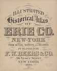
Illustrated historical atlas …
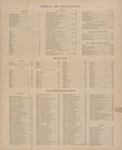
Table of Contents. ; Maps. ; …
Table of Air-Line Distances f…
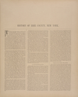
History of Erie County, New Y…
History of Erie County, New Y…
History of Erie County, New Y…
History of Erie County, New Y…
History of Erie County, New Y…
History of Erie County, New Y…
City and Town Histories.
City and Town Histories. [con…
City and Town Histories. [con…
City and Town Histories. [con…
City and Town Histories. [con…
City and Town Histories. [con…
City and Town Histories. [con…
Town Histories. [cont.]
Town Histories. [cont.]
Town Histories. [cont.]
Town Histories. [cont.]
Town Histories. [cont.]
Town Histories. [cont.]
Town Histories. [cont.]
Town Histories. [cont.]
Appendix.
Appendix. [cont.]
Appendix. [cont.]
Appendix. [cont.]
Appendix. [cont.]
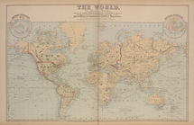
The World
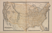
The United States of America
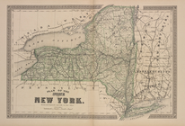
Plan of the State of New York.
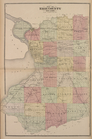
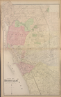
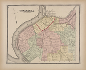
Map of Erie County New York
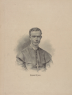
Bishop Ryan.
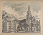
Bishop's House. ; St. Joseph'…
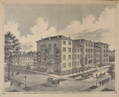
Le Couteulx St. Mary's Instit…
City of Buffalo
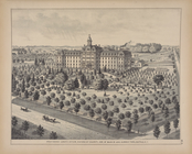
Providence Lunatic Asylum, Si…
indemere", Residence of R. M.…
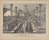
The Great cash one price andd…
Residence, Brewery and Sale a…
Ervin H. Ewell. ; Residence o…
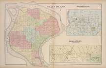
Grand Island [Township]; Sout…
Yeoman's Hotel, East Aurora, …
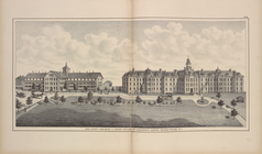
Erie County Alms house and In…
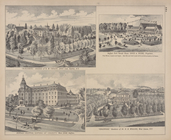
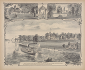
Parlor; Main Entrance; Dining…
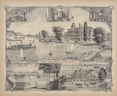
The Bedell House, Grand Islan…
View from Falconwood ; Entran…
Tonawanda [Township]
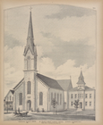
Erected bt Rev. Francis S. Uh…