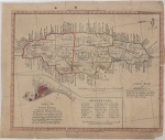
A new map of Jamaica: exhibiting the boundaries of each Parish and the different Post Roads throughout the Island, laid down from the latest surveys

Collection Data

Dates / Origin
Date Issued: 1906 (Questionable)
Place: Jamaica?
Publisher: s.n.
Library locations
Schomburg Center for Research in Black Culture, Jean Blackwell Hutson Research and Reference Division
Shelf locator: Sc Map N-52
Genres
Maps
Notes
Content: Inset: A general plan of Port Royal, in which the different states and towns are accurately laid out [Scale: 1 in.=800 ft.].
Physical Description
Extent: 1 map, col, 31 x 25 cm.
Type of Resource
Cartographic
Identifiers
NYPL catalog ID (B-number): b13907955
Universal Unique Identifier (UUID): ea170ea0-ee87-0131-f1e7-58d385a7b928
Show filters Hide filters
collection
x A new map of Jamaica: exhibiting the boundaries of each Parish and the different Post Roads throughout the Island, laid down from the latest surveys
genre
publisher
Date Range
to
1 result found