Click to visit the main New York Public Library Homepage
The New York Public Library
Digital Collections
About Digital Collections
Browse
Search only public domain materials
Items
Collections
Divisions
Home
Search
Browse
About
Search only public domain materials
Items
Collections
Divisions
Digital Collections
Using Images
Using Data
Collections
Charting America: Maps from the Lawrence H. Slaughter Collection and Others
Charting America: Maps from the Lawrence H. Slaughter Collection and Others
Navigation
Filters
Charting America: Maps from the Lawrence H. Slaughter Collection and Others
Previous
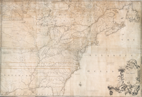
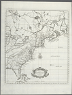
The south part of Virginia, now the north part of Carolina
0
Atlases, gazetteers, guidebooks and other books
377
Maps of the World
16
Maps of the Oceans
24
Maps of North and South America
23
Maps of North America.
551
Maps of New York City and State
1340
Lawrence H. Slaughter Collection of English maps, charts, globes, books and atlases
1020
John H. Levine Collection
60
More
Show filters
Hide filters
Show Only Public Domain
topic
Atlases, British
144
History
122
Geography
78
Maps in education
43
Geography, Ancient
42
More
Less
name
Montanus, Arnoldus, 1625?-1683
116
Ogilby, John, 1600-1676
116
Sayer, Robert, 1725-1794
77
Dunn, Samuel, d. 1794
76
Sheldonian Theatre
41
More
Less
collection
Lawrence H. Slaughter Collection of English maps, charts, globes, books and atlases
217
Atlases, gazetteers, guidebooks and other books
80
place
America
124
West Indies, British
116
Maps
63
England
44
North America
15
More
Less
genre
Maps
263
preliminaries
24
Charts
4
Prints
2
Tables (Data)
2
More
Less
publisher
Printed by the author, and are to be had at his house
116
Printed for Robert Sayer, No. 53, Fleet-Street
76
Printed at the Theater,
41
Printed by A. Godbid and J. Playford, for John Seller ...,
7
Printed for Robert Morden and Thomas Cockeril, at the Atlas in Cornhill, and at the Three Legs in the Poultrey, over against the Stocks-Market
6
More
Less
division
Map Division
296
type
cartographic
160
still image
105
text
36
Date Range
to
297 results found for:
Atlases, British
Sort by:
Relevance
Title
Date created
Date digitized
Sequence
A chart of Delaware Bay and R…
collection:
… of the
British
Ch
m
A chart of North and South Am…
note:
…, with the
British
, French, & Spanish
A chart of North and South Am…
note:
…, with the
British
, French, & Spanish
A chart of the sea coasts of …
topic:
Atlases
,
British
m
A chart of the West Indias fr…
topic:
Atlases
,
British
m
A chart of the West Indias fr…
topic:
Atlases
,
British
A chart of the West Indies fr…
topic:
Atlases
,
British
A compleat map of the Holy La…
topic:
Atlases
,
British
A compleat map of the West In…
topic:
Atlases
,
British
A complete map of the East In…
topic:
Atlases
,
British
A General Introduction to Geo…
topic:
Atlases
,
British
A General Introduction to Geo…
topic:
Atlases
,
British
A General Introduction to Geo…
topic:
Atlases
,
British
A General Introduction to Geo…
topic:
Atlases
,
British
A General Introduction to Geo…
topic:
Atlases
,
British
A General Introduction to Geo…
topic:
Atlases
,
British
A General Introduction to Geo…
topic:
Atlases
,
British
A General Introduction to Geo…
topic:
Atlases
,
British
A General Introduction to Geo…
topic:
Atlases
,
British
A General Introduction to Geo…
topic:
Atlases
,
British
A General Introduction to Geo…
topic:
Atlases
,
British
A General Introduction to Geo…
topic:
Atlases
,
British
A General Introduction to Geo…
topic:
Atlases
,
British
A General Introduction to Geo…
topic:
Atlases
,
British
A General Introduction to Geo…
topic:
Atlases
,
British
A General Introduction to Geo…
topic:
Atlases
,
British
A General Introduction to Geo…
topic:
Atlases
,
British
A General Introduction to Geo…
topic:
Atlases
,
British
A General Introduction to Geo…
topic:
Atlases
,
British
A General Introduction to Geo…
topic:
Atlases
,
British
A geographical table containi…
topic:
Atlases
,
British
A great Lyon of Marble ... th…
collection:
Atlases
A high Mast should be erected…
collection:
Atlases
A map exhibiting the dark sha…
topic:
Atlases
,
British
A map of Abyssinia and Nubia
topic:
Atlases
,
British
A map of Barbary, containing …
topic:
Atlases
,
British
A map of Chinese Tartary, wit…
topic:
Atlases
,
British
A map of Florida and ye Great…
topic:
Atlases
,
British
A map of independent Tartary,…
topic:
Atlases
,
British
A map of New England, New Yor…
collection:
… of their missionaries in the
British
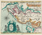
A map of New Iarsey
topic:
Atlases
,
British
m
A map of the
British
and French
A map of the
British
dominions in North
A map of the
British
-plantations
collection:
A map of the
British
-plantations on the continent
A map of the countries and pl…
topic:
Atlases
,
British
… territory and the
British
A map of the West-Indies &c. …
topic:
Atlases
,
British
A map of Turkey in Asia, cont…
topic:
Atlases
,
British
A mapp of the world
topic:
Atlases
,
British
A new & correct map of the tr…
collection:
…, globes, books and
atlases
1
2
Previous
Next
1
2
Previous
Next