Click to visit the main New York Public Library Homepage
The New York Public Library
Digital Collections
About Digital Collections
Browse
Search only public domain materials
Items
Collections
Divisions
Home
Search
Browse
About
Search only public domain materials
Items
Collections
Divisions
Digital Collections
Using Images
Using Data
Collections
Charting America: Maps from the Lawrence H. Slaughter Collection and Others
Charting America: Maps from the Lawrence H. Slaughter Collection and Others
Navigation
Filters
Charting America: Maps from the Lawrence H. Slaughter Collection and Others
Previous
The south part of Virginia, now the north part of Carolina
0
Atlases, gazetteers, guidebooks and other books
377
Maps of the World
16
Maps of the Oceans
24
Maps of North and South America
23
Maps of North America.
551
Maps of New York City and State
1340
Lawrence H. Slaughter Collection of English maps, charts, globes, books and atlases
1020
John H. Levine Collection
60
More
Show filters
Hide filters
Show Only Public Domain
topic
Geography
262
Nautical charts
82
Administrative and political divisions
58
Mathematics
57
Astronomy, 1681
55
More
Less
name
Ortelius, Abraham, 1527-1598
130
Coignet, Michel, 1549-1623
126
Shawe, James
126
Moll, Herman, -1732
95
Flamsteed, John, 1646-1719
55
More
Less
collection
Lawrence H. Slaughter Collection of English maps, charts, globes, books and atlases
749
Maps of New York City and State
263
John H. Levine Collection
47
Maps of the Oceans
17
Maps of North and South America
15
More
Less
place
New York (N.Y.)
161
New York (State)
144
United States
139
Maps
105
North America
96
More
Less
genre
Maps
1097
Early maps
11
Facsimiles
11
Title pages
7
Early works to 1800
6
More
Less
publisher
Printed for Ieames Shawe, and are to be solde at his shoppe nigh Ludgate,
126
Printed by A. Godbid and J. Playford, for R. Scott, bookseller
55
Printed for Timothy Childe at the White Hart at the West-end of St. Paul's Church-yard
47
s.n
36
... Sold ... by Tho. Bowles, print and map-seller in St. Paul's-Churchyard
32
More
Less
division
Map Division
1109
type
cartographic
1079
text
31
still image
18
Date Range
to
1,111 results found for:
Early maps
Sort by:
Relevance
Title
Date created
Date digitized
Sequence
A chart of Delawar Bay : with…
note:
… to
Early
Maps
of the Middle
A chart of Delawar River from…
note:
… to
Early
Maps
of the Middle
A chart of Delaware Bay and R…
note:
… to
Early
Maps
of the Middle
A chart of Delaware Bay and R…
note:
… to
Early
Maps
of the Middle
A chart of Delaware Bay and R…
note:
… to
Early
Maps
of the Middle
A chart of Delaware Bay and R…
note:
… to
Early
Maps
of the Middle
A chart of New York Harbour :…
note:
… to
Early
Maps
of the Middle
A chart of New York Harbour :…
note:
… to
Early
Maps
of the Middle
A chart of New York Island & …
note:
… to
Early
Maps
of the Middle
[A chart of New York Island &…
note:
… to
Early
Maps
of the Middle
m
A chart of North and South Am…
note:
… to
Early
Maps
of the Middle
A chart of the Atlantic Ocean…
note:
… to
Early
Maps
of the Middle
m
A chart of the Atlantic or We…
note:
… to
Early
Maps
of the Middle
A chart of the Atlantic or We…
note:
… to
Early
Maps
of the Middle
[A Chart of the Atlantic or W…
note:
… to
Early
Maps
of the Middle
A chart of the bar of Sandy H…
note:
… to
Early
Maps
of the Middle
A chart of the bar of Sandy H…
note:
… to
Early
Maps
of the Middle
A chart of the coast of Ameri…
note:
… to
Early
Maps
of the Middle
A chart of the Gulf Stream
note:
… to
Early
Maps
of the Middle
A chart of the sea coast of N…
note:
… to
Early
Maps
of the Middle
A chart of the sea coasts of …
note:
… to
Early
Maps
of the Middle
A chart of the sea coasts of …
note:
… to
Early
Maps
of the Middle
m
A chart of the West Indias fr…
note:
… to
Early
Maps
of the Middle
m
A chart of the West Indias fr…
note:
… to
Early
Maps
of the Middle
A chart of the West Indies fr…
note:
… to
Early
Maps
of the Middle
A chart of the world : exhibi…
note:
… to
Early
Maps
of the Middle
A Chart of ye coast of New En…
note:
… to
Early
Maps
of the Middle
A compleat chart of the coast…
note:
… to
Early
Maps
of the Middle
A correct
map
of the city of Washington
note:
… to
Early
Maps
of the Middle
A correct
map
of the city of Washington
note:
… to
Early
Maps
of the Middle
A description of the Towne of…
topic:
Maps
, Manuscript
A draught of New York and Per…
note:
… to
Early
Maps
of the Middle
A draught of New York from th…
note:
… to
Early
Maps
of the Middle
A draught of New York from th…
collection:
Maps
of New York City and State
A General
map
of America divided into North
note:
… to
Early
Maps
of the Middle
A general
map
of North America : drawn
note:
… to
Early
Maps
of the Middle
A general
map
of North America : from
note:
… to
Early
Maps
of the Middle
A general
map
of the world, or terraqueous
note:
… to
Early
Maps
of the Middle
A Generall chart for the West…
note:
… to
Early
Maps
of the Middle
A Generall chart of the Weste…
note:
… to
Early
Maps
of the Middle
A geological section of the c…
note:
… to
Early
Maps
of the Middle
A
map
of America
note:
… to
Early
Maps
of the Middle
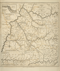
A
Map
of Carolana and of the River Meschacebe &c.
note:
… to
Early
Maps
of the Middle
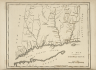
A
map
of Connecticut.
note:
… to
Early
Maps
of the Middle
A
map
of Florida and ye Great Lakes
A
map
of Kentucky, drawn from actual
note:
… to
Early
Maps
of the Middle
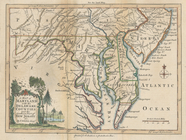
A
map
of Maryland with the Delaware counties
note:
… to
Early
Maps
of the Middle
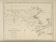
A
map
of Massachusets [sic] from
note:
… to
Early
Maps
of the Middle
A
map
of New England, New York, New
note:
… to
Early
Maps
of the Middle
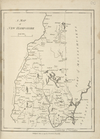
A
map
of New Hampshire.
note:
… to
Early
Maps
of the Middle
1
2
3
4
5
Previous
Next
1
2
3
4
5
Previous
Next