Click to visit the main New York Public Library Homepage
The New York Public Library
Digital Collections
About Digital Collections
Browse
Search only public domain materials
Items
Collections
Divisions
Home
Search
Browse
About
Search only public domain materials
Items
Collections
Divisions
Digital Collections
Using Images
Using Data
Collections
Charting America: Maps from the Lawrence H. Slaughter Collection and Others
Charting America: Maps from the Lawrence H. Slaughter Collection and Others
Navigation
Filters
Charting America: Maps from the Lawrence H. Slaughter Collection and Others
Previous
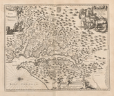
The south part of Virginia, now the north part of Carolina
0
Atlases, gazetteers, guidebooks and other books
377
Maps of the World
16
Maps of the Oceans
24
Maps of North and South America
23
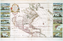
Maps of North America.
551
Maps of New York City and State
1340
Lawrence H. Slaughter Collection of English maps, charts, globes, books and atlases
1020
John H. Levine Collection
60
More
Show filters
Hide filters
Show Only Public Domain
topic
History
118
Nautical charts
9
Atlases, British
8
Geography
5
West Indies, British
5
More
Less
name
Montanus, Arnoldus, 1625?-1683
116
Ogilby, John, 1600-1676
116
Moll, Herman, -1732
7
Sayer, Robert, 1725-1794
6
Jefferys, Thomas, d. 1771
4
More
Less
collection
Lawrence H. Slaughter Collection of English maps, charts, globes, books and atlases
150
Atlases, gazetteers, guidebooks and other books
15
Maps of North and South America
1
Maps of the Oceans
1
place
America
122
West Indies, British
116
West Indies
19
Caribbean Area
10
Atlantic Ocean
8
More
Less
genre
Maps
165
Nautical charts
2
Frontispieces
1
Illustrations
1
Prints
1
More
Less
publisher
Printed by the author, and are to be had at his house
116
Printed for Robert Sayer, No. 53, Fleet-Street
3
P. Goos
3
... Mathew Albert and George Frederick Lotter
2
Apud Haeredes J. Janssonii
2
More
Less
division
Map Division
166
type
still image
98
cartographic
67
text
2
Date Range
to
167 results found for:
West Indies
Sort by:
Relevance
Title
Date created
Date digitized
Sequence
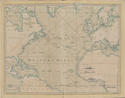
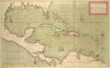
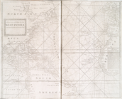
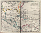
The Atlantic or Western Ocean
note:
… of the
West
Indies
.
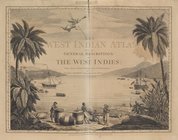
The
West
-India atlas...
note:
… of the
West
Indies
.
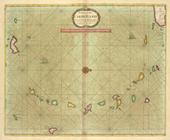
Pascaerte van't Eylant St. Ju…
… chart for the
West
Indies
of E. Wright
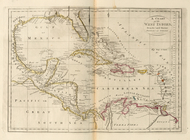
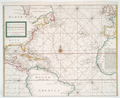
A chart of the
West
Indies
, from the latest
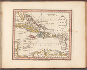
A Generall chart for the
West
Indies
: according
… chart for the
West
Indies
, of E. Wrights
m
Johnson's
West
Indies
m
A chart of the
West
Indias from Cap Cod to ye
topic:
West
Indies
, British
m
A chart of the
West
Indias from Cap Cod to ye
topic:
West
Indies
, British
… chart for the
West
Indies
of E. Wright
… of the tradeing part of the
WEST
INDIES
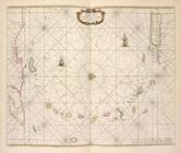
A chart of the CARIBE ILANDS
Episcopatus Bergensis
… of the trading part of the
West
Indies
note:
…. ships in the
West
Indies
… chart for the
West
Indies
....
Dioecesis Trundhemiensis pars…
… chart for the
West
Indies
, of E. Wright
Pascaert van de Caribes Eylan…
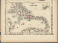
A map of the
West
-
Indies
&c
topic:
West
Indies
, British
West
India Islands
… and South, and
West
Indies
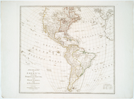
America
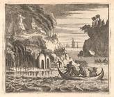
Christofel Colonus
Scene viewed by Columbus.
Angra op Tercera
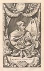
Americus Vesputius
Ferdinand Magellanus
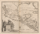
Vetus Mexico
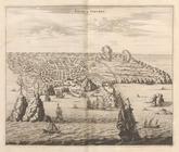
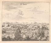
St. Iago
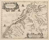
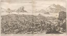
Nova Virginiae Tabula
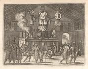
Native Temple
Pagus Hispanorum
St. Francisco De Campeche
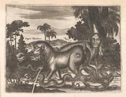
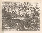
Strange Animals of Guatemala
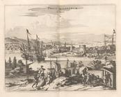
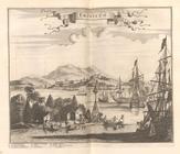
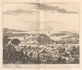
Truxillo.
Nova Hispania Nova Galicia Gv…
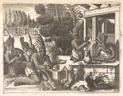
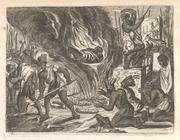
Cacao preparation.
Nova Mexico
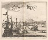
Portus Acapulco
Funerary activities, Tabasco,…
Priest, New Gallicia.
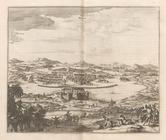
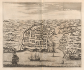
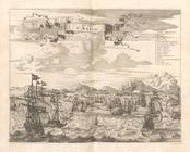
Urbs Domingo In Hispaniola
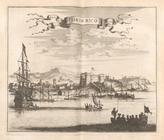
Porto Rico
Plants of Jamaica.
De Stadt St. Martin
Plants of St. Bartholomew.
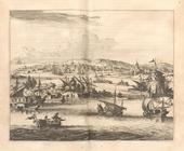
Cartagena
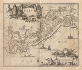
Peru
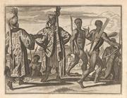
Natives of Peru.