Click to visit the main New York Public Library Homepage
The New York Public Library
Digital Collections
About Digital Collections
Browse
Search only public domain materials
Items
Collections
Divisions
Home
Search
Browse
About
Search only public domain materials
Items
Collections
Divisions
Digital Collections
Using Images
Using Data
Collections
Charting America: Maps from the Lawrence H. Slaughter Collection and Others
Charting America: Maps from the Lawrence H. Slaughter Collection and Others
Navigation
Filters
Charting America: Maps from the Lawrence H. Slaughter Collection and Others
Previous
The south part of Virginia, now the north part of Carolina
0
Atlases, gazetteers, guidebooks and other books
377
Maps of the World
16
Maps of the Oceans
24
Maps of North and South America
23
Maps of North America.
551
Maps of New York City and State
1340
Lawrence H. Slaughter Collection of English maps, charts, globes, books and atlases
1020
John H. Levine Collection
60
More
Show filters
Hide filters
Show Only Public Domain
topic
Nautical charts
15
Navigation
4
Almanacs, English
2
Astronomy
2
Coasts
2
More
Less
name
Norie, J. W. (John William), 1772-1843
4
Seller, John, active 1658-1698
4
Heather, William
3
Stephenson, J., engraver
3
Bache, A. D. (Alexander Dallas), 1806-1867
2
More
Less
collection
Lawrence H. Slaughter Collection of English maps, charts, globes, books and atlases
20
Maps of New York City and State
10
Atlases, gazetteers, guidebooks and other books
1
John H. Levine Collection
1
Maps of North and South America
1
More
Less
place
New York (State)
8
America
5
Atlantic Coast (U.S.)
5
Maps
5
Atlantic Ocean
4
More
Less
genre
x
Maps
Nautical charts
1
Topographic maps
1
publisher
J.T. Lloyd
2
Published ... by W. Heather at the Navigation Warehouse, No. 157 Leadenhall Street,
2
Rob[er]t Laurie & James Whittle, No. 53 Fleet Street
2
U.S. Coast Survey office
2
Walker Lith. & Pub. Co
2
More
Less
division
Map Division
34
type
cartographic
34
text
2
Date Range
to
34 results found for:
x
Navigation
Filtering on:
x
Genre
: Maps
Sort by:
Relevance
Title
Date created
Date digitized
Sequence
Carte nouvelle de la mer du S…
collection:
…
navigation
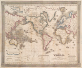
The world, on Mercator's proj…
note:
… of different
navigators
, route
Part of North America: compre…
collection:
… the West-India
navigation
A general chart of the West I…
collection:
… and experienced
navigators
of our
America.
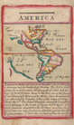
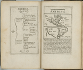
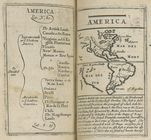
America.
collection:
…,
navigation
, astrology
America.
collection:
…,
navigation
, astrology
America.
collection:
….
navigation
astrology
Chart of the Atlantic Ocean.
topic:
Navigation
A chart of the Gulf Stream
note:
… the
navigation
from Newfoundland
Susquehanna River to Schuylki…
note:
…
navigation
of Pennsylvania
…, for the
navigation
between
…, for the
navigation
between Cape Cod
A chart of the coast of Ameri…
note:
…., at the
Navigation
Warehouse
A new chart of the Atlantic o…
note:
…, teacher of
navigation
Terra nova, ac maris tractus …
note:
From Louis Renard's Atlas de la
navigation
A New and correct chart of th…
note:
… to trade and
navigation
A chart of the Atlantick Ocea…
note:
… to trade and
navigation
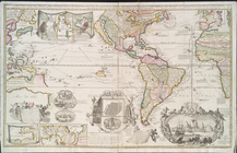
A new chart of America with t…
note:
… and Williams, at the
Navigation
North America
abstract:
…
navigational
hazards off
Carte de la baye et riviere d…
abstract:
… to tides and
navigation
To the independent mariners o…
note:
…, teacher of
navigation
m
Lloyd's Topographical map of …
m
Lloyd's topographical map of …
Coast chart, no. 118, Napeagu…
topic:
Navigation
Long Island Sound (western sh…
topic:
Navigation
Middle part of Long Island So…
topic:
Navigation
A view of Collect Pond and it…
note:
… of steam
navigation
.
A view of Collect Pond and it…
note:
… of steam
navigation
.
Freight terminal map of New Y…
m
United States--east coast, Ne…
note:
…
navigation
charts.
Freight terminal map of New Y…
collection:
… and the New England
Navigation
… to
navigate
the North Sea
Carte de la Nouvelle Angleter…
note:
… and a few
navigational
End of results
|
Top