Click to visit the main New York Public Library Homepage
The New York Public Library
Digital Collections
About Digital Collections
Browse
Search only public domain materials
Items
Collections
Divisions
Home
Search
Browse
About
Search only public domain materials
Items
Collections
Divisions
Digital Collections
Using Images
Using Data
Collections
Charting America: Maps from the Lawrence H. Slaughter Collection and Others
Charting America: Maps from the Lawrence H. Slaughter Collection and Others
Navigation
Filters
Charting America: Maps from the Lawrence H. Slaughter Collection and Others
Previous
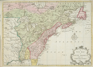
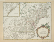
The south part of Virginia, now the north part of Carolina
0
Atlases, gazetteers, guidebooks and other books
377
Maps of the World
16
Maps of the Oceans
24
Maps of North and South America
23
Maps of North America.
551
Maps of New York City and State
1340
Lawrence H. Slaughter Collection of English maps, charts, globes, books and atlases
1020
John H. Levine Collection
60
More
Show filters
Hide filters
Show Only Public Domain
topic
Atlases
1
Historical geography
1
Long Island, Battle of, New York, N.Y., 1776
1
Nautical charts
1
name
Brion de la Tour, Louis, -1823
3
Jaillot, Alexis Hubert, 1632?-1712
2
Robert de Vaugondy, Gilles, 1688-1766
2
Clüver, Philipp, 1580-1622
1
Faden, William, 1749-1836
1
More
Less
collection
Lawrence H. Slaughter Collection of English maps, charts, globes, books and atlases
9
John H. Levine Collection
5
Maps of North and South America
1
place
North America
8
America
2
America -- Maps -- Early works to 1800
1
Delaware
1
Early works to 1800
1
More
Less
genre
Maps
15
publisher
x
s.n
Published ... by W. Heather at the Navigation Warehouse, No. 157 Leadenhall Street,
1
division
Map Division
15
type
x
cartographic
Date Range
to
15 results found for:
x
North America
Filtering on:
x
Publisher
: s.n.
x
Type
: cartographic
Sort by:
Relevance
Title
Date created
Date digitized
Sequence
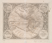
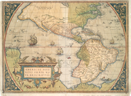
America
, siue, India Nova
note:
Burden, P.D. Mapping of
North
America
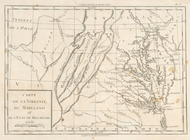
Carte de la Virginie, du Mary…
note:
Research catalog of maps of
America
to 1860
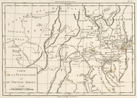
Carte de la Pensylvanie et du…
note:
Research catalog of maps of
America
to 1860
Carte de la Nouvelle York : y…
Part of
North
America
America
.
note:
…, P.D. Mapping of
North
America
, 360
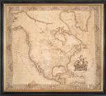
A new map of
North
America
from the latest
note:
Jolly, D.C. Maps of
America
in periodicals
North
America
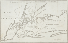
Sketch of the country illustr…
note:
LC Maps of
North
America
, 1750-1789, 1150
A chart of the bar of Sandy H…
note:
LC Maps of
North
America
, 1750-1789, 1293
… in Septemtrionali
America
note:
Covers
North
America
from Quebec
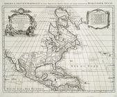
Americae
sive novi orbis, nova descriptio.
note:
Burden, P.D. Mapping of
North
America
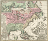
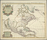
Amerique septentrionale divis…
Amerique septentrionale divis…
Partie de l'Amerique septentr…
note:
Variant of LC Maps of
North
America
, 1750-1789
End of results
|
Top