Click to visit the main New York Public Library Homepage
The New York Public Library
Digital Collections
About Digital Collections
Browse
Search only public domain materials
Items
Collections
Divisions
Home
Search
Browse
About
Search only public domain materials
Items
Collections
Divisions
Digital Collections
Using Images
Using Data
Collections
Charting America: Maps from the Lawrence H. Slaughter Collection and Others
Charting America: Maps from the Lawrence H. Slaughter Collection and Others
Navigation
Filters
Charting America: Maps from the Lawrence H. Slaughter Collection and Others
Previous
The south part of Virginia, now the north part of Carolina
0
Atlases, gazetteers, guidebooks and other books
377
Maps of the World
16
Maps of the Oceans
24
Maps of North and South America
23
Maps of North America.
551
Maps of New York City and State
1340
Lawrence H. Slaughter Collection of English maps, charts, globes, books and atlases
1020
John H. Levine Collection
60
More
Show filters
Hide filters
Show Only Public Domain
topic
Middle Atlantic States
2
Nautical charts
2
New England
2
Railroads
2
Administrative and political divisions
1
More
Less
name
Bache, A. D. (Alexander Dallas), 1806-1867
2
Cary, John, approximately 1754-1835
2
Hassler, F. R. (Ferdinand Rudolph), 1770-1843
2
Knight, John, approximately 1802-1872
2
Mathiot, G
2
More
Less
collection
Lawrence H. Slaughter Collection of English maps, charts, globes, books and atlases
8
Maps of New York City and State
4
Atlases, gazetteers, guidebooks and other books
3
John H. Levine Collection
1
place
New York (State)
5
Rhode Island
4
Block Island (Island)
2
Connecticut
2
Long Island (N.Y.)
2
More
Less
genre
Maps
16
Nautical charts
2
publisher
S. A. Mitchell, jr
2
U.S. Coast Survey office
2
By J. van Schoonhoven en Comp. en G. van den Brink, Janz
1
Chas. Van Benthuysen & Sons
1
Homann Heirs?
1
More
Less
division
Map Division
16
type
cartographic
16
Date Range
to
16 results found for:
x
Rhode Island
Filtering on:
x
Rights
: Public Domain
Sort by:
Relevance
Title
Date created
Date digitized
Sequence
…,
Rhode
Island
, &c
… Hampshire, la
Rhode
Island
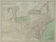
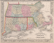
A map of
Rhode
Island
.
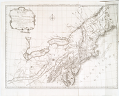
…, Connecticut,
Rhode
Island
, een
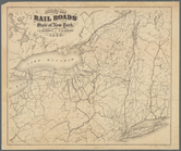
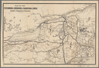
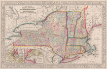
Revised map of the rail roads…
note:
…,
Rhode
Island
… &
Rhode
Island
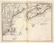
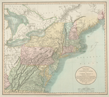
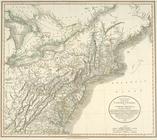
A new map of New England, New…
note:
Covers Massachusetts,
Rhode
Island
…, Connecticut,
Rhode
Island
Position der Königl; Grosbrit…
note:
…, and parts of
Rhode
Island
Map of the Fitchburg, Cheshir…
note:
… Hampshire,
Rhode
Island
…
Island
m
Eastern part of Long
Island
Sound …
abstract:
… entrance to Long
Island
…, Connecticut,
Rhode
Island
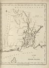
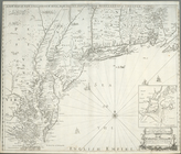
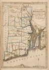
The State of
Rhode
Island
. Compiled from
…, and
Rhode
Island
.
…, Massachusetts,
Rhode
Island
End of results
|
Top