Click to visit the main New York Public Library Homepage
The New York Public Library
Digital Collections
About Digital Collections
Browse
Search only public domain materials
Items
Collections
Divisions
Home
Search
Browse
About
Search only public domain materials
Items
Collections
Divisions
Digital Collections
Using Images
Using Data
Collections
Charting America: Maps from the Lawrence H. Slaughter Collection and Others
Charting America: Maps from the Lawrence H. Slaughter Collection and Others
Navigation
Filters
Charting America: Maps from the Lawrence H. Slaughter Collection and Others
Previous
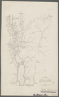
The south part of Virginia, now the north part of Carolina
0
Atlases, gazetteers, guidebooks and other books
377
Maps of the World
16
Maps of the Oceans
24
Maps of North and South America
23
Maps of North America.
551
Maps of New York City and State
1340
Lawrence H. Slaughter Collection of English maps, charts, globes, books and atlases
1020
John H. Levine Collection
60
More
Show filters
Hide filters
Show Only Public Domain
topic
x
History
Rivers
3
Boundaries
2
Chronology
2
Fortification
2
More
Less
name
American Revolution (1775-1783)
4
Andrews, Ferdinand, 1802-1883
4
Faden, William, 1749-1836
3
G.W. Boynton & Co
3
Soulés, François, 1748-1809
3
More
Less
collection
Maps of New York City and State
21
Lawrence H. Slaughter Collection of English maps, charts, globes, books and atlases
9
place
United States
28
New York (State)
17
New York (N.Y.)
5
Brooklyn (New York, N.Y.)
3
Hudson River Valley (N.Y. and N.J.)
3
More
Less
genre
Maps
30
Early works to 1800
2
Facsimiles
1
publisher
Ferdinand Andrews
4
Buisson,
3
Gabriel Nicolaus Raspe
2
Long Island Historical Society
2
U.S. Light-House Board
2
More
Less
division
Map Division
30
type
cartographic
30
Date Range
to
30 results found for:
x
United States
Filtering on:
x
Topic
: History
Sort by:
Relevance
Title
Date created
Date digitized
Sequence
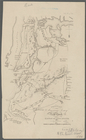
North America from the French…
collection:
…, and present
state
Carte d'une partie de l'Améri…
Côte de York-town à Boston : …
Plan d'York en Virginie, avec…
Die vereinigten Staaten von N…
… part of the
United
States
of America
Carte du theatre de la guerre…
note:
Second
state
containing inset of Yorktown
The Theatre of war in North A…
The country twenty five miles…
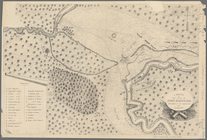
Plan of West Point
collection:
Maps of New York City and
State
m
Niagara 1819
note:
… the
United
States
The second section of the sur…
note:
… the
United
States
The Country twenty five miles…
collection:
Maps of New York City and
State
Plan of the position taken by…
collection:
Maps of New York City and
State
A topographical map of the no…
collection:
Maps of New York City and
State
Operations on the Hudson River
collection:
Maps of New York City and
State
Operations on Hudson's River
collection:
Maps of New York City and
State
Plan of the Battle of Long Is…
collection:
Maps of New York City and
State
Map of Brooklyn at the time o…
collection:
Maps of New York City and
State
Attack on forts Clinton and M…
collection:
Maps of New York City and
State
Position of the American Army…
collection:
Maps of New York City and
State
Battle of Long Island: from S…
collection:
Maps of New York City and
State
A sketch of the operations of…
collection:
Maps of New York City and
State
Map of New York City and of M…
collection:
Maps of New York City and
State
Plan von den Operationen der …
collection:
Maps of New York City and
State
Position de l'armée Américain…
collection:
Maps of New York City and
State
Plan of the position which th…
collection:
Maps of New York City and
State
A sketch of the siege of Fort…
collection:
Maps of New York City and
State
Works at Stony Point and Verp…
collection:
Maps of New York City and
State
Grundriss des nördlichen Thei…
collection:
Maps of New York City and
State
End of results
|
Top