Click to visit the main New York Public Library Homepage
The New York Public Library
Digital Collections
About Digital Collections
Browse
Search only public domain materials
Items
Collections
Divisions
Home
Search
Browse
About
Search only public domain materials
Items
Collections
Divisions
Digital Collections
Using Images
Using Data
Collections
Charting America: Maps from the Lawrence H. Slaughter Collection and Others
Charting America: Maps from the Lawrence H. Slaughter Collection and Others
Navigation
Filters
Charting America: Maps from the Lawrence H. Slaughter Collection and Others
Previous
The south part of Virginia, now the north part of Carolina
0
Atlases, gazetteers, guidebooks and other books
377
Maps of the World
16
Maps of the Oceans
24
Maps of North and South America
23
Maps of North America.
551
Maps of New York City and State
1340
Lawrence H. Slaughter Collection of English maps, charts, globes, books and atlases
1020
John H. Levine Collection
60
More
Show filters
Hide filters
Show Only Public Domain
topic
x
Landowners
Harbors
1
Real property
1
Roads
1
Yellow fever
1
name
Colles, Christopher, 1738-1816
1
J.H. Colton & Co
1
Lloyd, James T
1
Lloyd, James T
1
collection
Maps of New York City and State
4
place
United States
3
Hudson River (N.Y. and N.J.)
2
Hudson River Valley (N.Y. and N.J.)
2
New York (State)
2
New York Metropolitan Area
2
More
Less
genre
Maps
4
Facsimiles
1
Road maps
1
Strip maps
1
Topographic maps
1
publisher
J.T. Lloyd
2
J.H. Colton & Co
1
Publisher not identified
1
division
Map Division
4
type
cartographic
4
Date Range
to
4 results found for:
x
United States
Filtering on:
x
Topic
: Landowners
Sort by:
Relevance
Title
Date created
Date digitized
Sequence
New York to New Rochelle: fro…
note:
… of the roads of the
United
States
of America
m
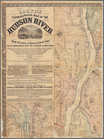
Lloyd's Topographical map of …
collection:
Maps of New York City and
State
m
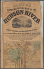
Lloyd's topographical map of …
collection:
Maps of New York City and
State
Map of the port & vicinity of…
collection:
Maps of New York City and
State