Click to visit the main New York Public Library Homepage
The New York Public Library
Digital Collections
About Digital Collections
Browse
Search only public domain materials
Items
Collections
Divisions
Home
Search
Browse
About
Search only public domain materials
Items
Collections
Divisions
Digital Collections
Using Images
Using Data
Collections
Charting America: Maps from the Lawrence H. Slaughter Collection and Others
Charting America: Maps from the Lawrence H. Slaughter Collection and Others
Navigation
Filters
Charting America: Maps from the Lawrence H. Slaughter Collection and Others
Previous
The south part of Virginia, now the north part of Carolina
0
Atlases, gazetteers, guidebooks and other books
377
Maps of the World
16
Maps of the Oceans
24
Maps of North and South America
23
Maps of North America.
551
Maps of New York City and State
1340
Lawrence H. Slaughter Collection of English maps, charts, globes, books and atlases
1020
John H. Levine Collection
60
More
Show filters
Hide filters
Show Only Public Domain
topic
x
Nautical charts
Coasts
4
Harbors
2
Atlases
1
Atlases, British
1
name
Robert Sayer and John Bennett (Firm)
3
Des Barres, Joseph F. W. (Joseph Frederick Wallet), 1729-1824
2
Laurie & Whittle
2
Clerk, James, active 1680-1695
1
Fisher, Joshua, 1707-1783
1
More
Less
collection
Lawrence H. Slaughter Collection of English maps, charts, globes, books and atlases
11
Maps of New York City and State
1
place
New England
5
New York Region
4
Atlantic Coast (North America)
3
Hudson River Estuary (N.Y. and N.J.)
3
Maps
3
More
Less
genre
Maps
12
publisher
Printed for Robt. Sayer & John Bennett, sea chart & map-sellers ..
3
Publish'd ... by I.F.W. Des Barres Esqr.,
2
And are to be sold at his shopps in Wapping at the Hermitage and in Exchange-Alley near the Royall-Exchange ..
1
By Johannis van Keulen, boek en zee kaart verkoper, aande Niewe Brugh, inde Gekroonde Lootsman,
1
By Pieter Goos, op de Texelse Kay, naest de Rams-koy, in de Zee-Spiegel
1
More
Less
division
Map Division
12
type
cartographic
12
Date Range
to
12 results found for:
x
New England
Filtering on:
x
Topic
: Nautical charts
Sort by:
Relevance
Title
Date created
Date digitized
Sequence
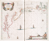
… coasts of
New
-
England
,
New
-Jarsey, Virginia
use:
… partner (e.g.,
New
York
A chart of Delaware Bay and R…
use:
… partner (e.g.,
New
York
Pas caerte van Nieu Nederland…
use:
… partner (e.g.,
New
York
… in
New
England
use:
… partner (e.g.,
New
York
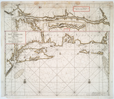
A Chart of ye coast of
New
England
,
New
York
use:
… partner (e.g.,
New
York
…
England
,
New
York,
New
use:
… partner (e.g.,
New
York
Pas-Kaart vande zee kusten va…
use:
… partner (e.g.,
New
York
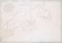
The coast of Nova Scotia,
New
England
,
New
use:
… partner (e.g.,
New
York
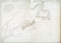
The coast of Nova Scotia,
New
England
,
New
use:
… partner (e.g.,
New
York
…, from Sandy Hook to
New
use:
… partner (e.g.,
New
York
…, from Sandy Hook to
New
use:
… partner (e.g.,
New
York
…, from Sandy Hook to
New
use:
… partner (e.g.,
New
York
End of results
|
Top