Click to visit the main New York Public Library Homepage
The New York Public Library
Digital Collections
About Digital Collections
Browse
Search only public domain materials
Items
Collections
Divisions
Home
Search
Browse
About
Search only public domain materials
Items
Collections
Divisions
Digital Collections
Using Images
Using Data
Collections
Charting America: Maps from the Lawrence H. Slaughter Collection and Others
Charting America: Maps from the Lawrence H. Slaughter Collection and Others
Navigation
Filters
Charting America: Maps from the Lawrence H. Slaughter Collection and Others
Previous
The south part of Virginia, now the north part of Carolina
0
Atlases, gazetteers, guidebooks and other books
377
Maps of the World
16
Maps of the Oceans
24
Maps of North and South America
23
Maps of North America.
551
Maps of New York City and State
1340
Lawrence H. Slaughter Collection of English maps, charts, globes, books and atlases
1020
John H. Levine Collection
60
More
Show filters
Hide filters
Show Only Public Domain
topic
Fortification
2
Real property
2
Geography
1
Geology
1
Geology, Stratigraphic
1
More
Less
name
Moll, Herman, -1732
2
Rodd, Thomas, 1763-1822
2
A.T. Goodrich & Co
1
Akerly, Samuel
1
Bowles, Thomas, 1694-1773
1
More
Less
collection
Maps of New York City and State
6
Lawrence H. Slaughter Collection of English maps, charts, globes, books and atlases
2
place
New York (State)
6
New York (N.Y.)
4
Islip (N.Y. : Town) -- Maps
2
Islip (Town)
2
New York
2
More
Less
genre
Maps
8
publisher
Thomas Rodd
2
... Sold ... by Tho. Bowles, print and map-seller in St. Paul's-Churchyard
1
A.T. Goodrich & Co., No. 124 Broad Way
1
Charles Wood?,
1
G. Hayward Lith. [1 Platt] St.,
1
More
Less
division
Map Division
8
type
x
still image
Date Range
to
8 results found for:
x
Middle Atlantic States
Filtering on:
x
Type
: still image
Sort by:
Relevance
Title
Date created
Date digitized
Sequence
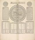
Geography epitomiz'd.
note:
… to Early Maps of the
Middle
Atlantic
Seaboard.
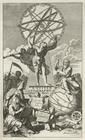
A system of geography with ne…
note:
… to Early Maps of the
Middle
Atlantic
Seaboard.
A geological section of the c…
note:
… to Early Maps of the
Middle
Atlantic
Seaboard.
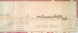
Profile of lower part of Crot…
note:
… to Early Maps of the
Middle
Atlantic
Seaboard.
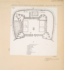
The Fort of Albany
note:
… to Early Maps of the
Middle
Atlantic
Seaboard.
Map of the village of Hermann…
note:
… to Early Maps of the
Middle
Atlantic
Seaboard.
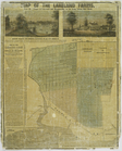
Map of the Lakeland farms, ne…
note:
… to Early Maps of the
Middle
Atlantic
Seaboard.
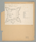
The Fort in New Yorke
note:
… to Early Maps of the
Middle
Atlantic
Seaboard.