Click to visit the main New York Public Library Homepage
The New York Public Library
Digital Collections
About Digital Collections
Browse
Search only public domain materials
Items
Collections
Divisions
Home
Search
Browse
About
Search only public domain materials
Items
Collections
Divisions
Digital Collections
Using Images
Using Data
Collections
Principles of geology: being an attempt to explain the former changes of the earth's surface, by reference to causes now in operation
Principles of geology: being an attempt to explain the former changes of the earth's surface, by reference to causes now in operation
About
Filters
Collection Data
Names
Lyell, Charles, Sir, 1797-1875
(Author)
Dates / Origin
Date Issued:
1830 - 1833
Place:
London
Publisher:
J. Murray
Library locations
General Research Division
Shelf locator: 3-PTC (Lyell, C. Principles of geology. 1830)
Topics
Geology
Genres
Prints
Maps
Diagrams
Notes
Content: Appendices: I. Tables of fossil shells by Monsieur G. P. Deshayes.--II. Lists of fossil shells chiefly collected by the author in Sicily and Italy, named by M. Deshayes.
Physical Description
Engravings
Type of Resource
Still image
Cartographic
Identifiers
RLIN/OCLC: 8990449
NYPL catalog ID (B-number):
b13776079
Universal Unique Identifier (UUID): ee8ff000-c6c3-012f-8148-58d385a7bc34
Show filters
Hide filters
Show Only Public Domain
topic
Geology
121
Earthquakes
8
Shells (Animal)
1
name
Lyell, Charles, Sir, 1797-1875
121
collection
x
Principles of geology: being an attempt to explain the former changes of the earth's surface, by reference to causes now in operation
place
Calabria
8
Italy
8
genre
x
Diagrams
Prints
121
publisher
J. Murray
121
division
General Research Division
121
type
still image
115
text
14
cartographic
6
Date Range
to
121 results found
Filtering on:
x
Genre
: Diagrams
Sort by:
Title
Date created
Date digitized
Sequence
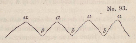
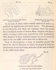
Diagram to explain the term '…
Diagram to explain the meanin…
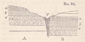
No. 91. Diagram showing the …
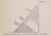
No. 90. Junction of granite …
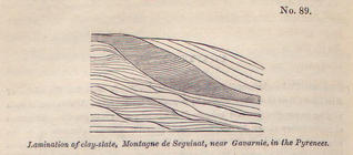
No. 89. Lamination of clay-s…
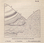
No. 88. Junction of granite …
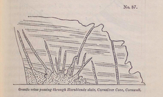
No. 87. Granite veins passin…
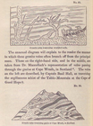
No. 85. Granite veins travers…
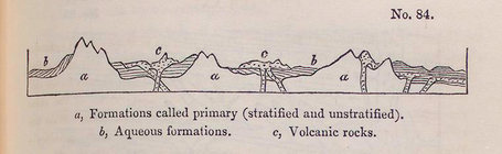
No. 84. Diagram showing the …
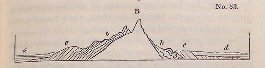
No. 83. Diagrams illustrati…
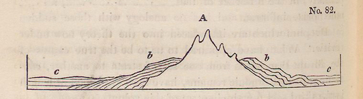
No. 82. Diagrams illustrativ…
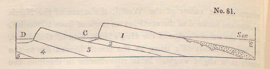
No. 81. Hypothetical section…
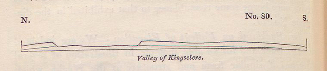
No. 80. Valley of Kingsclere.
No. 78. Valley of Kingsclere…
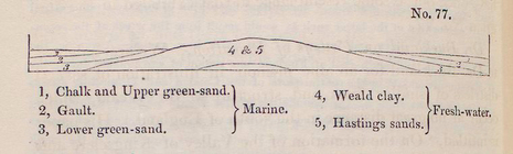
No. 77. Hypothetical section …
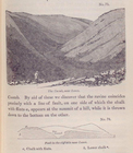
No. 75. The Coomb, near Lewe…
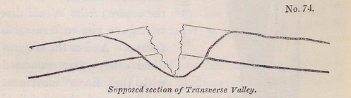
No. 74. Supposed section of …
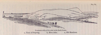
No. 73. Transverse valley of…
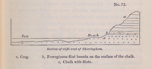
No. 72. Section of cliffs we…
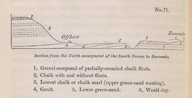
No. 71. Section from the Nor…
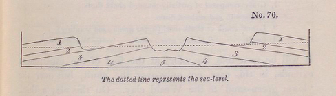
No. 70. The dotted line repr…
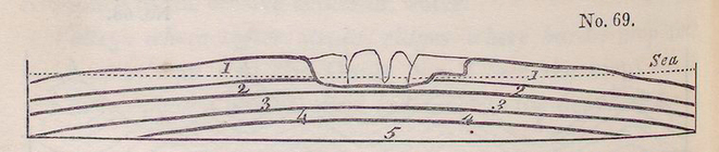
No. 69. Sections illustratin…
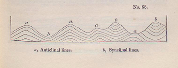
No. 68. Diagram explanatory …
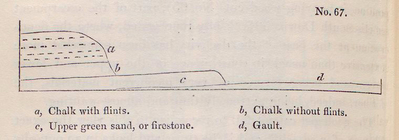
No. 67. Section of lower ter…
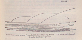
No. 66. Chalk escarpment as …
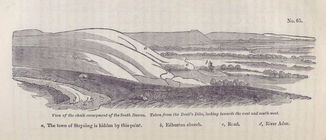
No. 65. View of the chalk es…
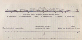
No. 63. Section from the Lon…
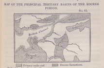
No. 62. Map of the principal…
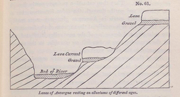
No. 61. Lavas of Auvergne re…
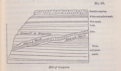
No. 60. Hill of Gergovia.
No. 58. Superposition of the…
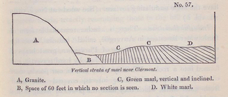
No. 57. Vertical strata of m…
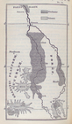
No. 56. Map of Auvergne, Can…
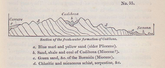
No. 55. Section of the fresh…
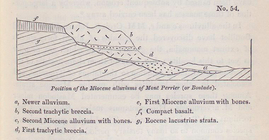
No. 54. Position of the Mioc…
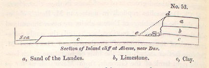
No. 53. Section of Inland cl…
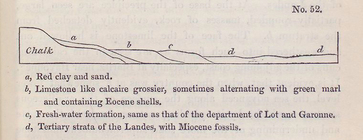
No. 52. Section explaining t…
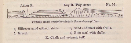
No. 51. Tertiary strata over…
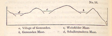
No. 50. Section of the same …
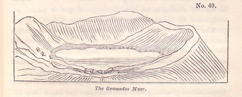
No. 49. The Gemunden Maar.
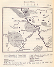
No. 48. Map of the volcanic …
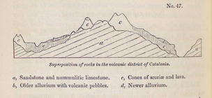
No. 47. Superposition of roc…
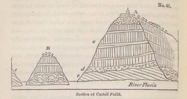
No. 46. Section at Castell F…
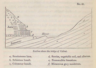
No. 45. Section above the br…
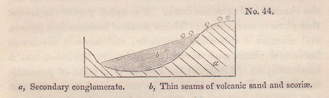
No. 44. Section of volcanic …
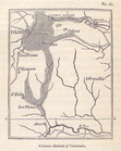
No. 43. Volacanic district o…
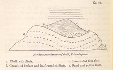
No. 42. Northern protuberanc…
No. 40. Section east of Sher…
No. 37. Bent strata of loam …
No. 35. Diagram illustrative…