


- The Library Shop
- Privacy Policy
- Rules and Regulations
- Using the Internet
- Website Terms and Conditions
- Gifts of Materials to NYPL
-
© The New York Public Library, 2024
The New York Public Library is a 501(c)(3) | EIN 13-1887440
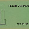
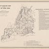
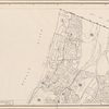
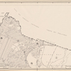
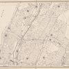
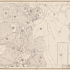
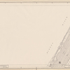
Lionel Pincus and Princess Firyal Map Division, The New York Public Library. "Height zoning map of the city of New York, compiled in the Dept. of City Planning, Division of Mapping and Zoning, May 27, 1953. Irving F. Ashworth, senior civil engineer." The New York Public Library Digital Collections. 1953. https://digitalcollections.nypl.org/items/0618a6f0-c5fb-012f-d073-58d385a7bc34
Lionel Pincus and Princess Firyal Map Division, The New York Public Library. "Height zoning map of the city of New York, compiled in the Dept. of City Planning, Division of Mapping and Zoning, May 27, 1953. Irving F. Ashworth, senior civil engineer." New York Public Library Digital Collections. Accessed April 25, 2024. https://digitalcollections.nypl.org/items/0618a6f0-c5fb-012f-d073-58d385a7bc34
Lionel Pincus and Princess Firyal Map Division, The New York Public Library. (1953). Height zoning map of the city of New York, compiled in the Dept. of City Planning, Division of Mapping and Zoning, May 27, 1953. Irving F. Ashworth, senior civil engineer. Retrieved from https://digitalcollections.nypl.org/items/0618a6f0-c5fb-012f-d073-58d385a7bc34
<ref name=NYPL>{{cite web | url=https://digitalcollections.nypl.org/items/0618a6f0-c5fb-012f-d073-58d385a7bc34 | title=
(cartographic)
Height zoning map of the city of New York, compiled in the Dept. of City Planning, Division of Mapping and Zoning, May 27, 1953. Irving F. Ashworth, senior civil engineer., (1953)
|author=Digital Collections, The New York Public Library |accessdate=April 25, 2024 |publisher=The New York Public Library, Astor, Lenox, and Tilden Foundations}}</ref>
