


![Central Park : memorial of the Common Council of the City of New York to the Legislature, approved June 11th, 1853...[title page]](https://images.nypl.org/index.php?id=5190254&t=b)


- The Library Shop
- Privacy Policy
- Rules and Regulations
- Using the Internet
- Website Terms and Conditions
- Gifts of Materials to NYPL
-
© The New York Public Library, 2024
The New York Public Library is a 501(c)(3) | EIN 13-1887440
Lionel Pincus and Princess Firyal Map Division, The New York Public Library. "A map shewing the extent of the great fire which broke out about 9 O'Clock on the night of the 16th December 1835, in the City of New-York" The New York Public Library Digital Collections. 1836. https://digitalcollections.nypl.org/items/0f1b3050-dc49-0139-6c72-0242ac110003
Lionel Pincus and Princess Firyal Map Division, The New York Public Library. "A map shewing the extent of the great fire which broke out about 9 O'Clock on the night of the 16th December 1835, in the City of New-York" New York Public Library Digital Collections. Accessed April 24, 2024. https://digitalcollections.nypl.org/items/0f1b3050-dc49-0139-6c72-0242ac110003
Lionel Pincus and Princess Firyal Map Division, The New York Public Library. (1836). A map shewing the extent of the great fire which broke out about 9 O'Clock on the night of the 16th December 1835, in the City of New-York Retrieved from https://digitalcollections.nypl.org/items/0f1b3050-dc49-0139-6c72-0242ac110003
<ref name=NYPL>{{cite web | url=https://digitalcollections.nypl.org/items/0f1b3050-dc49-0139-6c72-0242ac110003 | title=
(cartographic)
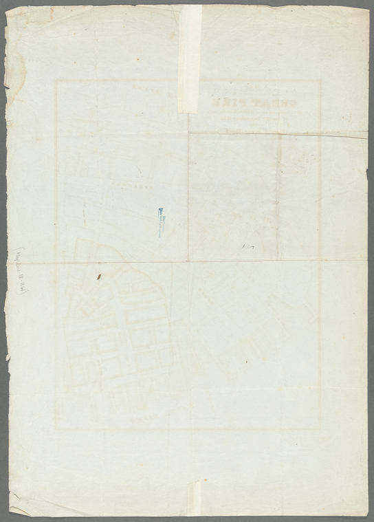
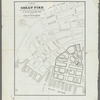
A map shewing the extent of the great fire which broke out about 9 O'Clock on the night of the 16th December 1835, in the City of New-York, (1836)
|author=Digital Collections, The New York Public Library |accessdate=April 24, 2024 |publisher=The New York Public Library, Astor, Lenox, and Tilden Foundations}}</ref>