


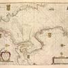
![A General Introduction to Geography and Cosmography [p. 1]](https://images.nypl.org/index.php?id=5207364&t=b)
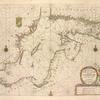
![A General Introduction to Geography and Cosmography [p. 2]](https://images.nypl.org/index.php?id=5207365&t=b)
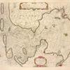
![A General Introduction to Geography and Cosmography [p. 3]](https://images.nypl.org/index.php?id=5207366&t=b)
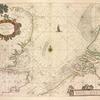
![A General Introduction to Geography and Cosmography [p. 4]](https://images.nypl.org/index.php?id=5207367&t=b)
![A General Introduction to Geography and Cosmography [p. 5]](https://images.nypl.org/index.php?id=5207368&t=b)
![A General Introduction to Geography and Cosmography [p. 6]](https://images.nypl.org/index.php?id=5207369&t=b)
![A General Introduction to Geography and Cosmography [p. 7]](https://images.nypl.org/index.php?id=5207370&t=b)
![A General Introduction to Geography and Cosmography [p. 8]](https://images.nypl.org/index.php?id=5207371&t=b)
![A General Introduction to Geography and Cosmography [p. 9]](https://images.nypl.org/index.php?id=5207372&t=b)
![A General Introduction to Geography and Cosmography [p. 10]](https://images.nypl.org/index.php?id=5207373&t=b)
![A General Introduction to Geography and Cosmography [p. 11]](https://images.nypl.org/index.php?id=5207374&t=b)
![A General Introduction to Geography and Cosmography [p. 12]](https://images.nypl.org/index.php?id=5207375&t=b)
![A General Introduction to Geography and Cosmography [p. 13]](https://images.nypl.org/index.php?id=5207376&t=b)
- The Library Shop
- Privacy Policy
- Rules and Regulations
- Using the Internet
- Website Terms and Conditions
- Gifts of Materials to NYPL
-
© The New York Public Library, 2024
The New York Public Library is a 501(c)(3) | EIN 13-1887440
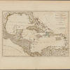
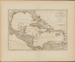
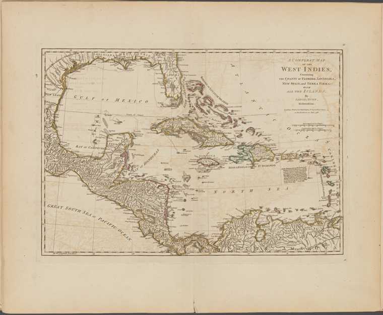
Lionel Pincus and Princess Firyal Map Division, The New York Public Library. "A compleat map of the West Indies, containing the coasts of Florida, Louisiana, New Spain, and Terra Firma" The New York Public Library Digital Collections. 1786. https://digitalcollections.nypl.org/items/20fac9f0-857d-0132-a435-58d385a7b928
Lionel Pincus and Princess Firyal Map Division, The New York Public Library. "A compleat map of the West Indies, containing the coasts of Florida, Louisiana, New Spain, and Terra Firma" New York Public Library Digital Collections. Accessed April 24, 2024. https://digitalcollections.nypl.org/items/20fac9f0-857d-0132-a435-58d385a7b928
Lionel Pincus and Princess Firyal Map Division, The New York Public Library. (1786). A compleat map of the West Indies, containing the coasts of Florida, Louisiana, New Spain, and Terra Firma Retrieved from https://digitalcollections.nypl.org/items/20fac9f0-857d-0132-a435-58d385a7b928
<ref name=NYPL>{{cite web | url=https://digitalcollections.nypl.org/items/20fac9f0-857d-0132-a435-58d385a7b928 | title=
(cartographic)
A compleat map of the West Indies, containing the coasts of Florida, Louisiana, New Spain, and Terra Firma, (1786)|author=Digital Collections, The New York Public Library |accessdate=April 24, 2024 |publisher=The New York Public Library, Astor, Lenox, and Tilden Foundations}}</ref>