


- The Library Shop
- Privacy Policy
- Rules and Regulations
- Using the Internet
- Website Terms and Conditions
- Gifts of Materials to NYPL
-
© The New York Public Library, 2024
The New York Public Library is a 501(c)(3) | EIN 13-1887440
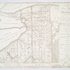
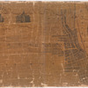
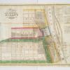
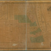
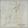
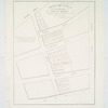
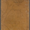
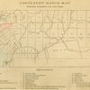
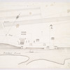
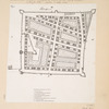
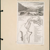
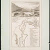
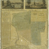
Lionel Pincus and Princess Firyal Map Division, The New York Public Library. "Map of Morris's Purchase or West Geneseo in the state of New York : exhibiting part of the Lakes Erie and Ontario, the Straights of Niagara, Chautauque Lake, and all the principal waters, the boundary lines of the several tracts of land purchased by the Holland Land Company, William and John Willink, and others, boundary lines of townships, boundary lines of New York and Indian reservations, laid down from actual survey, also a sketch of part of Upper Canada" The New York Public Library Digital Collections. 1804. https://digitalcollections.nypl.org/items/510d47da-f045-a3d9-e040-e00a18064a99
Lionel Pincus and Princess Firyal Map Division, The New York Public Library. "Map of Morris's Purchase or West Geneseo in the state of New York : exhibiting part of the Lakes Erie and Ontario, the Straights of Niagara, Chautauque Lake, and all the principal waters, the boundary lines of the several tracts of land purchased by the Holland Land Company, William and John Willink, and others, boundary lines of townships, boundary lines of New York and Indian reservations, laid down from actual survey, also a sketch of part of Upper Canada" New York Public Library Digital Collections. Accessed April 23, 2024. https://digitalcollections.nypl.org/items/510d47da-f045-a3d9-e040-e00a18064a99
Lionel Pincus and Princess Firyal Map Division, The New York Public Library. (1804). Map of Morris's Purchase or West Geneseo in the state of New York : exhibiting part of the Lakes Erie and Ontario, the Straights of Niagara, Chautauque Lake, and all the principal waters, the boundary lines of the several tracts of land purchased by the Holland Land Company, William and John Willink, and others, boundary lines of townships, boundary lines of New York and Indian reservations, laid down from actual survey, also a sketch of part of Upper Canada Retrieved from https://digitalcollections.nypl.org/items/510d47da-f045-a3d9-e040-e00a18064a99
<ref name=NYPL>{{cite web | url=https://digitalcollections.nypl.org/items/510d47da-f045-a3d9-e040-e00a18064a99 | title=
(cartographic)
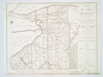
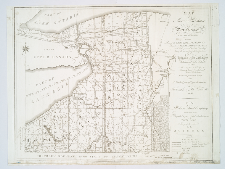
Map of Morris's Purchase or West Geneseo in the state of New York : exhibiting part of the Lakes Erie and Ontario, the Straights of Niagara, Chautauque Lake, and all the principal waters, the boundary lines of the several tracts of land purchased by the Holland Land Company, William and John Willink, and others, boundary lines of townships, boundary lines of New York and Indian reservations, laid down from actual survey, also a sketch of part of Upper Canada, (1804)
|author=Digital Collections, The New York Public Library |accessdate=April 23, 2024 |publisher=The New York Public Library, Astor, Lenox, and Tilden Foundations}}</ref>