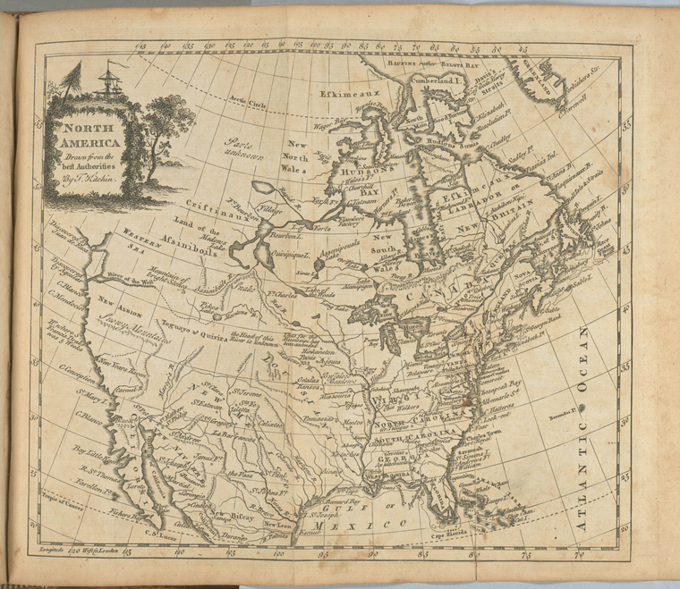
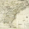
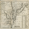
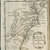
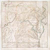
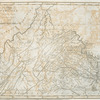
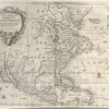
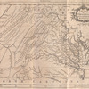
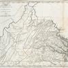
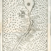
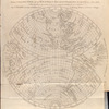
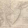
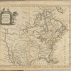
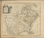
TitleNorth America
NamesFerguson, James, 1710-1776 (Associated name)Guthrie, William, 1708-1770 (Author)Kitchin, Thomas, 1718-1784 (Engraver)Robinson, G. G. (George G.) (Publisher)Dilly, Charles, 1739-1807 (Publisher)Dilly, E. (Edward), 1732-1779 (Associated name)Keere, Pieter van den, approximately 1571-approximately 1624 (Cartographer)
CollectionLawrence H. Slaughter Collection of English maps, charts, globes, books and atlases
Atlases
A new geographical, historical, and commercial grammar : and present state of the several kingdoms of the world ... : to which are added, I. A geographical index, with the names and places alphabetically arranged ...
Dates / OriginDate Issued: 1779Place: LondonPublisher: Printed for Edward and Charles Dilly in the Poultrey, and George Robinson, Pater-noster Row,
Library locationsLionel Pincus and Princess Firyal Map DivisionShelf locator: Map Div. 97-6455[LHS 3030; atlas cases]Shelf locator: Map Div. 97-6455 (Map facing p. 614) [In LHS 3030]
TopicsGeographyNorth AmericaNorth America -- Maps -- Early works to 1800
GenresMaps
NotesContent: "Illustrated with a correct set of maps, engraved by Mr. Kitchin, geographer."Content: 6th ed., improved and enlarged / the astronomical part by James Ferguson, F.R.S.Content: Lawrence H. Slaughter Collection ; 3030.Content: National Endowment for the Humanities Grant for Access to Early Maps of the Middle Atlantic Seaboard.Content: NYPL copy has autograp on t.p.: Joseph Drake. Additional ms. notations on vrso of t.p. and on final blank leaf.Statement of responsibility: by William Guthrie, esq.Content: Lawrence H. Slaughter Collection.Content: Relief shown pictorially.Statement of responsibility: drawn from the best authorities by T. Kitchin.
Physical DescriptionExtent: 1 map ; 19 x 22 cm. folded to 22 x 13 cm.
Type of ResourceCartographic
IdentifiersRLIN/OCLC: 36845122NYPL catalog ID (B-number): b15341106RLIN/OCLC: 48981846NYPL catalog ID (B-number): b15341105Universal Unique Identifier (UUID): 76a3f410-c5d4-012f-c987-58d385a7bc34
Rights StatementThe New York Public Library believes that this item is in the public domain under the laws of the United States, but did not make a determination as to its copyright status under the copyright laws of other countries. This item may not be in the public domain under the laws of other countries. Though not required, if you want to credit us as the source, please use the following statement, "From The New York Public Library," and provide a link back to the item on our Digital Collections site. Doing so helps us track how our collection is used and helps justify freely releasing even more content in the future.
Item timeline of events
-
-
-
-
-
-