


![New Topographical Atlas of the Counties of Albany and Schenectady New York [Title page]](https://images.nypl.org/index.php?id=1582608&t=b)
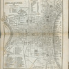
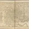
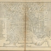
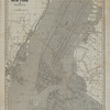
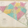
![West End of City [Village]; City of Albany [Township]; Albany City Business Directory](https://images.nypl.org/index.php?id=1582613&t=b)
![Bern [Township]](https://images.nypl.org/index.php?id=1582614&t=b)
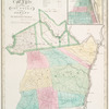
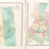
![Coeymans Business Directory; Coeymans Landing [Village]; South Bern [Village]; Bernville [Village]; Bernville Business Directory](https://images.nypl.org/index.php?id=1582615&t=b)
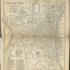
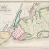
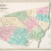
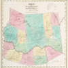
![Bethlehem [Township]](https://images.nypl.org/index.php?id=1582616&t=b)
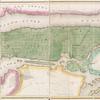
![Coeymans [Village]; Indian Fields Business Directory](https://images.nypl.org/index.php?id=1582617&t=b)
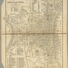
![Guilderland [Township]; Hamiltonville [Village]; Hamiltonville Business Directory; Knowersville Business Directory; Guilderland Centre [Village]; Guilderland Centre Business Directory](https://images.nypl.org/index.php?id=1582618&t=b)
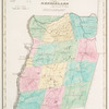
![Knoxville Business Directory; Knoxville [Village]; Knox [Township]](https://images.nypl.org/index.php?id=1582619&t=b)
![New Scotland [Township]; New Salem [Village]; Clarksville Business Directory; New Salem Business Directory; Clarksville [Village]](https://images.nypl.org/index.php?id=1582620&t=b)
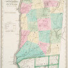
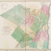
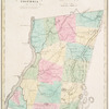
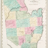
![Rensselaerville [Township]](https://images.nypl.org/index.php?id=1582621&t=b)
- The Library Shop
- Privacy Policy
- Rules and Regulations
- Using the Internet
- Website Terms and Conditions
- Gifts of Materials to NYPL
-
© The New York Public Library, 2024
The New York Public Library is a 501(c)(3) | EIN 13-1887440
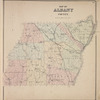
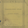
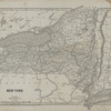
New topographical atlas of the counties of Albany and Schenectady, New York : from actual surveys
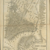
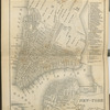
Lionel Pincus and Princess Firyal Map Division, The New York Public Library. "Map of Albany County" The New York Public Library Digital Collections. 1866. https://digitalcollections.nypl.org/items/510d47e3-72fd-a3d9-e040-e00a18064a99
Lionel Pincus and Princess Firyal Map Division, The New York Public Library. "Map of Albany County" New York Public Library Digital Collections. Accessed April 19, 2024. https://digitalcollections.nypl.org/items/510d47e3-72fd-a3d9-e040-e00a18064a99
Lionel Pincus and Princess Firyal Map Division, The New York Public Library. (1866). Map of Albany County Retrieved from https://digitalcollections.nypl.org/items/510d47e3-72fd-a3d9-e040-e00a18064a99
<ref name=NYPL>{{cite web | url=https://digitalcollections.nypl.org/items/510d47e3-72fd-a3d9-e040-e00a18064a99 | title=
(cartographic)
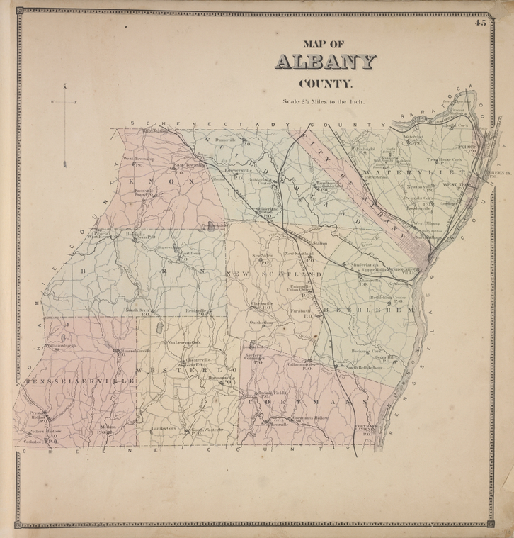
Map of Albany County, (1866)
|author=Digital Collections, The New York Public Library |accessdate=April 19, 2024 |publisher=The New York Public Library, Astor, Lenox, and Tilden Foundations}}</ref>