Map of Long Island: based upon recent U.S. coast surveys, together with local maps on file, supplemented by careful territorial observations

More Details Cite This Item

View this item elsewhere:

Title
Map of Long Island: based upon recent U.S. coast surveys, together with local maps on file, supplemented by careful territorial observations
Names
Hyde & Company (Publisher)
Balliet & Volk (Engraver)
Hyde & Company (Creator)
Collection

Maps of New York City and State

Parts

Long Island

Dates / Origin
Date Issued: 1896
Place: Brooklyn, N.Y.
Publisher: Hyde & Company
Library locations
Lionel Pincus and Princess Firyal Map Division
Shelf locator: Map Div. 16-5974
Topics
Landowners -- New York (State) -- Long Island (N.Y.)
Real property -- New York (State) -- Long Island (N.Y.)
Long Island (N.Y.)
Long Island (N.Y.) -- Administrative and political divisions
Genres
Maps
Notes
Statement of responsibility: "Balliet & Volk, map engravers, 27 So. 6th St. Phila., Pa."
Statement of responsibility: "Published by Hyde & Company, Classon Ave. Cor. Fulton St., Brooklyn, N.Y, July 1896."
Statement of responsibility: "Entered according to Act of Congress in the Year 1896, by Hyde & Company, in the Office of the Librarian at Congress at Washington."
Funding: Mapping the Nation (NEH grant, 2015-2018)
Physical Description
Extent: 1 map in 4 sheets : hand colored ; sheets 96 x 93 cm or smaller
Description
Depth shown by soundings. Very detailed, partial cadastral maps of Long Island showing counties, cities and towns, roads, railroads, landowners' names, and buildings. Section 3 & 4 oriented with north to the upper right; section 4 also includes index to villages and inset sub plan: Race Point about 8 miles from Plum Island. Section Index maps on the verso of each of 4 sheets.
Type of Resource
Cartographic
Identifiers
RLIN/OCLC: 77805422
NYPL catalog ID (B-number): b20645801
Other local Identifier: US162.2.01
Universal Unique Identifier (UUID): e288ac00-c6b7-0133-3516-00505686a51c
Rights Statement
The New York Public Library believes that this item is in the public domain under the laws of the United States, but did not make a determination as to its copyright status under the copyright laws of other countries. This item may not be in the public domain under the laws of other countries. Though not required, if you want to credit us as the source, please use the following statement, "From The New York Public Library," and provide a link back to the item on our Digital Collections site. Doing so helps us track how our collection is used and helps justify freely releasing even more content in the future.

Item timeline of events

  • 1896: Issued
  • 2018: Digitized
  • 2024: Found by you!
  • 2025

MLA Format

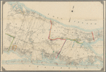
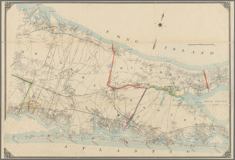
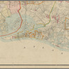
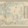
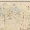
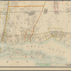
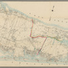
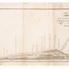
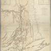
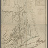
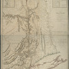
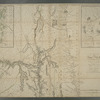
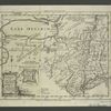
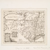
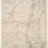
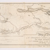
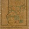
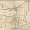
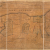
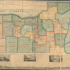
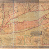
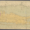
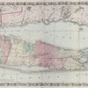
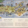
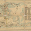
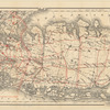
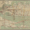
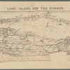
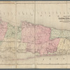
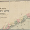
Lionel Pincus and Princess Firyal Map Division, The New York Public Library. "Map of Long Island" The New York Public Library Digital Collections. 1896. https://digitalcollections.nypl.org/items/5a1a22b0-5e06-0136-91f6-1d9c8a5b7e89

Chicago/Turabian Format

Lionel Pincus and Princess Firyal Map Division, The New York Public Library. "Map of Long Island" New York Public Library Digital Collections. Accessed April 20, 2024. https://digitalcollections.nypl.org/items/5a1a22b0-5e06-0136-91f6-1d9c8a5b7e89

APA Format

Lionel Pincus and Princess Firyal Map Division, The New York Public Library. (1896). Map of Long Island Retrieved from https://digitalcollections.nypl.org/items/5a1a22b0-5e06-0136-91f6-1d9c8a5b7e89

Wikipedia Citation

<ref name=NYPL>{{cite web | url=https://digitalcollections.nypl.org/items/5a1a22b0-5e06-0136-91f6-1d9c8a5b7e89 | title= (cartographic) 
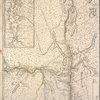
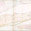
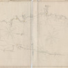
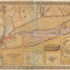
Map of Long Island, (1896) |author=Digital Collections, The New York Public Library |accessdate=April 20, 2024 |publisher=The New York Public Library, Astor, Lenox, and Tilden Foundations}}</ref>

Map of Long Island