A map of the British and French dominions in North America: with the roads, distances, limits, and extent of the settlements, humbly inscribed to the Right Honourable the Earl of Halifax, and the other Right Honourable the Lords Commissioners for Trade & Plantations

More Details Cite This Item

View this item elsewhere:

Title
A map of the British and French dominions in North America: with the roads, distances, limits, and extent of the settlements, humbly inscribed to the Right Honourable the Earl of Halifax, and the other Right Honourable the Lords Commissioners for Trade & Plantations
Names
Mitchell, John, 1711-1768 (Cartographer)
Kitchin, Thomas, d. 1784 (Engraver)
Collection

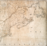
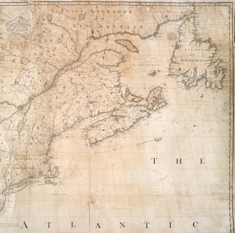
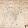
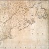
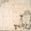
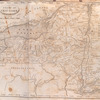
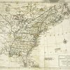
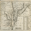
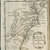
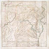
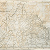
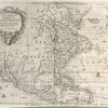
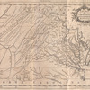
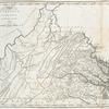
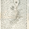
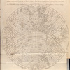
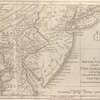
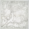
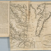
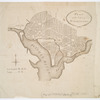
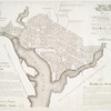
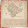
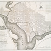
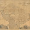
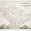
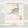
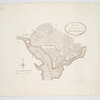
Lawrence H. Slaughter Collection of English maps, charts, globes, books and atlases

Charts and maps

Dates / Origin
Date Issued: 1755
Place: London
Publisher: Publish'd by the author
Library locations
Lionel Pincus and Princess Firyal Map Division
Shelf locator: Map Div. 97-6107 [LHS 484, rolled]
Topics
North America
Genres
Maps
Notes
Citation/reference: Ristow. A la carte, p. 10
Content: Relief shown pictorially.
Content: Third impression of 1st ed.; shows Worcester, Mass., as distinguished from previous impression.
Content: "Sold by And: Millar opposite Katharine Street in the Strand."
Content: Outline color.
Content: Includes text and inset "A new map of Hudson's Bay and Labrador from the late surveys of those coasts."
Statement of responsibility: by their Lordships most obliged and very humble servant, Jno. Mitchell ; Tho. Kitchin, sculp.
Physical Description
Extent: 1 map : hand col. ; 133 x 189 cm.
Type of Resource
Cartographic
Languages
English
Identifiers
RLIN/OCLC: 5402525
NYPL catalog ID (B-number): b13493675
Universal Unique Identifier (UUID): 3116cce0-c5d5-012f-a609-58d385a7bc34
Rights Statement
The New York Public Library believes that this item is in the public domain under the laws of the United States, but did not make a determination as to its copyright status under the copyright laws of other countries. This item may not be in the public domain under the laws of other countries. Though not required, if you want to credit us as the source, please use the following statement, "From The New York Public Library," and provide a link back to the item on our Digital Collections site. Doing so helps us track how our collection is used and helps justify freely releasing even more content in the future.

Item timeline of events

  • 1711: Creator Born
  • 1755: Issued
  • 1768: Creator Died
  • 2015: Digitized
  • 2024: Found by you!
  • 2025

MLA Format

Lionel Pincus and Princess Firyal Map Division, The New York Public Library. "A map of the British and French dominions in North America" The New York Public Library Digital Collections. 1755. https://digitalcollections.nypl.org/items/8b836de9-efc2-3652-e040-e00a18064a7e

Chicago/Turabian Format

Lionel Pincus and Princess Firyal Map Division, The New York Public Library. "A map of the British and French dominions in North America" New York Public Library Digital Collections. Accessed April 19, 2024. https://digitalcollections.nypl.org/items/8b836de9-efc2-3652-e040-e00a18064a7e

APA Format

Lionel Pincus and Princess Firyal Map Division, The New York Public Library. (1755). A map of the British and French dominions in North America Retrieved from https://digitalcollections.nypl.org/items/8b836de9-efc2-3652-e040-e00a18064a7e

Wikipedia Citation

<ref name=NYPL>{{cite web | url=https://digitalcollections.nypl.org/items/8b836de9-efc2-3652-e040-e00a18064a7e | title= (cartographic) A map of the British and French dominions in North America, (1755) |author=Digital Collections, The New York Public Library |accessdate=April 19, 2024 |publisher=The New York Public Library, Astor, Lenox, and Tilden Foundations}}</ref>

A map of the British and French dominions in North America