
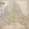
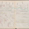
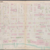
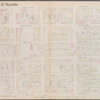
![Block Index. [Front]](https://s3.amazonaws.com/repo-transcoded-web-media-thumnails/a584bc60-c5f8-012f-a5b7-58d385a7bc34/a584bc60-c5f8-012f-a5b7-58d385a7bc34-00002.jpg)
![Block Index. [Front]](https://images.nypl.org/index.php?id=1703615&t=b)
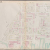
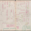
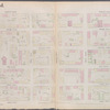
![Index to Streets. [Front]](https://s3.amazonaws.com/repo-transcoded-web-media-thumnails/a5e07750-c5f8-012f-e8d0-58d385a7bc34/a5e07750-c5f8-012f-e8d0-58d385a7bc34-00002.jpg)
![Index to Streets. [Front]](https://images.nypl.org/index.php?id=1703616&t=b)
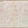
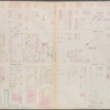
![Index to Streets - continued. [Front]](https://s3.amazonaws.com/repo-transcoded-web-media-thumnails/a626aa20-c5f8-012f-5cad-58d385a7bc34/a626aa20-c5f8-012f-5cad-58d385a7bc34-00002.jpg)
![Index to Streets - continued. [Front]](https://images.nypl.org/index.php?id=1703617&t=b)

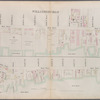
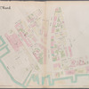
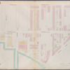
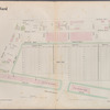
![Brooklyn, Vol. 1, Double Page Plate No. 1; Part of Wards 1, 2, 4 & 5, Section 1; [Map bounded by East River, Gold St., Hudson Ave., Little St.; Including Navy St., Johnson St., Pierrepont St.]; Sub Plan No. 1; [Map bounded by Hudson Ave., East River, U.S. Navy Yard; Including Little St., Marshall St.]](https://s3.amazonaws.com/repo-transcoded-web-media-thumnails/a6c4ccd0-c5f8-012f-ac36-58d385a7bc34/a6c4ccd0-c5f8-012f-ac36-58d385a7bc34-00002.jpg)
![Brooklyn, Vol. 1, Double Page Plate No. 1; Part of Wards 1, 2, 4 & 5, Section 1; [Map bounded by East River, Gold St., Hudson Ave., Little St.; Including Navy St., Johnson St., Pierrepont St.]; Sub Plan No. 1; [Map bounded by Hudson Ave., East River, U.S. Navy Yard; Including Little St., Marshall St.]](https://images.nypl.org/index.php?id=1703619&t=b)
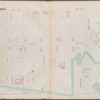
![Brooklyn, Vol. 1, Double Page Plate No. 2; Part of Wards 1, 3, 4 & 6, Section 1 & 2; [Map bounded by Pierrepont St., Johnson St., Bridge St., Hoyt St., Smith St.; Including Warren St., Baltic St., East River, Furman St.]](https://s3.amazonaws.com/repo-transcoded-web-media-thumnails/a7235090-c5f8-012f-c6a8-58d385a7bc34/a7235090-c5f8-012f-c6a8-58d385a7bc34-00002.jpg)
![Brooklyn, Vol. 1, Double Page Plate No. 2; Part of Wards 1, 3, 4 & 6, Section 1 & 2; [Map bounded by Pierrepont St., Johnson St., Bridge St., Hoyt St., Smith St.; Including Warren St., Baltic St., East River, Furman St.]](https://images.nypl.org/index.php?id=1703620&t=b)


- The Library Shop
- Privacy Policy
- Rules and Regulations
- Using the Internet
- Website Terms and Conditions
- Gifts of Materials to NYPL
-
© The New York Public Library, 2024
The New York Public Library is a 501(c)(3) | EIN 13-1887440
Lionel Pincus and Princess Firyal Map Division, The New York Public Library. "Atlas of the borough of Brooklyn, city of New York. Newly constructed and based upon official maps and plans on file in the Municipal Building and Registers Office (Hall of Records). Supplemented by careful field measurements and observations [1916-1920]" The New York Public Library Digital Collections. 1916 - 1920. https://digitalcollections.nypl.org/items/a4772020-c5f8-012f-2583-58d385a7bc34
Lionel Pincus and Princess Firyal Map Division, The New York Public Library. "Atlas of the borough of Brooklyn, city of New York. Newly constructed and based upon official maps and plans on file in the Municipal Building and Registers Office (Hall of Records). Supplemented by careful field measurements and observations [1916-1920]" New York Public Library Digital Collections. Accessed April 25, 2024. https://digitalcollections.nypl.org/items/a4772020-c5f8-012f-2583-58d385a7bc34
Lionel Pincus and Princess Firyal Map Division, The New York Public Library. (1916 - 1920). Atlas of the borough of Brooklyn, city of New York. Newly constructed and based upon official maps and plans on file in the Municipal Building and Registers Office (Hall of Records). Supplemented by careful field measurements and observations [1916-1920] Retrieved from https://digitalcollections.nypl.org/items/a4772020-c5f8-012f-2583-58d385a7bc34
<ref name=NYPL>{{cite web | url=https://digitalcollections.nypl.org/items/a4772020-c5f8-012f-2583-58d385a7bc34 | title=
(cartographic)
Atlas of the borough of Brooklyn, city of New York. Newly constructed and based upon official maps and plans on file in the Municipal Building and Registers Office (Hall of Records). Supplemented by careful field measurements and observations [1916-1920], (1916 - 1920)
|author=Digital Collections, The New York Public Library |accessdate=April 25, 2024 |publisher=The New York Public Library, Astor, Lenox, and Tilden Foundations}}</ref>
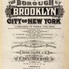
![Atlas of the borough of Brooklyn, city of New York. Newly constructed and based upon official maps and plans on file in the Municipal Building and Registers Office (Hall of Records). Supplemented by careful field measurements and observations [1916-1920]](https://s3.amazonaws.com/repo-transcoded-web-media-thumnails/a4e8a230-c5f8-012f-ff8c-58d385a7bc34/a4e8a230-c5f8-012f-ff8c-58d385a7bc34-00002.jpg)