
- The Library Shop
- Privacy Policy
- Rules and Regulations
- Using the Internet
- Website Terms and Conditions
- Gifts of Materials to NYPL
-
© The New York Public Library, 2024
The New York Public Library is a 501(c)(3) | EIN 13-1887440
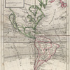
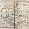
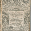
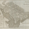
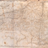
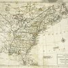
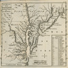
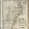
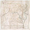
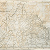
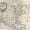
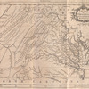
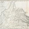
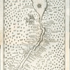
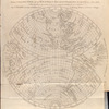
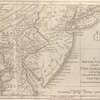
Lawrence H. Slaughter Collection of English maps, charts, globes, books and atlases
The New York Public Library. "A set of thirty-two new and correct maps of the principal parts of Europe, &c. : with the great or post-roads, and principal cross-roads, done in the year 1725, 1726 and 1727 : all except four, viz. England, Scotland, Ireland, and a general map of Turky in Europe, which have been done and printed before ..." The New York Public Library Digital Collections. 1727. https://digitalcollections.nypl.org/items/ea41f160-c5d3-012f-4fad-58d385a7bc34
The New York Public Library. "A set of thirty-two new and correct maps of the principal parts of Europe, &c. : with the great or post-roads, and principal cross-roads, done in the year 1725, 1726 and 1727 : all except four, viz. England, Scotland, Ireland, and a general map of Turky in Europe, which have been done and printed before ..." New York Public Library Digital Collections. Accessed April 18, 2024. https://digitalcollections.nypl.org/items/ea41f160-c5d3-012f-4fad-58d385a7bc34
The New York Public Library. (1727). A set of thirty-two new and correct maps of the principal parts of Europe, &c. : with the great or post-roads, and principal cross-roads, done in the year 1725, 1726 and 1727 : all except four, viz. England, Scotland, Ireland, and a general map of Turky in Europe, which have been done and printed before ... Retrieved from https://digitalcollections.nypl.org/items/ea41f160-c5d3-012f-4fad-58d385a7bc34
<ref name=NYPL>{{cite web | url=https://digitalcollections.nypl.org/items/ea41f160-c5d3-012f-4fad-58d385a7bc34 | title=

A set of thirty-two new and correct maps of the principal parts of Europe, &c. : with the great or post-roads, and principal cross-roads, done in the year 1725, 1726 and 1727 : all except four, viz. England, Scotland, Ireland, and a general map of Turky in Europe, which have been done and printed before ..., (1727)
|author=Digital Collections, The New York Public Library |accessdate=April 18, 2024 |publisher=The New York Public Library, Astor, Lenox, and Tilden Foundations}}</ref>
