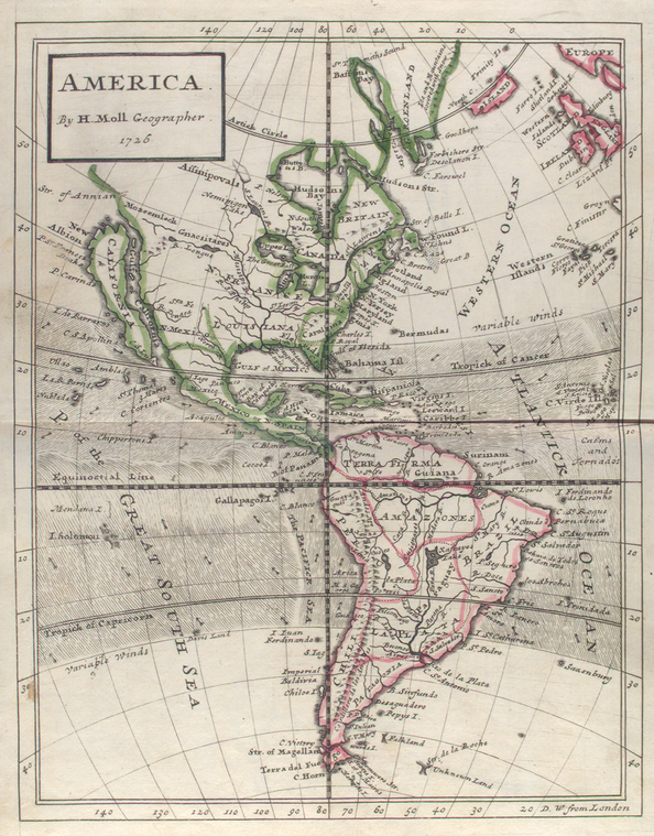
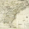
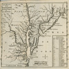
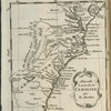
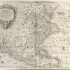
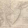
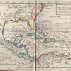
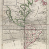
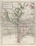
TitleAmerica
NamesMoll, Herman, -1732 (Cartographer)
CollectionLawrence H. Slaughter Collection of English maps, charts, globes, books and atlases
Atlases
A set of thirty-two new and correct maps of the principal parts of Europe, &c. : with the great or post-roads, and principal cross-roads, done in the year 1725, 1726 and 1727 : all except four, viz. England, Scotland, Ireland, and a general map of Turky in Europe, which have been done and printed before ...
Dates / OriginDate Issued: 1727 (Questionable)Place: [London]Publisher: And sold by him [Herman Moll], over-against Devereux-Court, between Temple-Bar and St. Clements's-Church in the Strand,
Library locationsLionel Pincus and Princess Firyal Map DivisionShelf locator: Map Div. 97-6052[LHS 328; atlas cases]Shelf locator: Map Div. 97-6052 (Map 31) [In LHS 328]
TopicsEurope -- Maps -- Early works to 1800Atlases, BritishRoads -- EuropeAmericaAmerica -- Maps -- Early works to 1800
GenresMaps
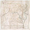
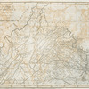
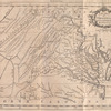
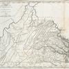
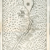
NotesContent: Includes contents list and advertisement of other publications on t.p.Content: Lawrence H. Slaughter Collection ; 328.Content: National Endowment for the Humanities Grant for Access to Early Maps of the Middle Atlantic Seaboard.Content: NYPL copy has autograph on free endpaper: C.W. Johnson.Content: Relief shown pictorially.Citation/reference: Phillips 4281, 5180Statement of responsibility: all done according to the latest observations, by Herman Moll, geographer.Content: Lawrence H. Slaughter Collection.Content: Prime meridian: London.Content: Shows drainage, colony boundaries, tradewinds. Shows California as an island.Statement of responsibility: by H. Moll, geographer, 1726.
Physical DescriptionExtent: 1 map : hand col. ; 25 x 19 cm.
Type of ResourceCartographic
IdentifiersRLIN/OCLC: 40963982NYPL catalog ID (B-number): b15369857RLIN/OCLC: 49399873NYPL catalog ID (B-number): b15369858Universal Unique Identifier (UUID): ead56690-c5d3-012f-7a4e-58d385a7bc34
Rights StatementThe New York Public Library believes that this item is in the public domain under the laws of the United States, but did not make a determination as to its copyright status under the copyright laws of other countries. This item may not be in the public domain under the laws of other countries. Though not required, if you want to credit us as the source, please use the following statement, "From The New York Public Library," and provide a link back to the item on our Digital Collections site. Doing so helps us track how our collection is used and helps justify freely releasing even more content in the future.
Item timeline of events
-
-
-
-