Click to visit the main New York Public Library Homepage
The New York Public Library
Digital Collections
About Digital Collections
Browse
Search only public domain materials
Items
Collections
Divisions
Home
Search
Browse
About
Search only public domain materials
Items
Collections
Divisions
Digital Collections
Using Images
Using Data
Search
Keyword search
Show filters
Hide filters
Show Only Public Domain
topic
Nautical charts
27
Coasts
18
Atlases, British
15
History
6
Geography
5
More
Less
name
Thornton, Samuel
173
Bache, A. D. (Alexander Dallas), 1806-1867
8
Godbid, Anne
8
Playford, John, ca. 1655-1685 or 6
8
Seller, John, fl. 1658-1698
8
More
Less
collection
Atlases, gazetteers, guidebooks and other books
173
Lawrence H. Slaughter Collection of English maps, charts, globes, books and atlases
44
Maps of North America
19
Portolan atlas
3
I. N. Phelps Stokes Collection of American Historical Prints
2
More
Less
place
Atlantic Ocean
21
Maps
16
English Channel
14
Mediterranean Sea
12
Biscay, Bay of (France and Spain)
11
More
Less
genre
Maps
250
Nautical charts
185
Bathymetric maps
10
Prints
6
Manuscripts
4
More
Less
publisher
Printed by A. Godbid and J. Playford, for John Seller ...,
8
Printed for Robert Morden and Thomas Cockeril, at the Atlas in Cornhill, and at the Three Legs in the Poultrey, over against the Stocks-Market
6
... Sold ... by Tho. Bowles, print and map-seller in St. Paul's-Churchyard
5
Printed for Ieames Shawe, and are to be solde at his shoppe nigh Ludgate,
4
Printed for Robt. Sayer & John Bennett, sea chart & map-sellers ..
3
More
Less
division
Map Division
241
Wallach Division: Print Collection
5
Spencer Collection
3
Rare Book Division
2
General Research Division
1
More
Less
type
cartographic
245
still image
13
text
4
notated music
2
moving image
1
Date Range
to
255 results found for:
Sea charts
Sort by:
Relevance
Title
Date created
Date digitized
Sequence
m
Silas Dickinson's book
abstract:
… include fingering
charts
m
Isole famose porti: fortezze,…
abstract:
… of the Mediterranean
sea
; also of Italy
m
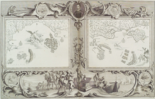
Plate from The tapestry hangi…
collection:
…, ten
charts
of the
sea
-coasts of England
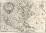
A new mapp of America Septent…
note:
… and
sea
monsters.
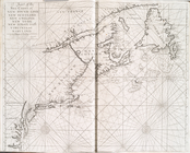
A
chart
of the
sea
coast of New Foundland
topic:
Nautical
charts
A
chart
of the
sea
coast of New Found Land
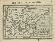
Romanum Teritorium.
collection:
… of English maps,
charts
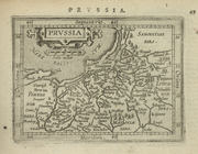
Prussia.
collection:
… of English maps,
charts
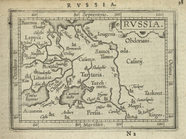
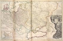
Russia.
collection:
… of English maps,
charts
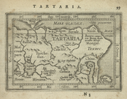
Tartaria.
collection:
… of English maps,
charts
An accurate map of North Amer…
note:
…,
sea
charts
, city views
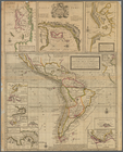
Part of North America: compre…
collection:
… the
sea
-coasts, capes, head-lands
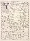
A new map of the islands of the Ægean
Sea
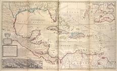
A general
chart
of the West India's [sic]
topic:
Nautical
charts
A
chart
of the
sea
coasts of New-England
topic:
Nautical
charts
… of ye South
Sea
Company
note:
… of the South-
Sea
-company, 1711.
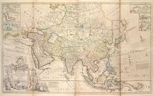
Map of Asia ...
note:
….; The Ice
Sea
; Part
… of Ameirca in the North
Sea
… of ye South
Sea
Company
…, and ye Black
Sea
&c.
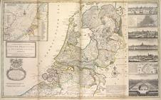
A new and exact map of the Un…
note:
Insets: Part of the South Britain, North
Sea
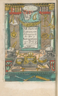
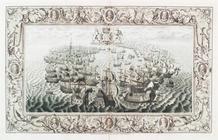
Frontispiece
collection:
…, A
sea
-atlas: describing the
sea
-coasts in most
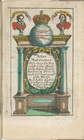
Title page
collection:
…, A
sea
-atlas: describing the
sea
-coasts in most
A mapp of the world
collection:
…, A
sea
-atlas: describing the
sea
-coasts in most
m
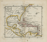
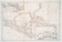
A
chart
of the West Indias from Cap Cod to ye
collection:
…, A
sea
-atlas: describing the
sea
-coasts in most
m
A
chart
of the West Indias from Cap Cod to ye
collection:
…, A
sea
-atlas: describing the
sea
-coasts in most
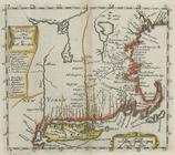
A
chart
of the
sea
coasts of New England
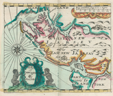
A map of New Iarsey
collection:
…, A
sea
-atlas: describing the
sea
-coasts in most
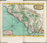
Carolina newly discribed
collection:
…, A
sea
-atlas: describing the
sea
-coasts in most
The Western Ilands
collection:
…, towns,
seas
, rivers
New England and New York
collection:
…, towns,
seas
, rivers
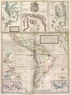
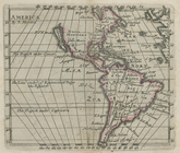
America
collection:
…, towns,
seas
, rivers
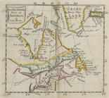
The north west part of America
collection:
…, towns,
seas
, rivers
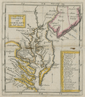
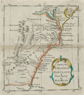
A new map of Virginia and Mar…
collection:
…, towns,
seas
, rivers
Carolina, Virginia, Mary Land…
collection:
…, towns,
seas
, rivers
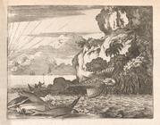
…, with ...
Sea
-Spiders
collection:
…, with ...
Sea
-Spiders, and horrible
…, the Guarapucu ... in the
Sea
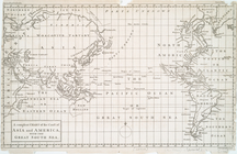
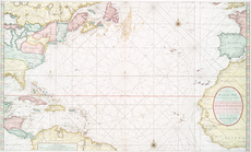
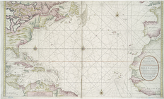
Chart
of the Atlantic Ocean.
collection:
… a complete reckoning at
sea
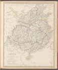
China: the interior, chiefly …
collection:
… of English maps,
charts
Chart
of Smith Sound Showing Dr. Hayes
collection:
The open Polar
Sea
: ...
… South
Sea
Plate IV from the tapestry ha…
collection:
…, ten
charts
of the
sea
-coasts of England
An actual survey of the
sea
coast from New
note:
…, as also, a new
chart
… the islands in the North
Sea
Nieuwe wassende graade zee ka…
collection:
New
sea
map of the Spannish Zee betwext t
…'Amerique = The new
sea
map
collection:
… l'Amerique = The new
sea
map
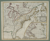
America Septentrionalis a Dom…
abstract:
…" and "Savana" rivers to the
sea
.
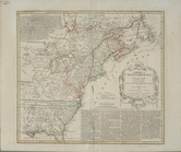
A new map of the English empi…
note:
… plotting
sea
route.
A
chart
of Delaware Bay and River
topic:
Nautical
charts
A
chart
of the
sea
coast of New Foundland
topic:
Nautical
charts
1
2
Previous
Next
1
2
Previous
Next