Click to visit the main New York Public Library Homepage
The New York Public Library
Digital Collections
About Digital Collections
Browse
Search only public domain materials
Items
Collections
Divisions
Home
Search
Browse
About
Search only public domain materials
Items
Collections
Divisions
Digital Collections
Using Images
Using Data
Search
Keyword search
Show filters
Hide filters
Show Only Public Domain
topic
Real property
8760
Fire insurance
5281
Cities & towns
5007
City planning
943
Social conditions
942
More
Less
name
Sanborn Map Company
5098
G.W. Bromley & Co
2475
New York (N.Y.). City Planning Commission
980
M.I.T. Press
942
Bromley, George Washington
788
More
Less
collection
Atlases of New York City
11722
Atlases of the United States
987
Lawrence H. Slaughter Collection of English maps, charts, globes, books and atlases
107
Atlases, gazetteers, guidebooks and other books
86
Maps of New York City and State
1
More
Less
place
New York (State)
10115
New York
4365
New York (N.Y.)
2606
Manhattan (New York, N.Y.)
1958
Brooklyn (New York, N.Y.)
947
More
Less
genre
Maps
12635
Atlases
940
Indexes
146
Topographic maps
135
Title pages
99
More
Less
publisher
Sanborn Map Company
5145
G.W. Bromley & Co
2297
MIT Press
942
E. Belcher Hyde
683
E. Robinson Co
342
More
Less
division
Map Division
12745
Milstein Division
29
type
cartographic
11698
still image
958
text
387
Date Range
to
Looking for this collection?
Atlases of New York City
11,722 items
12,904 results found for:
atlases of new york city
Sort by:
Relevance
Title
Date created
Date digitized
Sequence
…
atlases
of
New
York
City
use:
… partner (e.g.,
New
York
…
Atlases
of
New
York
City
use:
… partner (e.g.,
New
York
Brooklyn
use:
… partner (e.g.,
New
York
Brooklyn
use:
… partner (e.g.,
New
York
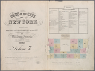
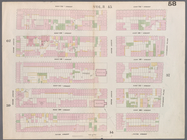
Plate 36: Maps Covering Vario…
use:
… partner (e.g.,
New
York
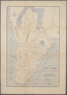
Maps of the
City
of Brooklyn
use:
… partner (e.g.,
New
York
Maps of the
City
of Brooklyn
use:
… partner (e.g.,
New
York
Front Cover
use:
… partner (e.g.,
New
York
…, Brooklyn Navy Yard,
York
use:
… partner (e.g.,
New
York
…, Bridge Street,
York
use:
… partner (e.g.,
New
York
…, Main Street,
York
use:
… partner (e.g.,
New
York
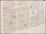
Plate 12: Map bounded by
York
Street
use:
… partner (e.g.,
New
York
Plate 6: Map bounded by Popla…
use:
… partner (e.g.,
New
York
Plate 7: Map bounded by Pierr…
use:
… partner (e.g.,
New
York
Plate 8: Map bounded by Pacif…
use:
… partner (e.g.,
New
York
Plate 10: Map bounded by Hami…
use:
… partner (e.g.,
New
York
Plate 11: Map bounded by But…
use:
… partner (e.g.,
New
York
Plate 13: Map bounded by Conc…
use:
… partner (e.g.,
New
York
Plate 16: Map bounded by Mont…
use:
… partner (e.g.,
New
York
Plate 17: Map bounded by Atla…
use:
… partner (e.g.,
New
York
Plate 18: Map bounded by Degr…
use:
… partner (e.g.,
New
York
Plate 19: Map bounded by Conc…
use:
… partner (e.g.,
New
York
Plate 21: Map bounded by Flus…
use:
… partner (e.g.,
New
York
Plate 22: Map bounded by Myrt…
use:
… partner (e.g.,
New
York
Plate 23: Map bounded by Lafa…
use:
… partner (e.g.,
New
York
Plate 24: Map bounded by Myrt…
use:
… partner (e.g.,
New
York
Plate 27: Map bounded by Sche…
use:
… partner (e.g.,
New
York
Plate 30: Map bounded by Berg…
use:
… partner (e.g.,
New
York
Plate 31: Map bounded by Warr…
use:
… partner (e.g.,
New
York
Plate 32: Map bounded by Degr…
use:
… partner (e.g.,
New
York
Plate 35: Map bounded by Will…
use:
… partner (e.g.,
New
York
Maps of the
city
of
New
-
York
use:
… partner (e.g.,
New
York
New
York
, the English colonial
city
use:
… partner (e.g.,
New
York
Map bounded by Murray Street,…
use:
… partner (e.g.,
New
York
Map bounded by Canal Street, …
use:
… partner (e.g.,
New
York
Map bounded by Hamersley Stre…
use:
… partner (e.g.,
New
York
Map bounded by Spring Street,…
use:
… partner (e.g.,
New
York
Map bounded by Broome Street,…
use:
… partner (e.g.,
New
York
Map bounded by Houston Street…
use:
… partner (e.g.,
New
York
Map bounded by Rivington Stre…
use:
… partner (e.g.,
New
York
Map bounded by Division Stree…
use:
… partner (e.g.,
New
York
Map bounded by 5th Street, Fi…
use:
… partner (e.g.,
New
York
Map bounded by 4th Street, Bo…
use:
… partner (e.g.,
New
York
m
Map bounded by 9th Street, Fo…
use:
… partner (e.g.,
New
York
Map bounded by 9th Street, Un…
use:
… partner (e.g.,
New
York
Map bounded by 14th Street, F…
use:
… partner (e.g.,
New
York
Map bounded by 14th Street, U…
use:
… partner (e.g.,
New
York
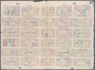
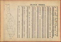
Block Index
use:
… partner (e.g.,
New
York
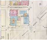
Duffield Street [detail]
use:
… partner (e.g.,
New
York
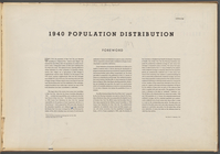
1940 population distribution:…
use:
… partner (e.g.,
New
York
1
2
3
4
5
6
7
8
9
10
…
51
52
Previous
Next
1
2
3
4
5
6
7
8
9
10
…
51
52
Previous
Next