Click to visit the main New York Public Library Homepage
The New York Public Library
Digital Collections
About Digital Collections
Browse
Search only public domain materials
Items
Collections
Divisions
Home
Search
Browse
About
Search only public domain materials
Items
Collections
Divisions
Digital Collections
Using Images
Using Data
Search
Filtered search
Show filters
Hide filters
Show Only Public Domain
topic
Parks
388
Streets
150
Houses
124
Interiors
102
Tunnels
102
More
Less
name
Soule, John P
179
Adams, S. F., 1844-
139
Kilburn Brothers
106
C.H. Shute & Son
102
Heywood, John B., -1870
87
More
Less
collection
Robert N. Dennis collection of stereoscopic views
4032
Maps of North America
139
Emmet Collection of Manuscripts Etc. Relating to American History
41
I. N. Phelps Stokes Collection of American Historical Prints
28
Maps of New York City and State
11
More
Less
place
x
Massachusetts
Boston (Mass.)
1191
Boston
866
Martha's Vineyard (Mass.)
480
Plymouth (Mass.)
154
More
Less
genre
Photographs
4033
Stereographs
4032
Maps
155
Prints
69
Cadastral maps
28
More
Less
publisher
C.H. Shute & Son and R.G. Shute
120
S.F. Adams
112
J.L. Lovell
86
H.P. McIntosh
85
J. Freeman
61
More
Less
division
Wallach Division: Photography Collection
4031
Map Division
151
Wallach Division: Print Collection
78
Rare Book Division
7
Schomburg Manuscripts, Archives and Rare Books Division
2
More
Less
type
still image
4119
cartographic
155
text
4
Date Range
to
4,275 results found
Filtering on:
x
Date
: 1540 - 1870
x
Place
: Massachusetts
x
Rights
: Public Domain
Sort by:
Title
Date created
Date digitized
Sequence
m
Scene on Boston Common
m
Boston slave riot, and trial …
Map of the state of New York:…
Map of the rail-roads of the …
Map of the rail roads of the …
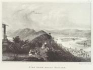
View from Mt. Holyoke
Fourth of July festivities at…
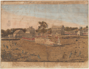
The battle of Lexington, Apri…
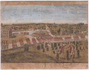
Plate II. A view of the town …
m
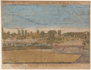
Plate III. The engagement at …
Plate IV. A view of the south…
Plan of Public Garden: showin…
Map of the water region: adja…
Plan of main ship channel in …
No. III, changes in the bed o…
Sketch of the Battle of Bunke…
Plan of Charles River and War…
Map showing the New York and …
Plan of extension of Devonshi…
Plan of extension of Devonshi…
Boston with Charlestown and R…
No. I, changes in the bed of …
Sketch of the action on the h…
Plan for the occupation of th…
Night attack on the court hou…
Church of the fugitive slaves…
The maypole of Merry Mount, 1…
Map of the town of Blackstone…
Map of the town of Fairhaven,…
Map of Gloucester, Cape Ann: …
Preliminary sketch showing th…
A sketch map of a portion of …
Lynn Harbor, Massachusetts 18…
Historical map of Nantucket
Preliminary chart of Nantucke…
Map of the town of Taunton: w…
Preliminary chart of Monomoy …
The harbor of Wood's Hole, Ma…
Preliminary chart of Plymouth…
Map of Marshfield, Mass.
Map of the town of Raynham, B…
Land given to the town of Qui…
A Plan of the action at Bunke…
Massachusetts and Rhode Island
Johnson's Vermont, New Hampsh…
Colton's railroad & township …
Southern New England
Johnson's Massachusetts, Conn…
Massachusetts, Connecticut an…
A map of the province of Mass…
1
2
3
4
5
6
7
8
9
10
…
17
18
Previous
Next
1
2
3
4
5
6
7
8
9
10
…
17
18
Previous
Next